Ride Report: 60 Miles, 955 Total Miles, 13.5 Avg mph, 3,284 Ft. Climbing, 4,155 Calories. Minus an additional 1.5 pounds this morning. I'm gonna feel like I'm starving when I have to cut back after this ride...
Big day today – and to illustrate I’ve included a pic of the
elevation chart from the ACA map for today’s ride. I’ve mentioned before that
the ACA maps break The Thin Blue Ride (also known as the Trans-Am) into 12
segments. On each segment, the map
provides additional detail in the form of about a dozen 30ish mile sections for
a total of roughly 360 miles per segment.
The sections are numbered sequentially starting in Astoria. So, when the reader looks at this elevation
chart, it roughly depicts the elevation gain over sections 32 and 33 of segment
3. Got it? If not call with any questions and leave a
message. We can talk when I get back to
Manhattan in October and finally have decent cell service again.
We overnighted just to the left of the farthest left red line – we were just barely inside section 31. The goal for the day was Lolo Hot Springs, to
the right edge of section 33. That’s a
total of 60 miles. As the reader can
clearly see, the day was all uphill until Lolo Pass, with the exception of a couple minor
descents. Let me assure you, they
weren’t significant enough to relieve the tedium of 52 miles uphill. That’s how far it was to Lolo Pass, which at
5,235 feet is (I believe) the highest pass we’ve been over since McKenzie. That, ladies and gentlemen, constitutes a big
day.
I have to insert here the gist of a conversation Susan and I had with Kelsy and Parker a couple of days ago. During the course of this conversation, I received a dissertation on the merits of eating healthy and how the food I was consuming was all “bad” sugar (somebody show me the good stuff then) and how I should consume better quality calories. This in furtherance of avoiding that "tingly" sensation I described in my legs during the conversation. Thanks – this set your mother out to buy better food for me. As a result, I consumed this on one of my breaks…
Yup – an avocado - and I’m eatin it right out of its shell – or whatever that
hard part on the outside is called. An
exoskeleton maybe? I dunno. Poor thing. I must admit that it wasn’t too bad. And as an added bonus, it made Kelsy’s mother happy.
But then I got a call from one of The Thin Blue Ride’s
corporate sponsors. They reminded me of
my contract and as a result, I was compelled not only to consume their product,
but to give it equal billing. Hence…
I demolished a Hostess cupcake - two bites, BTW. It was horrible. Over the last week I barely managed to choke down the contractually obligated 12 pack. But duty being what it
is, I soldiered on. The fine print requires both resupply and additional consumption. My God
– the horror of it all…
But on with the actual ride – brought to you by Hostess
cupcakes - freshness in every bite!
This was the view of the river from the bridge to the RV Park first thing in the morning. Only 52 miles to the summit...
This is the Sequoia checking out the next ten mile uphill
stretch. The first 40 miles
went like this: ten miles at a crack, then stop for a ten minute break. I planned today’s ride this way because I
knew it was somewhere around 46 miles when the grade would kick up. I also made it a point to ride easy for the
first 46 miles in order to save energy for the real climb between 46 and 52
miles. There was just a whole lotta this – 46 miles worth, to
be precise.
Well, this is encouraging...
As was this just a bit later. I don't think so...
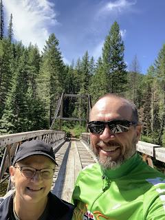
But this was good. One of the stops Susan selected for a ten mile break was at what the maps call "pack bridges". We eventually concluded that they're for the crossing the river on the numerous hiking trails throughout these mountains. Susan noted that when I went out on the bridge with her it swayed. It was a suspension bridge for God's sake. How is that my fault???
On the way up, I ran into this historical marker. Is there any place those Lewis and Clark guys
DIDN’T go in these parts. How did they
not end up with a state or two named after ‘em?
I propose re-naming Washington and Oregon as Lewis and Clark
respectively. I had a sense that the end
was near when I saw it. And sure enough, about 2 miles later…
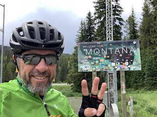
State number three – Montana! I don’t know if the reader is aware (I
certainly wasn’t until today) but Lolo Pass demarks the state line between
Idaho and Montana. Cyclists tend to
affix stickers to such signs as a memento of their passing. Hey - its the T/A. A lotta riders have been thru here. Not me tho – I’m not in to defacing public
property. That’s my story and I’m sticking
to it.
However, there being no Lolo Pass sign, I took a pic of the
next best thing. I believe this is a
snow depth marker. Holy Cow! That’s some
snow.
So, this is me pointing out the benefit of spending all that
time going 52 miles uphill. The
reward? Eight miles of downhill. Seems disproportionate, I know, but such is a
rider’s life.
This is home for the night – Lolo Hot Springs. We reserved a spot for The Rig in the RV Park
just across the highway from the Hot Springs.
As I pulled in, Susan had just finished checking in and was pulling in to
our slot. I kept up with her for the
first 4 miles of the downhill, but then it leveled out a bit and she was able
to get ahead of me.
This is one of the benefits of overnighting at Lolo Hot
Springs. It’s kinda implied in the name,
but they have a hot springs here and use it to feed both a swimming pool and
this (much) warmer and smaller pool.
This baby was right at 103 degrees at the “cool” end. That would be the end farthest from where the
spring water enters directly from between the rocks. I did two stints in it. Stayed a bit too long the first time and my
legs were wobbly when I got out so I had to sit down on the conveniently placed
benches. (Oh, that’s why they’re here.)
The reader should note a couple of things in this pic. 1: The nifty biker tan I have going. 2: The absence of said tan on my right shoulder. (Yes reader – your left) The white spot there is a scar left over from
sliding down the road after tangling with the mini-van while on a lunch hour
ride last September. I still watch mini
vans closely when encountered on a ride.
Them and logging trucks. The mini
vans are the chihuahua of vehicles. It’s
always the little ones that that have the worst attitudes.
Now I want to take a moment to follow up on something I
mentioned yesterday: Brad Schoen’s Mountain Misery Index. We’ll just use the acronym BS-MMI. It goes
like this. In order to determine the
index one must first calculate the Fatty Factor (FF). FF is simply the rider's weight divided by the number of bottles of water consumed during the climb. A rider can positively influence the FF by either losing weight or increasing water consumption during a climb.
Next one must Determine the LAG (Length and Grade). LAG is a measure of the length of the climb to the nearest tenth of a mile multiplied by the average grade (expressed as a percentage) of that same climb.
The FF is then divided by the LAG in order to determine the BS-MMI. The lower the quotient the more difficult the climb.
Expressed mathematically the formula looks like this:
Rider weight / Bottles Consumed = FF
(LG) X (%G) = LAG (Length and Grade)
FF
LAG = BS-MMI
So - now a real world example.
203 (my weight) / 6.2 bottles consumed
8.2 (length of climb) X .05 (5% grade)
32.7
.41
BS-MMI = 79.8. That's a pretty tough mountain, owing - in this case - to the length of grade. Ya can't make this stuff up. And, I might add, it serves as further proof of the scientific basis for my many and varied speculations.
And my high school math teacher thought I wasn’t paying
attention. Bah!
And if the reader will permit, one last pic for today...
This is what Susan’s plan for today looked like. Yup - she did it - solved the whole
quantum mechanics thing. Right there on the dash of The Rig. It was the uncertainty principle that gave her the hardest time just before breakfast. Actually, it’s
her way to track when and where to stop and wait for me to pass by. She just enters a parallel universe and waits
for me to pass by in my universe, then reappears. According to her, it was much easier than figuring out teleportation. She didn’t have to figure out how to
disassemble and reassemble all those molecules. I was pleased since I like my molecules just fine the way they are, thank you.
Till next time.


No comments:
Post a Comment