INTRODUCTION

Where to begin? It was a dark and stormy night...  (Snoopy).  No. It was the best of times, it was the worst of times...  ...

Saturday, June 8, 2019

The Thin Blue Ride - Part 1 - Day 17

Ft. Stevens State Park: 0 Miles (RV)

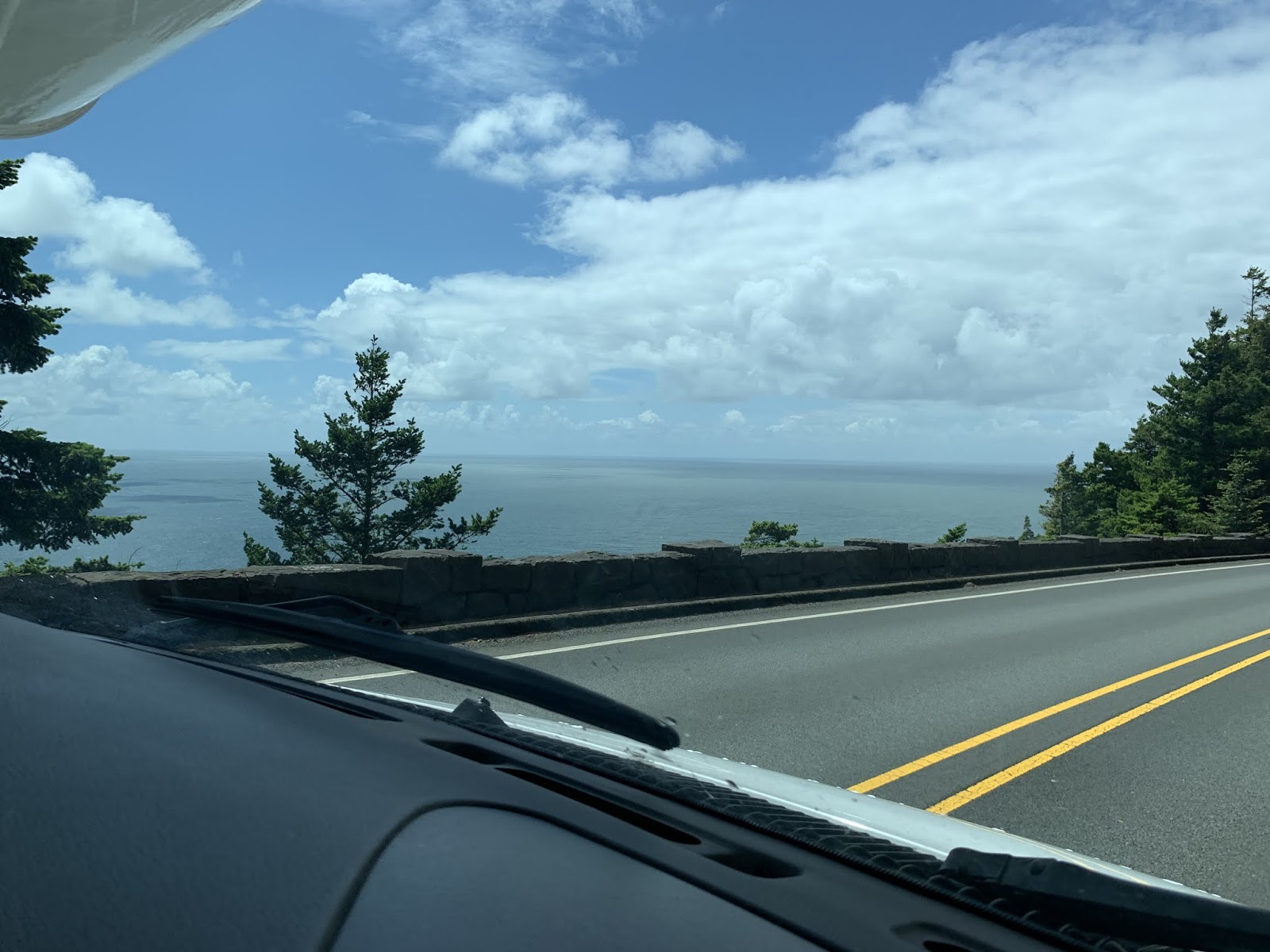
Ride Report: 20 Miles, 139 Total Miles, 17.5 mph avg, 1,447 calories, 256 ft. Climbing.  There being no other plausible explanation for the lack of climbing today, the reader may rightly accuse me of riding on a giant pancake today.  Well, other than riding by a bay for the entire route...

It was gonna be a great day.  Up for a ride, clean up, hop on the scooter w/ Susan and see some sights, then scoot over to Washington (our 7th state) for dinner at a seafood shop in the small town of Chinook.  The weather was supposed to be cloudy this morning with the sun out by noon and temps in the low to mid 60s.  The reader will likely recall my numerous rants about “AccuWeather”.  The weatherguessers there missed the mark again today.  Rain in the morning, sun not out till 1500 or a bit later, as a result temps lower than “predicted”.  You get the picture.  At this point I tire of berating “Accuweather” and will simply refer the reader to one of my previous rants.

So - instead we decided to flip tomorrow’s schedule with today’s.  This made today chore day and tomorrow cheesy tourist day.  A ride did stay in the schedule as planned, but it was colder than planned and I was wetter than planned when I got back.   (Takes deep breath.). But I’m over it now.  On with the day...


First view of the City of Astoria coming in over Young's Bay.  If the reader looks closely the reader will see in the distance the 101 bridge over the Columbia River.  Its just above the white pick-up.


Delta - up close and personal with that same bridge.


This is a pic from the parking lot of the Columbia River Maritime Museum.  Note the big boat thingy in the distance.  There were two more to the rear (aft?) of the Coast Guard Cuter whose nose (bow?) is peeking in on the right side of the pic.  None were moving.  It was low tide and I'm guessing that they're waiting for more water. (draft?)


Avast Matey!  With my display of sea going slang, the Coast Guard guys tried to sign me up.  I politely declined.  36 years in a uniform is enough for me.  Actually, if the reader will look closely they will note that the Cutter is a bit rusty in a couple of places.  Given that we're in a museum parking lot, I suspect the Cutter is on display and owned by the museum.  Alas, as the museum was closed so there was no one for me to ask.  


This is ...well...a really big anchor.  This pic shows up in most blogs of Trans-Am bound riders as its the starting point of the Trans-Am.  So, its pretty much obligatory.  But still cool.  A very nice local lady took the pic for me and when she inquired where I was from and what I was doing in town, I filled her in.  She acted surprised and it was as if she'd never heard of the trans-Am before.  I find that difficult to imagine.  Regardless, she wished me well and we had a nice, if brief, chat.


This is...well...a really big propeller. (screw?)  I read the plaque and the thing weighs 18,000 pounds.  That's 4k more than The Rig loaded.  It was apparently donated by the family of a local seaman.  Delta asked the same lady to take a pic of him with the propeller and I photo bombed him as she did so.  I think it came out well, but he was all cranky.


In fact, he took this pic and when we were discussing it on the way back to The Rig, he told me he wanted it because the anchor reminded him of hauling me all over God's creation.  I told ya he was cranky.


Once we made it back to the campground he asked for the phone to take this one.  He's enamored of these tall pine trees.  The entire campground is full of em.

So, that was the morning jaunt.  After that it was Chore Day...


As evidenced by this pic.  That's Susan's ball-cap just behind the row of silver washing machines facing the reader.  What can I say?  I married a woman as tall as a washing machine.  Though in her defense, they do sit on about a six inch platform...  Susan says they're "really tall" washing machines.  OK...


And this is the pic of The Rig in its temporary home her in Ft. Steven's State Park.  We're surrounded on three sides by these.  Its a very impressive location.

Oh, and Susan made a great dinner tonight. She calls it her La Fiesta meal - after the restaurant in Manhattan from which she appropriated the idea.  (If you're the food police and reading this, I deny any specific knowledge of her thievery.)  I did have a pic of it loaded in the blog today.  However, it has since disappeared.  Our service is wonky here and I had to load some of the pics twice.  This one apparently disappeared.  My apologies to the reader, but it looked delicious.

Till next time...

Friday, June 7, 2019

The Thin Blue Ride - Part 1 - Day 16

Fogerty Creek RV Park, Depoe Bay, OR to Ft. Stevens State Park, OR: 118 Miles (RV)

Ride Report: None - for details see below.

So - today is it.  We're scheduled to make Astoria today.  Well, technically the Ft. Stevens State Park on the coast just West of Astoria.  When I was shopping around for a place to spend a couple of days unwinding from Part 1 (2 1/2 weeks goofing off while traveling cross country is strenuous, doncha know?) before commencing Part 2, Ft. Stevens seemed just the ticket.  I'll get some pics of our camp site tomorrow.  Today was on and off rain - ALL DAY.  It continues as I draft this post.  But then, I suspect that's part of being in the Pacific Northwest.  I had planned to ride another 25 miles or so today, but the rain put a halt to that.  I'll ride thru rain when The Thin Blue Ride commences on June 10, but not now.  We even stopped at Neskowin on the way to Astoria thinking maybe we'd wait out the rain.  Nope - no luck there either. 

Though we were still on 101, it was an entirely different experience today as many of the miles were spent inland from the coast.  Nothing there so dramatic as ocean waves crashing against the rocks, but it was still enjoyable...


We noted a number of locations where there were still signs of recent logging activity.  though I'm not positive, I suspect the scar across the side of this hill is the cut for a logging road.  Its obvious that the mature trees are gone, and there are the remnants of the clear cutting operation strewn about the side of the hill.


And then there were shots like this.  If this pic isn't the poster child for a bucolic setting, I don't know what is.


And what is bucolic without dairy cows.  I'm pretty certain that this must be cow Valhalla.


And then came Tillamook.  Yes, its an actual city.  We knew not what to expect.  But when we got there - Civilization!  As evidenced in the pic below...

Really!  I can't remember the last time I had a Whopper.  But there was the King's place - right on 101!  Where I come from we call that a sign.  So, in we went.  The keen eyed reader will note The Rig in the parking lot across the street.  The King may be civilized, but even his parking lot isn't sufficient to accommodate The Rig.


And while we were in BK - this passed by on 101.   Good Lord, BK's window was like sitting in front of a big screen TV - which I haven't done in a while either.  I believe I had just mentioned in yesterday's post that I wanted to get a pic of one of these rigs.  My eternal gratitude to any reader who can tell me how they get the back half of that trailer thingy (A logging term there.) on and off.  My suspicion is that they use the same machine used to load the logs, but that's 100% speculation.  Ya see these things all over the place - with and without logs. 

But alas, eventually came the time to leave BK.  So we took our two chocolate chip cookies (The clerk practically made us buy em.) and off we went.  Shortly, 101 returned to the coast.  There were views in some places, but a substantial portion of the coast had been developed.  So it was hard to see the ocean between the houses, hotels, motels and other assorted buildings.  Disappointing, but we still got some pics...


I don't know how anyone could ever get tired of coming around a corner to this.


Or even better - this!


Yup - another tunnel.  I don't know if I've said so, but driving The Rig thru one of these us unnerving.  This one was better than most.  It was blessedly short and well lit to boot.


And then there were the tree tunnels.  This isn't the best one we encountered today, but it gets the idea across.  I finally had to turn on The Rig's headlights just so I could see the speedo and tach.  There just wasn't enough light at times.


And...one final ocean shot before we came to...


There it is.  The sign says, "Fort Stevens State Park".  We have a great site nestled in among some humongous pine trees.  I'd have included a pic but for the rain.  I'll get one tomorrow and pass it along.


And finally, there are the two pics below.  They're from Susan Schoen Photography, LLC and (as always) used by permission.  Here's the story.  I was sitting on the recliner yesterday when I heard her inhale sharply.  She then said, "You gotta see this.  It looks like Bigfoot."  By way of explanation, Susan's practice is to take tons of pics, then look at them later to see if there are any worth saving.  So - as she was reviewing some pics taken when we were in Northern California on 299, she stumbled across them.  She says she was just looking to get a river shot, but there he is - just about to step behind that small tree on the river bank.


This is gonna be bigger than the Patterson-Gimlin film.  (Google it)  Forget all about October 20, 1967.  The date Bigfoot believers should be committing to memory is June 5, 2019.  The shot was taken somewhere West of Whiskeytown Lake on Willow Creek with an i-phone 6S.  The 1967 Bigfoot eventually earned the moniker "Patty" in apparent honor of Patterson, who shot the film.  This one shall henceforth be known as ""Jane".  Susan picked it.  That's her middle name.


And shortly after, we ran across this.  Apparently he's also a rafting guide...

With luck like this, I reasonably anticipate that she'll resolve the wild "jackalope" question somewhere in Eastern Colorado or Western Kansas.  Stay tuned...

Till next time.

Thursday, June 6, 2019

The Thin Blue Ride - Part 1 - Day 15


Honey Bear by the Sea RV Park to Depoe Bay, OR: 179 miles (RV)

As a complete and total side bar, I just love to type “Honey Bear by the Sea”.  But on to the ride report...

Ride Report: 22 Miles, 119 Total Miles, 14.6 mph avg, 1,658 Calories, 1,300 ft. climbing.  Most of which (the climbing, that is) can probably be accounted for by the lump you see in the middle right of the pic below.  But more on that later.  On with the show...

When the Sequoia and I hit the road today and headed North on 101, this was our first view of the Pacific Ocean.  Simply amazing.  And it didn't let up for pretty much the entire ride.  With the exception of that lump.  Notice how it just sits there, daring you to come over and have a go.


This was the Seqouia's first view of the ocean and he was clamoring for a selfie.  So I gave him the phone.  Can't say as I blame him.  Its so endless as to be awe inspiring and a little bit intimidating at the same time.  Anyway - he yakked about it for the remainder of the ride.


Hey - what's good for the goose is good for the gander.  This is me in pretty much the same spot.  Examining one's selfies after taking them can be useful at times.  When I looked at this one, it explained why my chest was so cold.  So I zipped my jersey up and off we went.  I don't know what was wrong with Susan this morning.  I can't believe she let me out of The Rig this morning looking a hot mess.


At this point I assumed we were in the run-up to the "lump" which still looms in the background.


Turns out that wasn't the case - as this pic will illustrate.  What the reader can't see is that we just climbed 1.2 miles at between 6-8% and have come down the other side an equal distance.  When we stopped, the lump was still there - closer, but still way over there.  Good Lord - how big is that thing?  BTW - the Sequoia was going on endlessly about the ocean for the entire up-hill slog.  He was apparently quite impressed.  He had heard that Hawaii was in the Pacific and wanted to know how far away it was.  Turns out he heard there are girls in grass skirts there.  (Sigh)


OK - there is a bit of a lapse in pics between the last one and this one.  Me cell phone battery was about to die and I avoided using it till after we had gone over the "lump" - which as it turns out is called Humbug Mountain.  Again - ya can't make this stuff up.  While it was a decent climb, it didn't turn out as bad as initially feared.  Largely because the road went around to the right of the thing, up thru a pass between it and the other smaller hills, and then followed a creek downhill for a bit.  Still - the climb was both steeper and longer than the first one of the day.  We were rewarded with this view shortly after Humbug.

As an addition to the ride pics let me say that I frequently found myself smiling on this ride.  Here I was RIDING BESIDE THE PACIFIC OCEAN!!!!!  Oh yeah - and not at work.  Occasionally life turns out better than one anticipates.  Speaking of which...


This is Susan and I at Battle Rock Wayside State Park.  The town of Battle Rock is located there as well.  She met me in the parking lot of a much abused motel (not currently in service) so I could take a shower and we could have lunch together.  Battle Rock is a big deal locally.  When the guy who founded the town showed up with 9 men to do so, the local natives didn't take kindly to his attempts.  The settlers set up on Battle Rock and held off the indigenous natives till they could slip away under cover of darkness.  The guy came back the next year with 70 armed men and a small cannon.  I think we all know how the story goes from here.   


Bah - Humbug doesn't look like such a big deal from the Battle Rock side.  (The reader should take note of the rhetorical flourish encapsulated in the author's grousing about Humbug Mountain.  The author thinks its hilarious.)


From there 101 abandoned the coast for a bit and wandered inland.  Still pretty, but not visually stunning, as was the coast.


But shortly 101 returned to the coast.

I might add that the route today took us across any number of rivers, creeks, bays and estuaries.  All of which required bridges.  Some pics of which are below.


I thought this was ingenious.  Also good to know since I'll spend the majority of the first two days of the ride coming back down a portion of 101.  Though I didn't include the pic, they also have the same set-up for the one tunnel we went thru.


I thought this one was pretty impressive.  All that iron work and then the two spires at the entrance.  Very grand.


This one was a steel bridge with concrete abutments.  Note the pattern on the face of the abutments.  Very art deco.  I'm thinkin 20s.


On a bit of a different tack - I don't think I've mentioned that since hitting the Northern California mountains coming out of Redding and continuing thru today, we've seen a lot of logging trucks.  Full ones, empty ones (how do they manage to break that trailer down and store it on the back of a bob-tail semi?  I gotta get a pic of one of those.  Or I guess I could just ask Susan...)  BTW - your free dose of comedy for the day.  Get on YouTube and search for Brian Regan's logging truck schtick.  It'll be the best 5 minutes you ever wasted...

Anyway - we encountered this - right along the edge of a river.  It was in a town that had an industrial flavor and from a distance I thought it was a sand quarry.  But... 


Upon further review, the "sand quarry" decision was overturned.  Turns out that its a huge pile of very small wood chips.  Looked almost as if it had been shredded?  The only thing Susan and I could come up with was that it was prepped for use as wood pulp and sits here waiting to be shipped to parts unknown where they...make stuff...from wood pulp.  At least that's the technical explanation.


There were also piles and piles...


...and more piles and piles of these.  All were debarked and appeared to have been sorted by size.  But of course, all this means that views like this (see below)...


...were inevitable.  While it is a bit of an eyesore, one must also acknowledge the uses to which wood and wood products are put.  The ecologically friendly reader will note the clear cut area nearest the road.  However, in the mid distance, the short light green area is comprised of trees replanted after that area was clear cut.  And in the far distance, the reader will note mature trees.  Thus the logging companies insure their survival and meet the world's need for wood.  Makes ya wanna break out singing "The Circle of Life" doesn't it?


But alas, we were soon back to ocean views again.  The reader should note the author's sporty facial hair.  It was Susan's idea after I retired.


These, dear reader, are HUGE sand dunes.  Turns out there's a national park of sand dunes along the coast here.  People apparently come here with their mechanical toys and roar around in the dunes with them.  While not for me (Who wants sand filling their underwear at the end of the day, after all?) I can see how those less perplexed by friction in their pants might find it invigorating. 


Just to give the reader a sense of scale, note that the sand dune visible thru the windshield above Susan's right hand is taller than the mature trees in front of the dune.

And that's it for the day.  It was both fun and interesting.  We loved the sights along 101.  Oh, Wait... One last pic, from Susan Schoen photography, LLC...

She must have taken 20 photos on final approach to the lighthouse.  One, yes ONE, came out showing the lighthouse.  I zoomed it a bit and "walaa"  the blog's coolest ever lighthouse pic.  Used by permission.  (She loves lighthouses.)

Till next time...


Wednesday, June 5, 2019

The Thin Blue Ride - Part 1 - Day 14

Indian Creek RV Park West of Redding, CA to Honey Bear by the Sea RV Park, Ophir, OR: 240 miles

Ride Report:  None - Big travel day.  Got one planned for tomorrow tho.  Just hafta check back then if you're only reading the blog for the bike stuff...

Today's plan was to continue West on 299 through what appears by Google Maps to be a largely forested and mountainous area until we reach highway 101.  Then we turn North and head to the "Honey Bear by the Sea" RV park just South of Ophir, OR.  Seriously.  Ya can't make these names up.  We shall see how well that turns out.  But there's lots to cover before then.

We got a good start on the day since we knew it would be a long one.  Well, we had a good start for maybe the first half hour.  Then we spent a half hour sitting here...

Yup - road construction.  As best I could tell CDOT was scaling the side of the big hill in front of us.  It shows up as the tan smear in the center of the pic.  Traffic was stopped from both directions while we waited for the back hoe to load two semis.  Then we got to go.  The poor saps on the other side had to wait for the three that showed up as we were leaving to get loaded before they could come thru.


We spent a good bit of time in the Six Rivers National Forest.  It was beautiful.  Made for slow going driving The Rig up and down.  By slow, I mean that we spent two hours to make 64 miles.  that's slow by Granny standards!


We followed this river for a good while.  There were some amazing views.  My apologies to the reader, but I neglected to note the name of the river.  There were a number of rafting companies along the way.  The terrain was quite rugged.  Steve from the RV Park last nite told us that this area is where Bigfoot was first sighted.  And sure enough...

There he was just standing around at a "Patriot" gas station waiting for tourists to take pics with him.  He tried to hit me up for enough cash to buy some food and claimed to be a veteran.  All good fun, but then I happened upon the following...


The reader should be aware that I didn't go looking for this, and that until today I was a Bigfoot agnostic.  But we were driving along minding our own business on the edge of one of the small towns along 299 when I was taking a pic of something interesting beside the road.  When I later looked at the pic, I thought I saw something.  So I blew it up for a closer look and.....THIS!  AMAZING!  BIGFOOT IS REAL!!!!!!!!!!  I know, I know - its grainy and was taken from a distance.  But none-the-less, there he is.  It took several miles before I was able to get my breathing under control.  Once you actually see it - you BELIEVE!  Wow!

Then, just a little further down the road there was this...


Some bonehead shot one of his relatives and turned him into burgers!  A national treasure - gone!  I wonder what they taste like?

Anyway, all the Bigfoot drama aside, we eventually hit 101 and headed North.  Before long we were getting glimpses of the pacific.

It looked kinda like this.  But we weren't out of California yet.

Before we left the state was passed thru one last mountainous area and drove right thru these...


That's right.  Coastal Redwoods.  For maybe (?) 5-10 miles a guy couldn't swing a dead cat without hitting a Coastal Redwood.  Susan took so many pics I think she got tendonitis in her shutter finger...


These things are huge.  Not as beefy as the Giant Sequoias, but impressive in their own right.


I told ya she took a lot of pics...


She included the mirror in this pic just so the reader would have a sense of scale.  It was right beside the road.  Note: All redwood pics used with permission of Susan Schoen photography, LLC.


They remain proud of dead Redwoods even this far up North.  The reader will recall the "Fallen Monarch" from an earlier blog.  As proof I proffer this pic - tho this one remains nameless.  A section of redwood cut from a log dug up when doing some sort of construction just North of Orick, CA.  This according to the plaque affixed to the slab of tree, which also says it was over 1,000 years old.  This assumes that the person who aged the slab wasn't the bulldoze operator who also happened to dig it up...  A friendly local took the pic for us as were stopped in the parking lot of a local Mexican restaurant to dine in The Rig.  This isn't as bad as it sounds.  The restaurant was closed a lot lately because Mary had gotten sick.  Bonus Internet Points are in play again for the reader who can first determine how I know this.  The winner will be announced in a later post...


As we neared Oregon, I had been lecturing Susan to be sure and take a pic of the obligatory "Entering Oregon" sign when it came.  We had also decided to trade driving duties some time after Crescent City, CA.  so I just chose some random wide spot in the road and pulled over.  At which point Susan suggested we get out for this pic...

If the reader has been keeping track, I believe this is state number seven.


BTW - they also have plenty of elk here in Oregon.  We saw signs regularly warning us of them crossing the road.  Riddle - Why did the elk cross the road?  answer - They didn't.   They're too lazy to bother and just nap under these two trees beside the highway.


But lest I paint too rosy a picture of Oregon - we went thru this section of 101.  The observant reader will note the world's largest pothole in the road beside the new tarmac in the foreground.  the pothole was created when the entire side of the mountain slid toward the ocean at some point in the recent past.  The new tarmac is basically a detour thru the collapsed area.  As an aside - I've no idea why the guy in the oncoming lane is driving off the road.  Maybe he was trying to stay away from the remaining uphill side of the mountain fearing it would fall on him?  Maybe just a bad driver?  Hard to say.  


But what Oregon lacks in roadbed stability, it makes up for in spades with coastal views....


It looked like this whenever 101 was close to the shore and the trees weren't in the way.


OK - I admit it.  A coastal views are my equivalent of Susan's redwood pics.  Just can't get enough of em.


Oh yes - and we saw a few of these.  Not many in Kansas...


Which made this a difficult shot to get what with my risk averse bride and all...


I did manage to talk her into standing still long enough to get this pic.  Then I heard carping about her cold foot all the way back to The Rig.  It was worth it tho.  I'll report in a future post as to whether her toes fell off from the cold as she feared.  I mean really - look at the pic.  Whose feet are both actually IN the water...
(Author's note:  Susan is scowling at me.  Something about the pic being taken just before the tsunami rolled over her foot.  She apparently believes that's what all those tsunami signs were for.)

Till next time...