INTRODUCTION

Where to begin? It was a dark and stormy night...  (Snoopy).  No. It was the best of times, it was the worst of times...  ...

Saturday, July 13, 2019

The Thin Blue Ride - Part 2 Day 34 - Jeffrey City, WY to Rawlins, WY

Ride Report:  67 Miles, 1,658 Total Miles, 16.7 Avg. mph, 1,837 Ft. Climbing, 4,107 calories.

Considering that Sig and I crossed the continental divide not once, but twice, I think the average speed listed in the ride report is, well, pretty darned good.  At times we had a tailwind, at times crosswind and at times headwind.  It was pretty much an average wind day (at least in my experience) here in Wyoming.  The same was true of the scenery - it was...average.

I also learned something this morning.  Susan doesn't always understand what I'm telling her.  I walked out of the bathroom this morning and pronounced that it was a good thing the tube of toothpaste was almost empty because I threw it away.  She inquired why I might have done so, since there was still perfectly good toothpaste left in the tube.  I told her it was all wet.  She wanted to know why.  The answer was obvious, "Because I rinsed it off."   Susan: "What? Why would you rinse it off."  Me (Sighs): "Because I dropped it in the toilet."  Sometimes it's like twenty questions to get her to understand what I'm telling her.  I just don't get it...

But back to today's real fun - the ride to Rawlins...


Once we cleared the cloud of mosquitoes lying in wait at Jeffrey City, this was the view.  This was no mean feat, the mosquitoes were both numerous and aggressive.  At one point they pulled me off Sig and into the ditch to feed.  Sig came in with both handlebars swinging and extricated me, following which we rode like the wind to escape.  It's like they're the winged monkeys from The Wizard of Oz or something.  BTW - this was pretty much the view all day.


This is "Split Rock".  Hence the name of the bar/restaurant at which I dined yesterday afternoon.  It was apparently a marker for everybody from the Pony Express to emigrants headed West back in the day.  When we headed South out of town this morning, it was visible in the distance for probably 10 miles.  Used by permission of Susan Schoen Photography, LLC.  (Hey - I was busy riding.)


OK - I admit defeat on this one.  I think it was just yesterday that I said I had a fairly good idea how these geologic formations come to be, but this one has me stumped.  Any geologists out there wanna help out?   At first glimpse from a distance I thought it was a man made structure.  Obviously not.


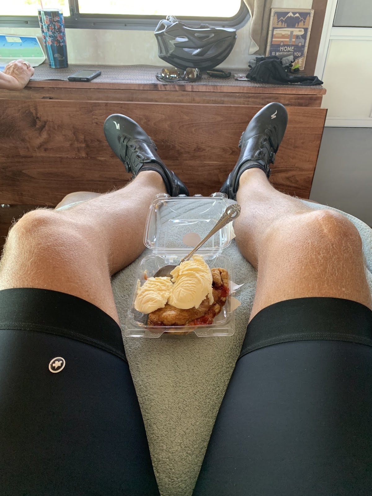
Then at some point before lunch, Susan forced this upon me at a brief stop.  This, boys and girls, is strawberry rhubarb pie WITH ice cream.  After how she dealt with that mouse, I wasn't sayin no...


Wyoming just has an eclectic mix of rock formations.  This granite intrusion was in the middle of a plain with a river running thru it.  Perhaps I should have paid more attention in Geology 101 back in college.


As I said earlier - two crossings of the continental divide today.  This was number 1.  I'd like the reader to believe that it was a big deal, but not so much.   The grade getting there was pretty shallow and only went on for maybe 5-6 miles.  But hey - it's still a continental divide.


Then it was break/experiment time.  This time with the last of the remaining four food groups: grains.  This would be basil spaghetti - made, I'm sure, from thoroughly processed wheat flour.  My lab assistant (Susan) found it left over in the fridge.  But a grain is a grain regardless of its form.   Pretty darned good!

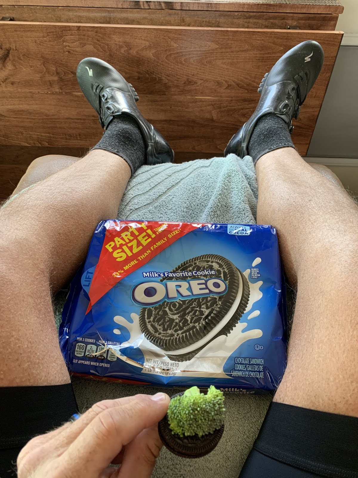
I believe that at this point I can declare an end to the OE research.  While the research still has to undergo peer review in the American Journal of Nutrition and Food Science, early indications are promising.  I think it safe to give my readers the inside scoop - so long as you all don't go out and buy Oreo stock.  The OE is the real deal.  It appears that Oreos do, in fact, improve the taste of everything.  The lab has been contacted by the American Medical Association.  They're wanting to glom onto our research and make some specific recommendations as to the MDOI (Minimum Daily Oreo Intake).


Back out on the open road, there was this.  It may be difficult to discern from a distance, but it looks like this entire section of the Earth's surface was uplifted on one end.  The "pasture" just takes off at an upward angle.  I can't imagine the forces necessary to make this happen, but there were several examples of it as we neared Rawlins.


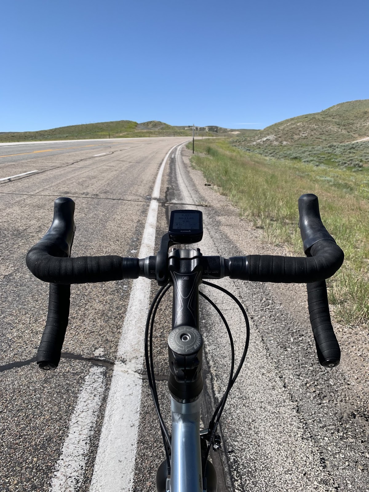
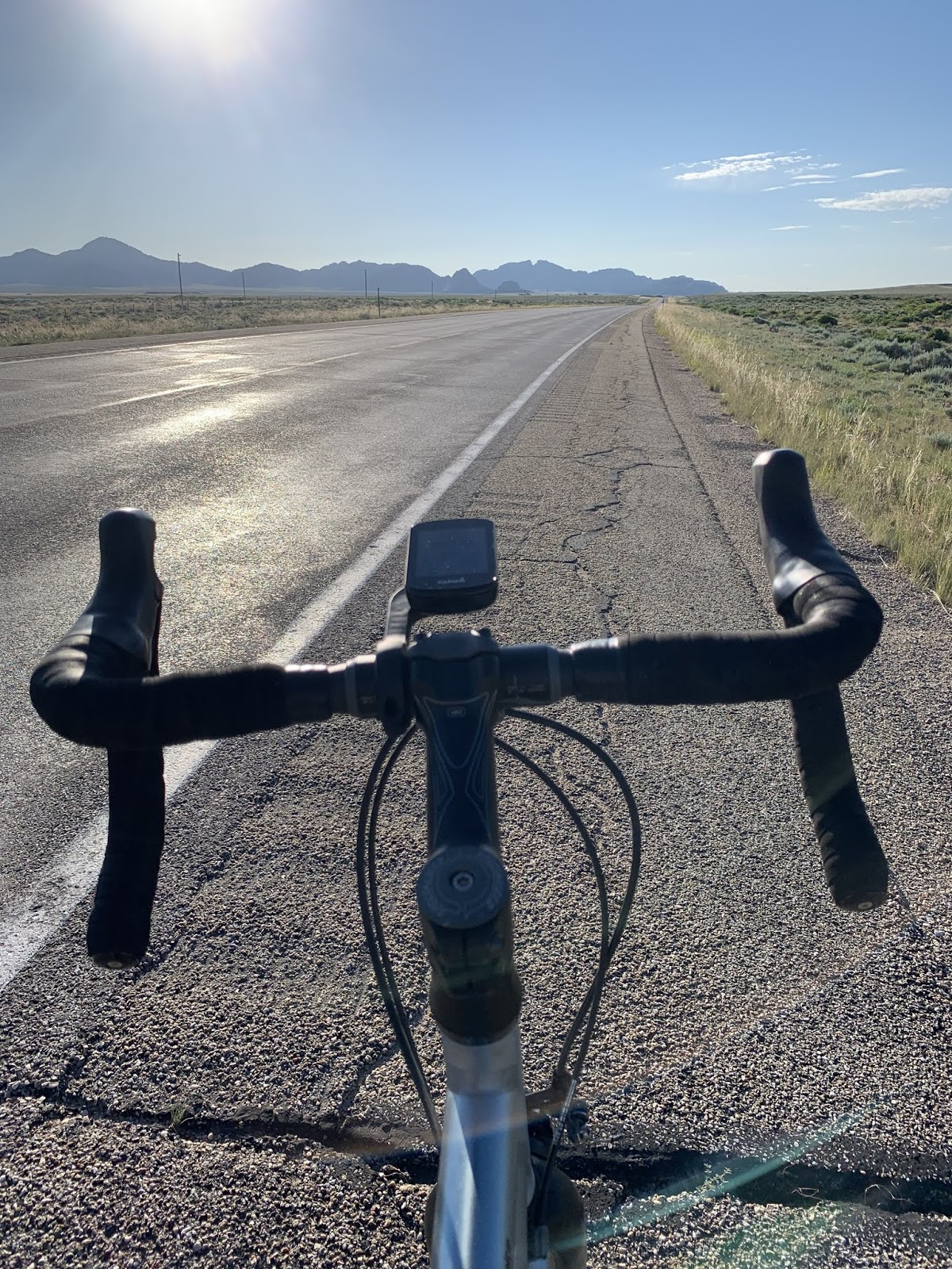
And just to illustrate the sameness of the scenery (for 67 miles) today I proffer the following two pics...

I stopped...somewhere...to take this pic of where Sig and are going.


I then rotated 180 degrees and took this pic of from whence we had just come.  This is like that game you played with two photos as a kid.  How many things different can the reader find.  Clouds don't count.


Susan found this marker on the route today.  It tells the story of mines that formerly dotted the hills near Rawlins and provided a mineral used to make red paint, well...red.  They were quite proud of it.  Used by permission of Susan Schoen Photography, LLC.


The scenery finally changed today on the run-up to continental divide #2.   Note the road snaking up the hill in the distance.  Once again, not particularly challenging.  The first mile ran 6-7%, but thereafter no more than 4% with much of it in the 2-3% range.  But it did run on for 6 miles.


Six miles later, we found the obligatory sign.  Number two for the day.  After this, it was a (mostly) downhill jaunt of 9ish miles to our overnight stop - the Wal-Mart in Rawlins.  When Susan got there, a semi had just taken the spot where she wanted to park.  She sent me over to inquire as to whether the trucker was going to overnight there or be leaving shortly.  I caught her giving him some sort of hand signals as I pedaled over and when I got there he told me he'd be leaving shortly.  As he pulled out about 20 minutes later he drove right past The Rig and gave Susan a thumbs up.  I'm tellin ya - marry a Teamster.

But speaking of the trucker, he seemed to be a good guy.  As I was just getting there to talk with him, what can only be described as an aged, homeless cowboy got to him first.  Lest the reader doubt my description, this is him in the pic below...

Ya had to see the inside of the back of the van.  The guy was homeless.

As it turns out, he wanted to tell the trucker that when they do...whatever is is they do with their air brakes that makes them screech...the screech sounded just like a female puma in heat.  How he came by this observation I've no idea, but he seemed particularly intent that the trucker should understand this fact.  I left them conversing about this unusual, but interesting, oddity involving air brakes and returned to The Rig.  Shortly, the trucker broke away and headed into Wally-World.  When he came out, he loaded his purchases in His Rig, and shortly returned to the Cowboy's van and gave him a plate of food.  Like I said, good guy.

And finally, this...
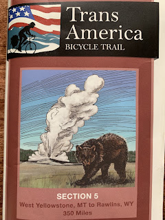
Having reached Rawlins, WY we have now completed map section 5.


And while I know that I've provided the day's destinations in the title of each post, I thought the reader might like an overview of section 5.  Click on the pic to enlarge. 

Till next time.


Friday, July 12, 2019

The Thin Blue Ride - Part 2 Day 33 - Lander, WY to Jeffrey City, WY

Ride Report:  57 Miles, 1,591 Total Miles, 14.9 Avg mph, 2,497 Ft. Climbing, 4,177 Calories, 3 new friends.

Distance wise, today's ride was a bit shorter than the norm, but it's pretty much inevitable out here.  The next town of any substance is Rawlins - which is waaaay to far to try and cover in a day.  There are two other intervening "towns", Muddy Gap (I'm afraid to ask) and Lamont.  When viewed on Google Maps, neither is more than an intersection, though Muddy Gap has a convenience store to offer.  And that's it.  Here at Jeffrey City, there is a restaurant/bar, a motel, a church and a pottery studio.  The pottery studio displayed both "OPEN" and "CLOSED" signs when I passed it on the way into town.

But let me bore the reader for a moment with a brief discussion of climbing versus elevation gain.  When one examines the ACA maps for today's trip, there is approximately a 1,000 foot elevation gain between Lander and Jeffrey City.  This will prompt the observant reader (or at least those not already sleeping as a result of this discussion) to inquire as to the 2,497 feet of climbing noted in the ride report.  This difference is easily explained.  Sig and I went up hill a lot and then we went down hill a lot.  In essence, the hills between Lander and Jeffrey City mean that we gained only 1,000 feet in elevation but had to climb 2.4 times as much to earn that overall elevation gain.  So - now ya know.  

Other than that, the only other noteworthy item today was the forecast.  It was supposed to be hot again.  As a result, Susan and I decided to get up and hit the road earlier than the usual 0800-0830 start time.  Sig and I were out the door and on the road by 0700.  Happily so since this meant that I rode an hour in temps in the low 60s early in the day.  That as opposed to riding another hour later in the afternoon when temps were above 90 degrees.  Though I hate mornings, it seems to at least have been a wise decision.  With the boring stuff aside, on with today's pics...


This was the view shortly after leaving Lander.  A relatively wide river valley bordered n both sides by the scalloped hills the reader can see in the distance.  Other than both the river and the valley becoming narrower, this was pretty much the view for the day.


An action shot from the road. This pic was taken on a closed course with an (almost) professional driver.  Do not try this at home.


I think I mentioned that the river became narrower as we rode today.  Of necessity this means less available water.  Trees are lonely in this part of Wyoming.  Sage brush, however, apparently breeds like bunnies.


So, there was only one hill worthy of mention as a climb today.  This is the ridge we had to get over to get to something approximating Jeffrey City's elevation.  I think the top was actually about 250 feet higher than Jeffrey City - which we lost as we went generally down to get there.  Looking at the ACA map I had it pegged at 5 miles.  It turned out to be 5.17 from the river at the bottom and consistently ran between 4-6% on the way up.  Not terrible, but the temps made it a might less than pleasant.


Part way up I found Susan.  By now, the consistent reader will know that she stops more frequently on climbs to keep an eye on me.  And to force food into me.  I took the opportunity to continue the series of experiments on the Oreo Effect. (OE - my research partners insist that I use the acronym.  It's apparently a science thing.)  Continuing the theme of the four main food groups, today's group of choice was fruit.  Since we happened to have a couple of peaches lying around doing nothing, we asked for volunteers.  This one dedicated his body to science.  The verdict?  It was actually quite yummy.  I think I'll have my attorneys at the Hostess Cupcakes division contact the people at Oreo and recommend Peach flavored fillings.  The royalties should be a nice supplemental income in retirement.


This is a view part way up the climb.  As I hinted at earlier - not the most difficult of climbs, but a hill is still a hill.


This was the view from the top.  while difficult for the reader to see unless the pic is enlarged, there are snow capped mountains in the background.  It was really quite a beautiful sight - in a dry, sage brush sorta way.


Having reached the top, Susan was there with The Rig and calories.  This time masquerading as vanilla ice cream and fresh blueberries.  Did I marry the right woman or what?  My apologies to the three new friends (who will be mentioned later) if you happen to be reading this post.  If I said that it's not like this every day, would you believe me?


This is Garrett.  He's riding a route of his own design and headed West.  At this point in his ride he's completed just over 3500 miles.  I'm only the second tourer he's run in to during that time.  He hails from Iowa (Des Moines I think?) and just graduated from college.  When I asked if his Mom was OK with the trip, he said that he was supposed to call every but hadn't been able to for 30 hours due to poor service.  I steered him to the pullout at the top of the climb some 11 miles down the road since both Susan and I had service there.  If you're Garrett's Mom and happen to be reading this, he's doing fine and you did a good job raising him.  But know that neither Grand Teton Nat'l Park nor Yellowstone have cell service.  That's a good 3 or 4 days of riding.


Once in Jeffrey City we immediately headed for the Split Rock Bar and Cafe.  Susan sidled up to the bar - I followed along.  It was really an interesting place.  The lady in the pic is Lisa.  She waited on us and then stayed around to chat with us for an hour and a half after she got off shift.  She and her boyfriend Kevin run the motel.  They were kind enough to let us boondock in their motel parking lot and even gave us the password to their WiFi so I could post today's events.

As a side-bar, we learned a lot about Jeffrey City from Lisa.  The town boomed with the rocket age in the late 1950s.  It was never incorporated and was always a uranium mining camp.  It boomed thru the early 1980s but by 1986 (according to Google) 95% of the population had left.  Let's do the math.   Rocket age + uranium boom = nuclear missiles.  Early 1980s + "detente"  = no more new nuclear missiles.  No more new nuclear missiles = uranium bust.   Geopolitics at the local level in a nutshell.  See The Thin Blue Ride for all your educational needs. 


Oh yes - I ordered this - along with two additional cans of Diet Pepsi that I quaffed.  The burger was perfect.  It had that "old griddle" taste.  The fries were hand cut and freshly fried.  Perfect! 


This guy wandered in shortly after his owner when someone opened the door to leave.  I didn't catch his name, but the dog's owner said the dog charged for pics.  Since I didn't have any cash on me, I asked him to send me a bill.  I think he looks fine with that.


So, the reader has already met one of the three new friends (Garrett).  These are the other two.  That would be Bernard on my right and the reader's left.  He's from the Netherlands and is riding the country this summer.  On my left (the reader's right) is Cynthia.  She's from Denver and works in marketing.  She quit her job to ride the T/A this summer and plans to get back into marketing when she's done.  We met at the bar/cafe when they pulled in shortly after we did.  Cynthia named her bike Blucifer (note the color).  Bernard thought it was odd that women name their bikes.  I was forced to tell him of Delta and Sig.  But in my defense, Susan named Sig.


And then there was this guy.  He's a 7x6 (if ya don't know, ask a hunter) and charged for pics too.  This is me paying the tab.

So there ya have it readers, a day in the life of Brad and Susan on The Thin Blue Ride.

Till next time.


Thursday, July 11, 2019

The Thin Blue Ride - Part 2 Day 32 - Wind River Indian Reservation, 13 Miles E of Dubois, WY to Lander, WY

Thursday, July 11th,  2019

Ride Report: 63 Miles, 1,534 Total Miles, 16.9 Avg mph, 1,772 Ft. Climbing, 4,806 Calories, 1 dehydrated rider, 1 stealth mouse encounter.  More on this below...

So - 63 miles headed pretty much SE today with the first quarter of that total being possessed of a tailwind.  Then the wind shifted.  After that, the second quarter of the ride was a cross wind and the final half of the ride was a headwind.  30 miles of headwind, to be precise, with steady winds of 15-20 and gusts up to 25.  Great fun.  The icing on the cake was the temperature.  I take back what I said in a post a while ago when I whined about the cool temps in the mountains.  When we made it to Lander today, the temp was 92 with a heat index of 97.  The results of this abuse of my integumentary system will become apparent as the reader progresses thru the post.

Oh - and I know you’re all dying to hear about the stealth mouse.  So, hang on to your hats readers, here we go...

Today's events started with the stealth mouse.  Somewhere around 0200 hours, Susan awoke to the sound of rustling.  She immediately woke me.  "I hear rustling" said my bride.  I did what all husbands do in these circumstances - jumped up to investigate.  While watching the living room / kitchen, I eventually spotted the little bugger.  He was sitting on top of my bag of OREOS while trying his best to open that self sealing sticky top.  Stupid mouse - ya can't pull the top back while you're sitting on it.  I looked at him.  He looked at me.  Then he winked and gave me a thumbs up.  I was beside myself with anger.  This little monster was going to ruin all my research.  I wanted desperately to stop him and get revenge for his cavalier attitude toward the wholesale theft of my Oreos.

However, having served 36 years with RCPD, my experience with revenge was somewhat limited.  So I consulted with an expert.  The Teamsters are widely known for "disappearing" people.  When Susan heard what he was doing, her immediate response was "Off him and feed him to the fishes".  She also mumbled something about introducing him to Jimmy Hoffa.  Convenient, as we are located right next to a river.  (If you're NYPD and reading this, check the East River.)  Next thing I know she had a mouse trap in her hands and an evil gleam in her eye.

The reader should understand this about Susan.  She abhors mice.  In fact, she abhors the entire genus in which the common house mouse resides.  If there were two genus mus left on the planet and they were in a zoo for breeding purposes, Susan would sneak into the zoo at night, execute the mice, rend them limb from limb and feed their bloody carcasses to the snakes.  And with not an iota of remorse.

(This is the short version.)

At about 0400 I heard the muted snap, smiled and rolled over.  When we got up in the morning...
 
This was the result.  Taken on our front step on the way to the river.  He was last seen bobbing merrily downstream while Susan laughed maniacally.  Teamsters make good wives - so long as you sleep with one eye open.


And this (taken later) is what he was after.  Seriously, how many could he have drug off.  He shoulda just asked politely.  We might have worked something out.

The ride commenced immediately following the "funeral".


And this was the interesting rock formation just off the highway as we turned to head South to Lander.


And this was less than two miles down the road.  While I'm obstructing the reader's view of it, there is a bighorn sheep crossing sign behind me.  This rock formation is amazing.


There were several other interesting geological features today.  This was one.  I think I have a basic understanding of how these things develop, but still find them interesting to cogitate upon.


And this is another.  The reader may observe that we've moved from the igneous rock of the Tetons to the sedimentary rock of the (almost) plains.


I believe I mentioned that it was hot and windy today.  This is what ya look like when you're hot and dehydrated.  This was after the second quarter of the ride, which I characterized as the toughest of the day.  I think I sucked down a Gatorade and a couple cans of Diet Pepsi.  I felt human after about 45 minutes.


This is what most of today looked like and was taken from the top of the toughest climb of the day - into the wind at 7%.  There's just a whole lotta whole lotta out there.  Although, interestingly, there was one female pronghorn antelope near the fence where it disappears in the distance.


And then it was back to the Oreo research.  Having tested the vegetable food group yesterday, today's test subject was the meat group.  Specifically, deli sliced ham and turkey.  This is ham - along with the obligatory ranch dressing.  Another winner!  And to think, that greedy little mouse put all this in jeopardy.


And 63 miles later when Susan got to the RV Park (I had beat her there since she stopped at Safeway to pick up a few things) she had this with her.  God bless teamsters!  About 10 minutes later it was all gone.  And my dehydration issues were resolving.  You know what happens when ya eat asparagus.  Watermelon - just sayin...

Till next time. 

The Thin Blue Ride - Part 2 Day 31 - Grand Teton Nat’l Park to Wind River Indian Reservation, 13 miles E of Dubois, WY

Wednesday, July 10th, 2019

Ride Report: 69 Miles, 1,471 Total Miles, 16.2 Avg mph, 3,324 Ft. Climbing, 5,251 Calories.  Max speed today was 42.6 mph. Also note that average speed.  Pretty darned good given all that time climbing. Woot! (Sorry, I picked that up from my daughter Kelsy.  I think it’s intended to express both excitement and approval.  Maybe…)

And before the reader asks, yes, we’re over-nighting on the Reservation.  We used Google Maps to find what turned out to be a (rather shabby) campground in which to boondock tonight.  It suits our purposes.  But other than some tire tracks in dried puddles, I see no recent signs that it has been inhabited and it shows signs of disuse.  Chief of which is that the concrete picnic tables (which are all in good shape) are overgrown with brush.  But it suits our purposes – and its free.  So here we are…

I think one would typically pay a good sum at an RV Park next to a river.  But not in this case.  We’re the only ones here.  Happily, this means no one out walking their yappers in the morning.  When they do it’s inevitable that they run into others doing the same and the dogs yap (hence the nomenclature) at each other.  The resulting yap-fest both wakes and irritates me.  But the irritation part is true of yappers in general – so maybe that’s the real problem.  But back to the day’s ride.

It went quite well.  There was obviously a good bit of climbing, but on this occasion that equated to a good bit of descending, though for a longer stretch but not as steep as the climb.  Here’s what it looked like…


Ignore that clutter in the foreground.  The hazy range in the distance is today’s obstacle.  We started at the Moran Entrance Gate to the Tetons this morning.  As it turns out, the climb started 8.8 miles later.  I met Susan for the first time at about 10 miles.  Her first words, “I think the real climbing has started already.”  She was spot on.


About a third of the way up, we met again at another pullout.  Since The Rig had been excluded from the blog lately, I took the opportunity to snap this pic.  Note the road winding back down the mountain in the background.  Then note the valley beside the road.  We’d just climbed up out of that valley.  Oh (yawn) and the Tetons in the background.  I really should charge you people to see this stuff.


At the next stop it was snack time and I elected to continue my research on the ability of Oreos to improve the taste of just about anything.  On this occasion one of the vegetable food group – the dreaded broccoli.  As it turns out, the Oreo Effect (my research partner’s name for it) even works on broccoli.  This has practical, every day uses.  For example, research suggests that parents can use Oreos to get their kids to eat broccoli.  Genius!


Well now, the big dogs have come out to play.  As we wound our way up the slope, our ultimate objective became clear - that's it in the distance - lurking.  Typical.  Stupid mountains.  Once again it’s difficult to tell from the pic, but the section Sig is standing in is about 5% slope.  The steeper section ahead ran 6-7%.


As we got closer to the top, this stair-stepped mountain showed up off to the side of the road.  It reminded me of the way hills in the Flint Hills around Manhattan develop the same stair step appearance.    Except its so tall nothing grows on it.  And it has snow in July. And it’s in Wyoming.


I believe that at 9,584 ft. elevation, this is the highest continental divide we’ve yet climbed.  So far as I could tell, I didn’t suffer from the altitude.  However, it was still pretty cool, though the open jersey might indicate otherwise.  Funny story of the day.  Just as I was pulling out from the continental divide, a touring rider was pulling up from the other side.  I engaged her in a short conversation and assured her that the fun part was coming now for both of us and pointed out the sign in the next pic.  Her response, “About time.  I totally earned that s#!t.”  The sign is the key.  See below…


I include this so that the reader can understand both her relief and her brief (if crude) description of human bodily functions.  And so that the reader can see what Sig and I climbed.  We climbed the shorter, steeper side of the mountain - if one considers 17 miles of 6% slope short.  She climbed the longer, shallower side.  Either way, it amounts to a LOT of work.


This was one of those occasions where the “pass” and the continental divide don’t quite line up.  I’m sure hydrologists and geologists get together at conferences to debate these things endlessly, (Zzzzzzzzzzzzzz – snork – the author wakes up) but to the layman it’s confusing.  Anyway, they were separated by about a quarter mile.  Whatever.  I was listening to my tunes as I climbed today.  Bon Jovi’s “You Give Love a Bad Name” was playing at the time.  It contains a line that starts with "Shot thru the heart".  How fitting…


I like to think of myself as bordering on sainthood.  If I could just get the nomination process going – any reader care to call His Holiness and recommend me for canonization?  But who needs a halo when you’ve got one like this?  Seriously, this was “my” sign – the one for the downhill run Sig and I would take.  Always a welcome sight.


This is a closer shot of that stair step mountain I mentioned earlier.  It was the one of only two in the area.  Curious.  (Used by permission of Susan Schoen Photography, LLC.  This pic may not be reproduced in any form without written permission of Susan Schoen Photography, LLC.)


Once over the mountain, things changed quickly.  Gone were the pine trees and foliage covered slopes.  They were replaced with this.  Not as eye catching, but still interesting.  I had my head down just riding along and when I looked up, I exclaimed, “Oh!” and had to stop for this pic.  They remind me of the painted hills we saw…somewhere earlier in the trip.  Neither Susan or I can recall right now where that was.


They continued on for quite some distance.  This pic was taken East of Dubois, WY.  Wouldn’t that be a great view from your back deck.  The reader should note the flags in the pic.  TAILWIND!
And that, readers, is it for the day.


Till next time.