INTRODUCTION

Where to begin? It was a dark and stormy night...  (Snoopy).  No. It was the best of times, it was the worst of times...  ...

Saturday, August 17, 2019

The Thin Blue Ride - Part 2 Day 70 - Ava, IL to Tunnel Hill, IL

Saturday, August 17th, 2019

Ride Report:  60 Miles, 3,129 Total Miles, 15.9 Avg. mph, 3,176 Ft. Climbing, 4,986 Calories.  A pretty good day. Humidity was back up again today so I was soaked by the time I made it to breaks in The Rig with Susan, but the clouds were merciful and hung around for most of the ride - only departing for the last hour or so.  This, of course, had the heat index at 100 degrees by the time we made it to Tunnel Hill, IL.  But at least it was just the last hour of the ride.  I’ve got say tho, that I’m feeling pretty good and have energy enough to finish well each day.  This as opposed to dragging my butt into The Rig at the end of each day.  That’s a good feeling to have.  Well, not the butt dragging.  The other one.  Additionally, I’ve considered adding a road report given some of the oddities we’ve encountered, but they’re not frequent enough to merit a daily report.  So I guess I’ll stick with just complaining when the occasion arises.  Today is one of those days.  I’ll get to the complaining later in the post.

Strap in boys and girls, here we go...


Early in the day.  The previously mentioned merciful clouds are present in this pic.  And the road decided to cooperate as well.  The road you can see in the background is Ava Road.  Original, I know - it ran between Ava and Murphysboro.  But back to the road, it was freshly paved - always a good thing for a rider.  I was riding on the shoulder, which interestingly enough the reader can see over my shoulder in the pic, as I took this shot.  Note the cool white lines reflected in my glasses - they look like racing stripes to me... 


The route thru Murphysboro took us on a two block stretch of brick pavers.  For those who have never ridden a carbon fiber wonder bike (Delta is of this ilk) - you can run over a quarter on one of these things and tell if it was heads or tails.  Now imagine how brick pavers feel.  Delta is no bigger fan than I am.  I told him to imagine he was racing on the cobbles of Paris/Roubaix. (Google Paris Roubaix pics)  That was the ticket, or at least it stopped the whining.


This is our first look at Grassy Lake which lies just SE of Carbondale, IL.  It's a small lake and we traversed the North and East sides to get to Goreville, IL.  While the road looked good here, and it was, this only lasted till we made it to the spillway just around the corner, then things went South.


By the time we got to this bridge, it was obvious that the concrete was pretty long in the tooth.  The bridge had received some substantial repairs, and looked trustworthy, but hmmm...

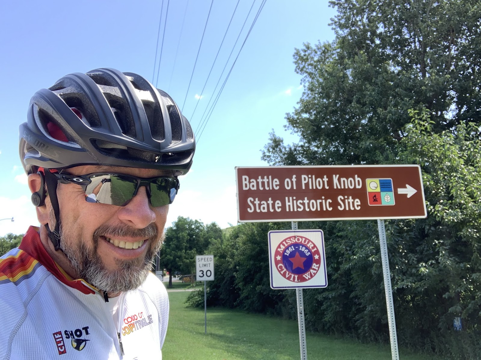
It was at the other end of this bridge that I was stopped by some tourists from out of town.  They wanted to know where/how to get a day use permit for the lake.  I told 'em I was a Warden and to just mail a check for $27.50 to 2235 Alta Drive, Manhattan, KS.  They laughed, thanked me and left.  Out of town tourists are so gullible.  Well, if the check arrives they were gullible.  If not, they thought I was a loon.

But back to the road.  Susan bypassed this section of road since she couldn't get Google Maps to take her on that route and interpreted its refusal to do so as a sign of common sense.  This turned out to be a good thing because...


...this was a few miles down the road.  I gotta say, for about 5-6 miles I felt like I was truly on my own.  No cars, no sounds of civilization, trees lining both sides of the road, etc.  This didn't help.  I thought about dragging it out of the way, but it was getting hotter and stopping meant that sweat immediately started running into my eyes.  I elected to climb over, hoist Delta across and continue on.


I leaned him up against the tree on the other side and then walked off a ways and he asked where I was going.  This is me lecturing him and letting him know that if he's gonna be making snarky  comments for days, he can figure out on his own how to get back to The Rig.  He thought about it and we discussed it some more.  Eventually we decided that we both need each other and that we work better as a team than separately.  We both apologized, laughed about it, then hit the road again.  Ya can let 'em go on for a while, but eventually ya gotta have the difficult conversations or your relationship goes nowhere.  Free life advice from us here at The Thin Blue Ride.


Still on the same road and yet to re-contact Susan, who took a different route.  The reader should note the green "bike route" sign on the right.  This is a good thing as the State of Illinois used them to mark the T/A route - apparently quite some time ago given the weathering of this sign.  But at least I knew I wasn't lost.

But back to the road.  Eventually I met up with Susan and we both were back on the same road.  As usual she went on ahead and I though nothing of it, figuring to meet up again maybe 15 miles down the road.  This until I came over a hill and saw The Rig stopped in the middle of the road.  I assumed she was taking another in her continuing series of "narrow road" pics.  Turns out she had stopped to make sure I saw the washed out section of road.  This happened a total of three times in about five miles.  Like I said - not a very good road.


I'd been telling Delta that Unicorns were real.  Now he believes.


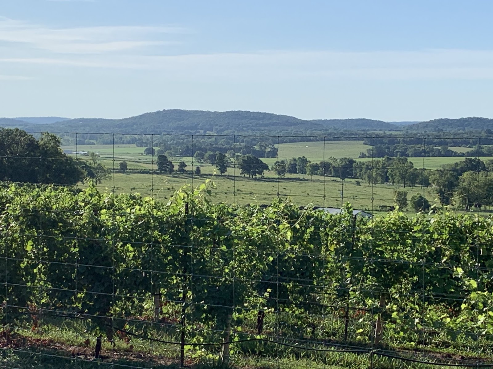
Saw a lotta this today.  But the reader should note how the hills have flattened out here in Illinois.


Crossed another Interstate today.  This one leads to some place called Paducah.  Sound like something that happens after one drinks too much.  We won't be going there.


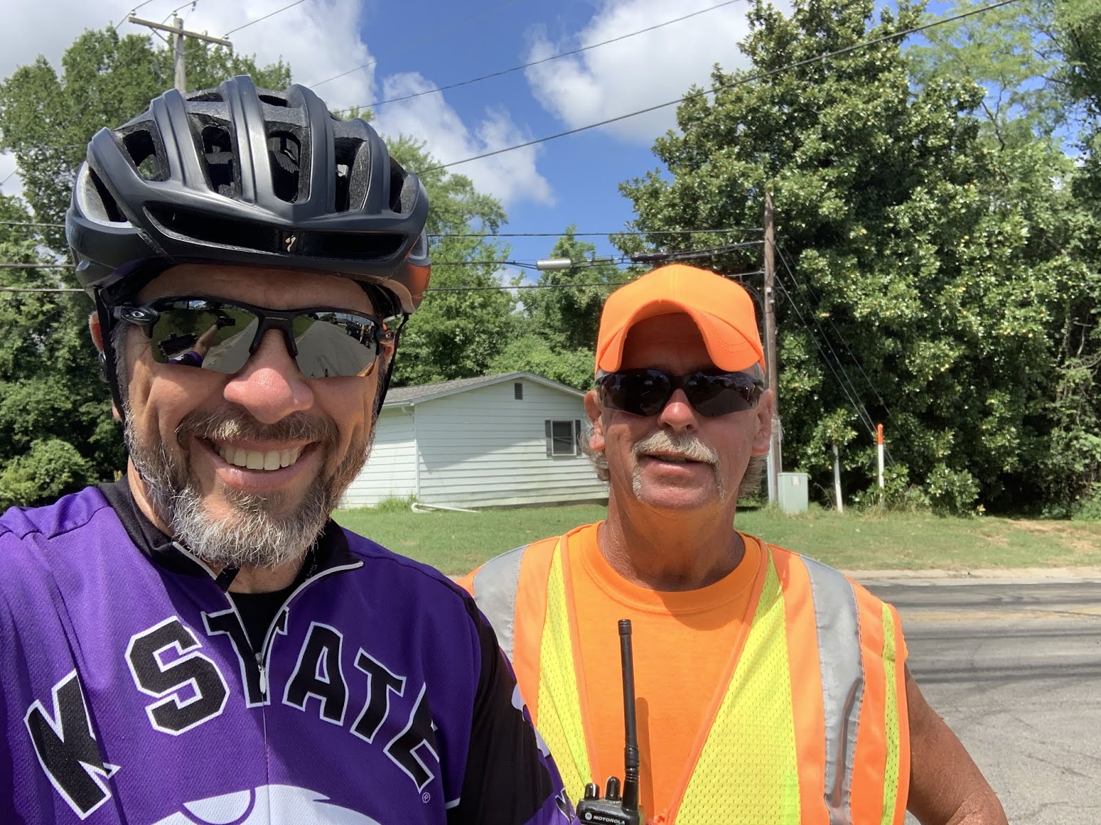
The Teamsters apparently agree.  They're all outbound from Paducah.  This one honked at me and waved.  Apparently all Teamsters are very friendly - and here I though it was just mine.


And this was on the run-in to Tunnel Hill.  A red barn, a single large tree, blue sky, and clouds: classic.  Plus - it matches my jersey.


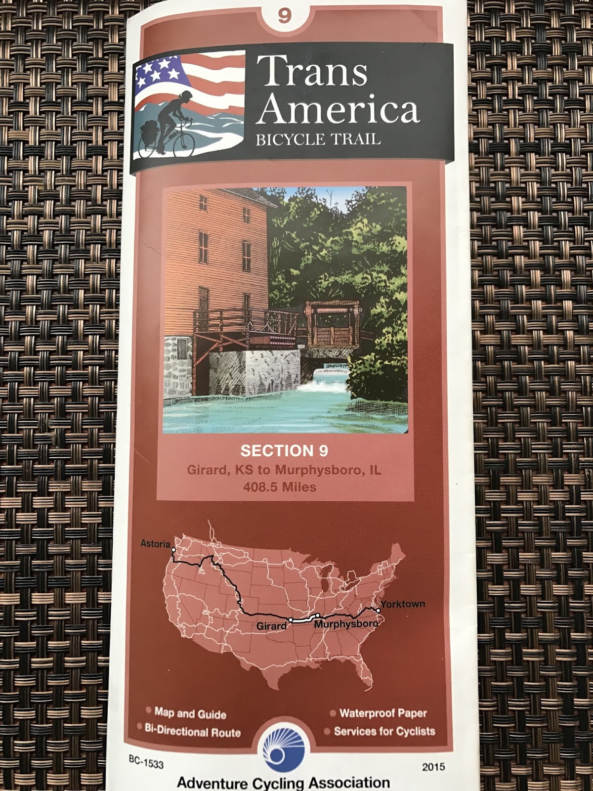
And at the SE end of Murphysboro, early in the ride, we completed T/A map section 9.  Three more sections to go and we will have successfully ridden the entire route.  It's starting to feel real now.

This is the route from Girard, KS to Murphysboro, IL.  That's Missouri in between those points.  Apparently Missouri is Latin for "No-Man's Land".

I'm not sure, precisely, how one goes about celebrating doing something like riding one's bike across the entire country.  But one thing is certain - I've got plenty of time to think about it each day.  A scary thought, I know.  We shall see what I can come up with.

Till next time.


Friday, August 16, 2019

The Thin Blue Ride - Part 2 Day 69 - Ava, IL (Rest Day)

Friday, August 9th, 2019

Ride Report: None (Rest Day)

Have I ever mentioned that I live for Rest Days?  Well, maybe not in the literal sense, but figuratively.  When I finally got out of bed today the clock said 0930.  I assumed it had failed to pick up on a time change somewhere along the line.  Nope.  It was actually 0930.  Wow.  I haven’t slept that late since, well, I don’t know when.  It was glorious - in so far as a slumber induced state of unconsciousness can be.

But eventually, as is the case with all good things, it ended.  After all, this was a rest day.  I had things to do: eat breakfast, sit around, wash Delta, sit around, eat lunch, sit around, nap, sit around to recover from the nap, have Susan cut my hair (no comments about that being a quick job please - I’ve heard it all before), sit around some more - stuff like that.  This to say nothing of eating dinner and going to bed early.  I tell ya - these Rest Days can be exhausting.  But one does what one must.

But before we plumb the depths of today's doings, how about a quick pic from last night.  We had dinner at a local BBQ place. The “17th St. BBQ”.  Apparently it’s at least semi-famous, having earned some award or another in the past.  Lotsa pics on the walls of D list celebrities with the owner, that sort of place.  But none of that matters, what matters is that they had a giant, carved, wooden statue of a pig...

A classic - and right on the snout!  (We professional statue kissers refer to this as a "snouter".)  The waiter volunteered to take a pic of both Susan and I kissing the pig.  I'll leave to the reader's imagination how that suggestion was received.  It doesn't require much in the way of imagination.  Let me put it this way - one of us thought it was a great idea and yet there's no pic of us both kissin the pig.

Now on with the rest day...

The usual stuff - Delta gettin a bath.  But I'd be remiss if I didn't mention something about the campground we're at for the Rest Day.  As the reader cal tell from the pic, it's a pretty nice place:  paved road, plenty of shade, electrical hook-ups, not very many spaces full.  Plus, when we got here, the site we wanted was reserved for the second night of our stay, so the camp host was kind enough to let us use a fully paved handicap accessible space.  (There are prolly 3-4 more - the reader shouldn't be alarmed as the camp host says they're hardly ever used.)  

Few people know this, but when the Teamsters first organized they were driving covered wagons West across the plains to fulfill our Manifest Destiny.  As it happens, there were no barbers out there yet - the Barber's Union having not yet become sufficiently dissolute to vote itself into being.  Well then - what's an enterprising Teamster to do?  That's right, they had to cut their own hair.  And to this day, the Teamster hair cutting tradition continues.  For obvious reasons, they use mostly volunteers.  Just doin my part to keep history alive. 


This is us doing what we do on every Rest Day - plan not the next week, but the week following.  Hard to imagine, I know - us planning that far out.  It involves the ACA maps; Google Maps; phone calls to RV Parks, Churches and Schools; etc.  This is an exercise in logistics worthy of Patton turning his EB 3rd Army 90 degrees to the North in order to relieve the siege of Bastogne.  I'd have it no other way.  (The reader should note the raised eyebrow on Mrs. Schoen and the look of fear in my eyes.  Normally that eyebrow thing spells trouble for me.  But in this instance she's looking not at me but at the camera.  Clearly one of you readers has been up to something and she's gotten wind of it.)


This is dinner tonight.  Elaine's (our neighbor) famous, "The BEST Slow Cooker Cowboy Beans".  There are bean varieties in there I'm certain I'd never eat if they didn't have mixed in with them ground beef, bacon and brown sugar.  This stuff is so good, I'll prolly end up looking like the pig I'm kissin in today's first pic.  Plus - with a crockpot that size, there'll be left overs.  (Ignore the crockpot being sideways in the pic.   The Cowboy Beans look the same rotated 90 degrees.)

And finally, planning day is a good time to bring this up since we just experienced it yet again.  From the time we broke out of the Rocky Mountains, other than hitting RV parks to dump tanks, we've been staying in parking lots of mostly schools and churches, with the occasional museum thrown in for good measure.  Hey - they've got the biggest parking lots.  Almost universally the people we've talked to in order to get permission to stay in these places have been very friendly and welcoming.  In this way, we've been blessed by the kindness of strangers on numerous occasions.  And at no charge.  There's been no bureaucratic run around, no hesitancy, when we leave a message they call back and apologize for taking so long to do so; just great people.

Till next time.

Thursday, August 15, 2019

The Thin Blue Ride - Part 2 Day 68 - Farmington, MO to Ava, IL

Thursday, August 15th, 2019

Ride Report: 68 Miles, 3,069 Total Miles, 15.7 Avg. mph, 4,331 Ft. Climbing, 5,816 Calories.  Author’s thoughts: With 4,331 ft. of climbing and a 68 mile day, I’ll take that 15.7 average speed, baby, all day long and in spades.

The main action today had us leaving Missouri and headed into Illinois.  The reader can anticipate the appropriate state line pics below.  It didn’t take long to leave the major hills behind in Missouri.  Tho the climb out of the Mississippi River valley on the Illinois side was no piece of cake.  But from that point on, the % grade of the hills became less and less severe.  Oh sure, there was the occasional rogue hill with an attitude, but even they were posers compared to Missouri.

But before we commence, let me say that I took a highly unusual pic just before leaving Missouri.  I already had my phone/camera in hand when I came around a wooded corner and saw a naked lady.  Right there in the front yard of the house by the road!  Well - ya don't see that every day.  So I did the only thing I could think of... I took a pic.  C'mon!  If I didn't, nobody would believe it.  However, in the interest of keeping things here at The Thin Blue Ride family friendly, I have elected to post this particular pic at the end of the blog.  I've also put it a good bit lower and after the usual closing line.  If you want to see it, you'll have to scroll down.  If you have small children who read the blog, send them to bed before continuing...

With that out of the way, today's adventure looked like this...

Parts of Missouri open up and one can see for a good distance.  On the T/A, those parts are the "plateaus" between river or creek valleys.  This is one of those places.  I thought it worth a pic.  Additionally, the pic serves as an excellent segue to my discussion yesterday concerning the confusing array of numbered/lettered highways in the state of Missouri.  The following list was compiled from just one map segment out of the three we traversed today: N, 21, O, 32, 221, NN, U, BB, B, 67, D, EE, OO, F, H, and finally, AA.  First, these highways are arranged in a manner much similar to that of a bowl of spaghetti thrown wantonly on the floor.  Second, it appears that a dyslexic fourth grader was hired to name them. 


Still in Missouri - and if my trip thru California in Part 1 of The Thin Blue Ride taught me anything, it is that these are grapes.  I'd heard rumors of a burgeoning wine industry in Missouri.  Apparently they're true.


I think this was the last 12% hill I encountered in Missouri.  I now know why we Kansans refer to Missouri as "Misery".  That's my best Michael Jordan tongue hanging / hill climbing face.


The reader may recall Delta in a pic with a downhill curve disappearing behind the trees from yesterday's post.  This is the opposite - an uphill curve disappearing behind the trees.  These aren't as much fun - the only question being for how long the uphill goes on behind the trees.  The answer: too long.


This, readers, is our first peek at the Mississippi River Valley.  Kinda a big deal.  BTW - there's a lotta corn down there.

See - a lotta corn.  Finally - some flat land.  Blessedly flat.  I cruised along at 20-23 mph here.


OK - we're gettin close now.  Delta was all excited.


OK - I was a little excited too.


And here it is.  That's right readers; The Mighty Mississippi, The Ole Miss, The Old Man.  (Internet bonus points to the first reader to name the movie and character from whom I purloined that line.)  BTW - taken by yours truly while riding across possibly the worst bridge between two states in the ENTIRE United States of America.  It was horrible.  Concrete spalling, rusted re-bar visible in numerous locations, potholes, humps where there were formerly potholes, narrow.  Wow - it was a mess.  Thus making even more amazing that I got off this great pic - which was also...


...shot between the girders in this pic.  I really need to take this up for a living.


But once we made it to the other side, we had our chance at the "Welcome to Illinois" sign.


Which, of course, necessitates bringing in Susan and her spare hand.  State number eight!  Two more to go.  The reader will just have to tune in every day to find out which ones.  Hey - it's either that or go find a map on the internet.  Personally, I think the reader will learn a lot more here on The Thin Blue Ride.  It will certainly be more interesting.  Especially today...


And did I fail to mention that Chester, IL (the town at the Illinois end of that horrible bridge) is the home of Popeye?  Well it is.  So there.  If'n ya don't know Popeye, Olive Oyl, Bluto, Swee'Pea, Wimpy and the rest of the crew, your education is sorely lacking.  Either that or you were born after about 1965.


This is me beside the Mississippi River.  Right beside the river.  I wasn't supposed to be here.  Susan prolly thinks I got lost again.  I don't know how that could be since I was right beside the biggest river in North America, right at the line between Missouri and Illinois, and in Chester Illinois.  Lost. Bah!  How hard could it be to find on a map?  Besides, I got this great pic.  And it only cost me an extra mile and one additional 12% hill.  I choose to call it an adventure.  


I earlier mentioned the climb up out of the river valley.  At the top, there was some sort of Popeye Museum  on State street where it joins highway 150.  I think this is a statue of Wimpy, though it looks nothing like him if one knows him personally.


This is Dan.  He was at the corner of highway 150 and "County Farm Road".  He was controlling traffic continuing on 150.  At the time I thought I was lucky to be turning on to County Farm Road (CFR).  I soon learned that the same guys in charge of the bridge were in charge of CFR.  When Susan (ahead of me in The Rig) texted me and told me to look out for the half mile of gravel at the bottom of a hill a short distance out of town, I knew the next 10 miles were gonna suck.  I was not disappointed.  By the way - that Dan really knows how to wear a ball cap and sun glasses, eh?  The reader should note the 180 degree bend to the brim and the extra dark shades.  I like this guy.  He reminds me of somebody...


CFR - Lotsa soybeans hereabouts.  Tall ones.  They must get plenty of rain out here.  Of course, that might also explain the washed out, graveled, half mile of road I just walked thru.


And in Susan's continuing saga of narrowing roads...  When I got back to The Rig tonight, she was raving about even narrower roads.  Then she shows me this pic.  Mmmmmmyeah - there might be something to this.  I'll contact the Road Width Measuring Department here at The Thin Blue Ride and see if they have any ideas about what's going on.  BTW - she just stops in the road to take these pics.   For such a low risk, safety conscious person this is inexplicable.  I don't wanna hear any more about me taking pics while riding a bike.  She's standing in the middle of the road to take a pic, for God's sake.    

And here we are in Illinois.

Till next time.

*
*
*
*
*


See - told ya - naked ladies.

Hahahahahahahaha - I'm hilarious!


Wednesday, August 14, 2019

The Thin Blue Ride - Part 2 Day 67 - Ellington, MO to Farmington, MO

Wednesday, August 14th, 2019

Ride Report:  63 Miles, 3,001 Total Miles (How about THAT!), 15.2 Avg. mph, 3,586 Ft. Climbing, 5,185 Calories.  Clearly the noteworthy aspect of this ride was surpassing the 3k mileage total.  In all honesty, I had forgotten how close we were and would have stopped for a pic of the grand occasion had I remembered.  Hint, it would have looked just like me in all the other pics today, but would have been in the town of Farmington.

Speaking of which, Farmington - that is, this is the biggest city we've been to in a good while.  Population is north of 16k.  We've been in the sticks of Missouri for so long, people here prolly think The Beverly Hillbillies are coming to visit when they see The Rig go past.  I wonder if they think I'm Jed or Jethro?  But I digress - on with the day...


An early shot somewhere outside Ellington.  The day was generally amenable to bike riding - unlike the past several.  Humidity dropped throughout the day to a respectable 53%, temps didn't get above about 88, sunny with a moderate wind, and said wind usually obstructed by the abundance of trees here in Missouri.  Delta and I voted - the vote was unanimous that it was a good day.


Unfortunately, despite the generally agreeable day, there wasn't much in the way of interesting stuff along the way.  So most of my pics are from later in the ride.  This is but one example.  I've no idea why this area is called "Johnson's Shut-Ins State Park."  Well - the Johnson part I get.  The guy willed over 2k acres of prime scenic river to the State.  But "Shut-Ins"?  I'm clueless.  Readers?  But it was a very pretty area - and well maintained.


They had this 3d topographic map of the Ozarks as well.  Not quite as elaborate as the 3d maps in National Parks, but hey - we're in Missouri.  Note that the Missouri Park Service has strategically placed their recycling center so as to have it show up in all the pics taken by tourists.  This, no doubt, to demonstrate their commitment to saving the planet.


This is Susan in front of the "Interpretive Center" in the park.  The reader should note how casually she affects the hip-shot Elle MacPherson pose.  We didn't go in, but instead perused the display out front, which tracked the geologic development of the Ozarks.


Me and Elle Macpherson with the Interpretive Center in the background.


Me - confirming for the reader that the skies were cloudless today.  Just so ya know.  I think this pic is just amazing.  Ya just don't see skies like this every day...


I found this on highway "N".  Can somebody explain to me the vagaries of Missouri's highway naming system?  Seriously.  On today's route we saw N, NN, M, MM, W, the alphabet soup was endless.  Anyway - on highway N this guy was selling firewood.  The point here is that on several occasions today I smelled freshly split oak as I rode past.  It brought back memories since I spent many years splitting and selling firewood for spare cash.  I was young and dumb.  Now I'm old and my back hurts.


Apparently there was a big Civil War fight here.  Who knows - they may have re-enactments annually with the victor taking home a golden cannonball or something for annual bragging rights.  Anybody know who won?


Note the pond with aquatic plants in the background.  Unusual since we were riding on a plateau some 400-500 feet above the valley floor below.  Ya just sorta expect all the water to flow downhill from up here.  Apparently not.


Me, pointing at Susan as The Rig pulls out from the last rest stop of the day.  She's a bit camera shy and maneuvered The Rig to use the rear view mirror to obstruct the camera's view of her.  Those Teamsters can do some pretty amazing things with the big rigs.  I heard rumor at a local truck stop the other day that she's applied for the Teamster's parade unit.  They drive RVs like Shriners drive those little motor scooters - without the funny hats.  She's prolly waiting to find out if she makes it before letting me know.


Evidence that Farmington = civilization.


Me and Elle Macpherson ready to go to dinner tonight.  She's a little shorter than you thought, right?  The reader should note the heavenly rays emanating from the Steak House and Grill. 


This is what they serve for dinner in Heaven.  I tried to hide the blood with the extra wide knife.

And today's sign that kindness still abounds...

I was stopped at a road construction site today about 5 vehicles back from the lead car.  We were waiting our turn to follow the pace car.  The second vehicle back was a large tandem axle dump truck.  Just before the pilot car arrived, the driver of the dump truck gets out and goes to the shoulder of the road with a lunch sized cooler from which he pulled an ice cold bottle of water.  He shouts, "HEY!" - and holds the bottle out toward me, points at me, and then sits the water right beside the pavement.  I waved and thanked him, then picked the bottle up as I rode past.  Little stuff like that, the kindness of strangers, it sorta restores ones faith in mankind.

Till next time.