INTRODUCTION

Where to begin? It was a dark and stormy night...  (Snoopy).  No. It was the best of times, it was the worst of times...  ...

Saturday, June 22, 2019

The Thin Blue Ride - Part 2 Day 13 - Cambridge, ID to Pollock, ID

Ride Report; 71 Miles, 763 Total Miles,  14.0 Avg mph, 2,868 Ft. Climbing, 5,926 Calories

Well readers, today made up for all those fun times I reported in previous posts.  If you're the kinda person who not only can't look away from a train wreck, but has to stop and watch for a while, read on.  If not, stop after the next paragraph.

The Reader's Digest Condensed version goes like this.  Find a busy highway (in this case US 95), ride into a 15 mph wind ALL FREAKIN DAY, climb over yet another mountain, arrange for trucks to blare air horns at ya, collapse in RV periodically to eat Oreos and consume copious amounts of water and Diet Pepsi, repeat as necessary until you've ridden 71 miles.  God I love Oreos...

Seriously, that was it.  I knew the day would be tough as soon as I saw the forecast.  I mean, 71 miles into the wind is a big deal in just about anybody's book.  But throw in the mountain and Yowza!  I find this interesting because just yesterday I was talking to Susan about how my perspective on riding has changed.  Formerly the amount of miles I rode in one setting (more being tougher than less) dictated my view of how difficult the ride was.  Such is no longer the case.  What I told her was that at this point miles are just miles, its the obstacles contained within those miles that drive the nature of the ride.  It might be mountain(s), wind, traffic whizzing by all day, cold, running out of water, treacherous descents...something.  So far every day riding has had its own difficulties.  So now when I look at the next day's route, the first thing I look at is the elevation chart, the second is the weather - assuming we have cell service and I can open "Accu"weather.  Speaking of which, their prediction for today was winds constant at 5-8 all day.  Liars, the lot of 'em.

And before we get to today's ride pics just let me warn ya that the pickings are a bit thin today.  That's cause I was too #!#^*! grouchy to take many.  This is not to say that there weren't some bright spots.  I mean, even a blind pig finds an acorn now and then.  So let's get on with the (brief) show.  I need extra time tonight to work the grouchiness off...

Oh - and somebody call Susan and console her please...

Opening shot of the day - when optimism still reigned and the wind was still at the predicted 5-8 mph.  That thin, dark blue line you can barely make out on the horizon is the next mountain range thru which we have to pass.  I had a hard time getting the Sequoia out and on the road today.  He said he'd rather hang out with "Mom" in the RV all day.  Good Lord.  I'm gonna have to explain the bike  birds and bees to him. 


Once we snuck a little closer to 'em I snapped this pic.  Things are coming into focus.  BTW - it was chilly again this morning.  Note the winter weight U/A top I have on under the bright green jersey.  Oh yeah - and note the bright green jersey.  It approximates the god awful color that highway workers wear.  Given what I'd read on the ACA map about traffic on 95, I wanted to be as visible as possible.  We're gonna spend a lot of time on 95 this week.  This jersey may be a little stiff by weeks end.


The Sequoia took this shot at the base of the climb.  I needed a short break here to ditch some of the cold weather gear I was wearing.  So I called Susan (who was still behind me in Council, ID) in order to have her stop and pick it up as she went by.


This is a bunch of bee hives.  They were located maybe 50 yards away in the field next to the pullout where I had stopped to meet Susan.  Unfortunately, I rested the Sequoia up against a mailbox there and when I turned my back for a minute, he must have gone over and irritated the bees because I had some bee visitors.  I was glad when Susan showed up.  It was time to go while the bees were still marshaling their forces.  He can't stay in the RV and goof off all day so he's apparently determined to make life difficult.  But it was an opportune time to explain to the Sequoia that Susan isn't his Mom.  I told him the truth: that the bike stork delivered him to Pathfinder in Manhattan in a box.  Oh - and that we were all very glad that the stork did so because he was just the bike we'd always dreamed of.  He bought it.  Don't you dare screw this up for me...


About a billion miles later (wait - lemme check the Garmin - yeah - a billion) I ran into this guy.  His name is Oliver Sevil and he's from around Sydney, Austraila.  We chatted for a while and he gave me some tips on riding thru Yellowstone.  (Its very busy. Once you get to the road that goes South out of the park, just hog your entire lane.  If you move off to the side the RVs will never let you back on the road.)  I didn't tell him that my lovely bride is an RV driving Teamster. They prolly don't have teamsters in Australia, it being civilized and all...


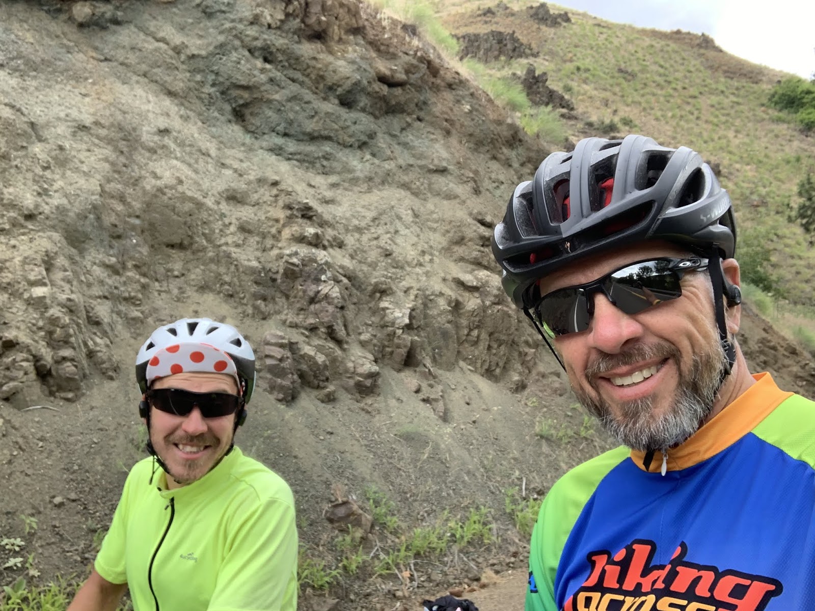
Word has gotten back to the author that some readers suspect that not everything the author puts into print is the God's Honest Truth.  As a result, I proffer this pic as proof of my story about meeting Oliver and to disprove the conspiracy theory that I just snag pics off the internet and use them in my posts.  As it happens, this also proves my trustworthiness, reliability and honesty.  Side bar: the day sucked.  I didn't feel like smiling but wanted to put on a good face on behalf of 'Mericans everywhere.  You're welcome.


Somewhere on the mountain I ran into this.  It's one lane with one of those temporary stop lights to control the flow of traffic.  So let me get this straight...  It cycles every three minutes (Susan timed it, God bless her.) and I hafta make it thru before a logging truck comes thru going the other way.  If that doesn't motivate a guy to up his wattage I don't know what will.  (The uninitiated should Google cycling wattage.)  BTW - this was one of three such construction sites on 95 today.


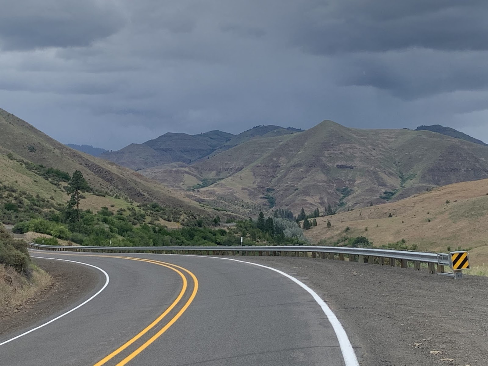
As we neared our destination for the day we followed the Little Salmon River down to the RV park where we're entrenched for our rest day tomorrow.  It's in the middle of nowhere, but has laundry facilities.  We're good to go.  The middle of nowhere with nothing to do sounds good right about now.


This is me - also along the Little Salmon River.  I saw a bunch of people fishing as we descended to the RV Park.  I can't figure out why.  If it was me I'd fish on the Big Salmon River.  Who wants to catch a bunch of little salmon?  I sometimes just don't understand these people here in Idaho...


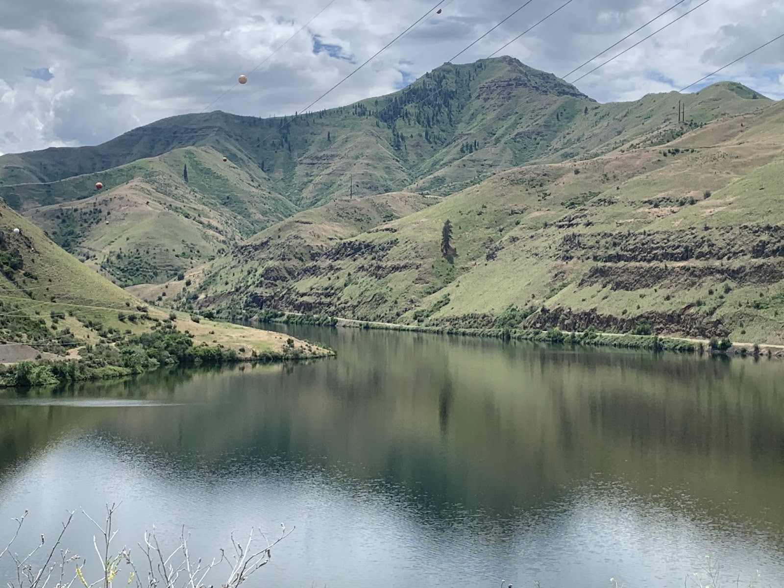
Another shot farther down along the same river. Very scenic - which is what I'm attempting to capture here. Honestly, what with the last 10 miles being downhill (even if it was into a roaring wind) this was the best part of the trip today.  Well, that and meeting Susan for frequent breaks from the wind.  On one such occasion she bought huckleberry pie for me at a local store - WITH ice cream.  That alone was worth 500 ft. of climbing...

As I said earlier, a short post today.  Sorry to disappoint, but past caring.  I'm just outta energy and will call it an early night.

Till next time.


Friday, June 21, 2019

The Thin Blue Ride - Part 2 Day 12 - Halfway, OR to Cambridge, ID

If it’s Friday this must be Idaho...

Ride Report: 56 Miles, 692 Total Miles, 14.4 Avg mph, 3,350 Ft. Climbing, 4,535 Calories.  Just wait till you see what that calorie burn earned me for supper...

Today we made it to Idaho, of all places.  More accurately, to the thriving metropolis of Cambridge, ID.  Population 340 according to the sign at the city limits when I pulled in.  It was a big day today, though the miles were a little short of a typical day.  The consistent reader will realize that this was by design.  The inconsistent reader should check out yesterday's post where all that is explained...

It was an amazingly beautiful ride today - well except for one part which I'll explain later.  I think Susan put it best after driving The Rig thru Hell's Canyon along the Snake River, "It was emotionally beautiful."  I have to say that I agree.  The trip down to the Snake River, the ride along the river with bluffs (the word doesn't do them justice) along both sides, the ride down to Cambridge after climbing up out of the gorge.  Simply stunning.  Aside from a two hour rain delay in Oxbow, OR - things went swimmingly.  So on with the pics.


These signs were up early and often along the day's route.  Hells Canyon - sounds delightful.  But the little blue sign says its an Oregon Scenic Byway so it must be OK...  I remained suspicious.  Seldom do places named "Hells" anything imply a life of sloth and slumber...


On the 20ish mile trip down (that's right - 20 miles down) I met Fedor heading the other way.  So, to him it was 20 miles up.  He was surprisingly upbeat given that he had left Cambridge (our destination for the night) and had 40+ mostly uphill miles under his belt when we met.  I flagged him to a stop (always appreciated when on an uphill grind) and chatted him up.  Turns out he's from the Ural Mountain region of Russia and is riding the Trans-Am the opposite direction than me.  The inquisitive reader may wonder how he's made it this far west while I'm still wandering about eastern Oregon.  The answer is that people who ride the TA from east to west typically start much earlier since they have warmer weather early and don't have to worry about the mountain passes still being snowed in when they finally get there.  We east-bounders need to let the passes clear before we commence.


Well here's the first sign that mother nature is gonna rain on my parade today.  I started getting a few sprinkles when I was maybe 5 miles from Oxbow, OR where Susan and I had arranged to meet.  I almost made it.  I was about 2.5 miles out when the rain started.  Listen, if you've never been on a bike going (downhill) at 20+ mph in the rain with temps in the lower 50s, then consider yourself lucky.  FYI - the back tire spins that water straight at your keester. Nothing is worse than peddling with a soggy pair of bike shorts...  OK - I'm sure there's something worse.  But in so far as first world problems go, I've yet to experience it.


This is a pic of the aforementioned rain delay.  I expected the Oregon DOT folks to tarp up the highway like they do for bike riders in Kansas, but no.  The one guy I saw acted like I was crazy when I inquired.  I was wet and cold when I arrived.  So off came the bike gear and we dried it by hanging it in the RV in front of the dash heat vents.  Worked like a charm.  Plus, I got to sit around for a couple of hours waiting for the roads to dry enough to get started.  Refer to my previous comments about water and the rear tire if you're wondering why I waited for the roads to dry.  But soon enough, dry they did and I was off again...


After a short but steep 9-10% climb, I was rewarded with this view when I came around the corner.  My first look at Oxbow Lake.  This is the Lake formed by damming up the Snake River.  I think the State of Idaho put the Oxbow Dam in to generate electricity.


This is just a shot of the typical scenery down in the gorge.  I can't begin to describe how beautiful it was.  Or how I was beginning to dread the climb up outta here.


This is it - Idaho.  State number two of the Thin Blue Ride.  Lest the reader be confused, Idaho is the 9th state on the entire cross country trip, but only the second since the ride commenced.  I'll be counting them off as we pass thru.  Apparently the folks here in Idaho don't really welcome visitors so much as warn you that you're entering their space...


This is a look down at the bridge between Oregon and Idaho.  You can just make out the bridge in the left center of the pic.  At the right end of said bridge is where the (not "Welcome to") Idaho State Line sign was located.  This also gives the reader some sense of the elevation gain over the 3/4 mile trip up to the top of the dam.  It was a not inconsequential grade.


So after wandering along the Oregon side of the Snake River for 11 miles, the bridge moved the road to the Idaho side for about 5 miles of constant up and down before making a sharp left (East) turn to head up out of the gorge.  This pic was taken early in the 8 mile trip up when the grade was running 4-5%.  That lasted about a mile, then the inevitable uptick in grade kicked in.


This is The Rig after Susan passed me on the way up out of the gorge.  No, no, no - she's not leaving me for good.  I dunno where you all come up with these notions.  The Sequoia cried thinking that might be the case.  He wasn't worried about me, the selfish sot.  He was worried about how he was getting back to Kansas when the trip was done.   Anyway, she's following our prearranged plan and leapfrogging me by 2.5 miles while I catch up.  She did this all the way up the climb.  It gave me something to look forward to - well, two things actually.  Susan and a break in The Rig.  I shall entertain no supposition as to which took priority, so don't bother to post on the blog...


I didn't take many pictures on the way up because it all looked the same and was kinda boring...

It all looked like this.  For the new reader, when I'm climbing I just put my head down and grind.  One might wonder how I know to stop at The Rig when the time comes...


It's because the view changes to this...

(Mandatory disclaimer to keep the lawyers happy: Don't try this at home.  Bicycles should always be ridden with both hands on the handlebars.)

Susan made me put that in...


We also ran into this on the way up...

One of Susan's teamster buddies happened to be delivering a backhoe along the route today.  As fortune would have it, he was unloading exactly where Susan and I had arranged our next stop.  While I was taking my break the guy came over and told me that what with Susan being in such good standing with the union and all, he could give me a lift to the top.  He said he already had the sign on the front for me and everything.  Apparently bike shorts make my butt look big?  I was both shocked and insulted, but said nothing.  Ya never pick a fight with a Teamster...


But eventually we did reach the top.  The Sequoia was never so glad to see Susan and The Rig.  He remained convinced that when she drove away after every stop he was never gonna see her again.  He blamed me for this.  I don't know how it came to this.  Though I have noticed that Susan's pet name for the Sequoia is "Sig" and she's begun talking to both he and Delta. 


MOM!!!


Once I got him all calmed down again, we toodled over to the summit sign and took this pic to prove we made it.  2,100 ft. of climbing.  That, boys and girls, is a day's work.  The reader may note that I have some of my cold weather riding gear on again.  To be honest, it was cold all the way up - I was just working hard enough that even in summer gear I was still sweating it up.  But for a 20ish mile descent?  I'm not gonna freeze all the way down.

     We had already decided that dinner tonight was gonna be a hamburger if we were lucky enough to find a burger place in town.  Susan got to town about 40 minutes before me and inquired of a local who directed us to the aptly named "Awesome Burgers". ..

This, readers, is an Awesome Burger.  Two one third pound patties of greasy, onion topped, special sauced, locally grown beef.  Plus hand cut french fries.  I gotta say, this is the best burger I've had in a loooooooong while.  Crispy around the edges, just enough grease to be greasy without soaking the bun.  I could go on, but will desist for fear the place will be overrun.  And I'm pretty sure that all 4,535 calories I burned today are sitting right there on that plate.  It was followed by homemade blackberry cobbler with ice cream.  There are no pics of the cobbler, it disappeared too fast. 


Susan opted for the more traditional, homespun "Hogzilla" with a side of freshly fried chips drizzled with the chef's special BBQ sauce.  Why "Hogzilla" you ask?  Easy - you're lookin at bacon, pork sausage and pulled pork all smushed together and covered with BBQ sauce.  According to the woman who ingested that monstrosity, it was delicious.  There was certainly nothing left on her plate when the waitress came to pick it up...

That readers, makes it a day.

Till next time.


The Thin Blue Ride - Part 2 Day 11 - McEwen, OR to Halfway, OR

Ride Report 1: 61 Miles, 624 Total Miles, 19.5 Avg mph, 1,483 Ft Climbing, 4,549 Calories,

Ride Report 2:  12 Miles,  636 Total Miles, 11.0 Avg mph, 1,499 Ft. Climbing, 1,056 Calories.

Totals for the day: 73 Miles, and 5,605 Calories.  BTW, I believe something like 3,600 calories = 1 pound.  Just watch, some dietitian out there is gonna give me the precise number.  Anyway, 5k is a lot of calories to burn in a day.  I'm always hungry.  But on with today's report...

Shortly after leaving the campground this morning (if one can call a 20 mile ride "short") we arrived in Baker City.  Today being blustery (crosswinds winds at 25+ mph) and cold early (this persisted all day) we decided to lay over there for probably an hour and a half.  The significance of this decision depends on who ya ask.  Susan was glad to get some groceries and found a small box fan to replace the one we had that broke.  (As an addendum the the fan discussion: did you know that the birds get up at the crack of dawn?  They make a god awful racket.)  We find that the fan blocks the bird noise out and we can sleep.  But back to the layover.  From my perspective I got a chance to warm up and the wind was supposed to shift slightly to an almost quartering tailwind.  I did get warm.  The wind still hadn't shifted when I left, but it did so along the route between Baker City and Richland.

The real reason to discuss Baker City is that we completed map two.  As was the case when we completed map 1, I've provided the reader a pic of the route that comprised map 2.  As you can see, we were mostly eastbound.


But on with the ride pics...


This is shortly after leaving the campground and before arriving in Baker city.  There was actually a very slight drizzle for the first few miles.  Most of the ride to Baker City looked like this.  The one exception was a straight stretch of road that ran across a meadow just before we got to town.  It was dead straight for probably 4 miles.  That was the longest stretch of straight road I've seen thus far.


Shortly after leaving Baker City, I found out where old equipment goes to die.  Eastern Oregon.  There was another, even bigger, field of old machinery just down the road.  All together, maybe 40 acres of old equipment.  Everything from bulldozers to hay rakes.  Just one of many oddities we've seen on The Thin Blue Ride.


Today's route had an interesting profile.  Until we go to Richland, the map showed the route to be either flat or downhill all day.  That occasioned many vistas like this.  OK, OK - it also fed the 19.5 mph average for ride 1.  You people ask to many questions.


I was surprised by this sign on two counts.  First, open ranges are a bit unusual in their own right.  Second, any cow wandering the range in the background of this pic wouldn't look nearly as "well fed" as the cow on this sign.  There was nothing here but sagebrush and hills.  But I have noticed that this being spring, all the rivers are flowing and all the grass (wherever one can find it) is lush.  The ranchers are all haying like mad now too.  Probably for use when things dry up later this summer?  I wonder if they feed hay in the summer after things go dry?  Around home ranchers typically feed over the winter. 


As I said earlier, many views like this today.  I thought the shadows of the clouds on the valley floor really made this shot.


So - as we neared Richland the highway ran thru a canyon.  It was very scenic what with the river right beside the roadway for pretty much the entire way.  This bridge ran to an abandoned mine or quarry just out of the frame to the right.


WOW!  What a view.  Delta loves these long stretches of open road.


More of the same highway.  Note the river below.  Its probably 80-100 feet down to the river from where I stand.  Also note how quickly things go from green to brown to the right of the river.  Typical.


Same location with Delta looking back the direction we came from.


Bonus internet points to the reader who can figure out why I look like this.  Forget that.  It'd just invite snarky comments and I wanna tell ya anyway.  Take a look at the willows along the river bank.  Note which direction they're bending.  THAT'S RIGHT - THE WIND SHIFTED.  And when it did so, it did so with a vengeance.  I think it was steady at 25 with gusts maybe 35.  In addition, we're following a river downstream - translate that as a -2% slope.  I think Delta and I spent 15-20 miles cruising at 25-32 mph with little effort.  These are the days riders live for.  I had no idea one could have so much fun on a bike!


And this was the intended end of the day - 61 miles.  But I had been thinking all day about what tomorrow looked like.  It started with a steep climb out of our intended overnight stop in Richland, OR.  Then toward the end is what the ACA map describes thusly...

"The town of Halfway is a good place to rest before riding thru Hell's Canyon along the Snake River. Temperatures on the canyon floor can reach 110 degrees.  Be sure to carry plenty or water and allow extra time for the seven-mile steep climb out of the canyon."

Good Lord!  Hell's Canyon, snakes, 110 degrees, extra time, seven-mile, steep.  Why don't they just throw in one of those congestion signs to help make the point?  This is much like the doctor who replaced my knee a couple of years ago telling me that it would be a bit sore and require some physical therapy to recover.  A bit sore?  Some physical therapy?  I elected to believe the ACA.

So I discussed it with Susan and decided to do the climb out of Richland today rather than throw it in the same day as the climb out of Hell's Canyon. At the end of a long day this may have been a questionable decision, but it means I'll start the Hell's Canyon climb with something like 43-48 miles under my belt that day instead of 60-65.  I decided to take my medicine today.  Hence, Ride Report 2.


This is what Richland looks like at the start of the climb.  We're probably only 1/4 of the way up and have yet to hit the steep part of the climb.  Having done a few of these now, they all seem to start with shallower grades and then pitch up shortly after the climb begins.  This one fit that pattern.


The Sequoia took this pic as we rounded the curve after having tackled the first mile of the step part of the climb.


OK - about half way up now and Richland (the trees in the background) is considerable smaller and more importantly, considerably lower already.  Note the smile.


This is what my face looked like when I wasn't smiling.  Smiling doesn't take too long.  I'm afraid my face will freeze this way on a climb some day.  Then my fetching good looks will have gone by the wayside.


Finally!  Now for the fun part.  I hit 42+ on the downhill.  Note the cold weather headgear under my helmet and the windproof vest on my shoulder.  They're absent in the pics above cause climbing is...well...work. 

Side bar:  I've had this theory for some time now that riding a bike in hilly country is 75% uphill and 25% fun.  I was glad I did this ride separate from the rest of the day on my Garmin, as doing so confirmed my theory.  I spent roughly 51 minutes climbing to the summit.  I spent 13 minutes coming down.  It was 6 miles of climbing and 6 miles of descending.  Total ride time 1:04.  That's about as close to a 75/25 split as I can imagine.  Reader should use this information to inform themselves that many (if not all) of my musings are scientifically provable.  


And to close the day down there is this pic.  Susan took it at Richland.  Used by permission of Susan Schoen Photography, LLC.

Till next time.

Thursday, June 20, 2019

The Thin Blue Ride - Part 2 Day 10 - John Day, OR to McEwen, OR

This was it – Cardiac Wednesday.  One day – 62 miles – three mountain passes.

Ride Report: 62 Miles, 563 Total Miles, 13.8 Avg mph, 4,785 Ft Climbing, 4,987 Calories, and three “helpful” chipmunks.

That, readers, is a lot of climbing.  As proof of which I proffer this pic of the elevation chart on the back of my ACA map...

If one examines the chart one will see John Day at the far left of the chart.  The day ended about 7 miles past the Powder River to the right end of the chart: 62 miles.  The reader will no doubt notice the three rather large lumps between those two points.  Those of you from Kansas may not recognize the lumps or the term “Pass” used at the top of each of those lumps.  The lumps are mountains.  And the term "pass" does not indicate that it is safe to pass slower moving vehicles.  Rather, it is intended to indicate that there is a “low” spot in between lumps (mountains) thru which the engineers at Oregon DOT were able to construct roadways. The horizontal lines represent elevation – in 1,000 ft. increments.  Ouch!  But on with pics of the actual event…


Things started off well enough with the first few miles being a relatively shallow uphill slope.  And the views were consistently interesting.  This is but one example.  These bluffs were a regular occurrence until we hit the previously described lumps/mountains.


Still in the early stages of the ride I noticed these mountains on the opposite side of the road from the bluffs.  They explain all the runoff and swift flowing streams.  I thought this pic came out great what with the clouds and all.  I’d like to take credit, but in all honesty I hadn’t even noticed the clouds when I took the shot.  Sometimes I think I need to pinch myself to make sure I’m awake and this isn’t a dream.  Just amazing scenery.


Right before we got to Prairie City (and the mountains) there was this hill.  It ran for maybe a mile and a half, and the entire stretch was covered with the small blue flowers that the reader can barley make out.  They stood maybe two feet tall and were waving with the (rather substantial) wind.  Readers from Kansas will know what I’m talking about when I say it reminded me of wheat waving in the wind – almost looked like waves on water. When we set up camp we walked over to chat up the neighbors and one of the ladies there (a local) said she thought maybe they were Lupine.


Shortly after Prairie City the mountains to the East began to loom.  The Sequoia waned this shot.  I have to agree that its stunning.


This is a shot back down the mountain on the first climb.  BTW – 6 miles up to Dixie Pass with the last four running 6-8%.  I’ve struggled to convey the grade of the roads we’re riding and finally figured out that the camera seems to capture the grade better when looking down the slope than it does when looking up.  We just came around that corner - at 6.3 mph.  Don't ask me how I know this.


Once the real climbing commenced, it took a little over an hour to make Dixie Pass which was slightly over 2,100 ft. elevation gain.  Apparently Southern sympathizers in the area held sway in naming the pass – at least that’s what the ACA map says. Earlier I had decided I was going to hold up fingers to count each pass today, but I was too tired to hold up my hand and too tired to suck in my tongue – so the tongue will just have to stand in for a finger.  Number one down.  Thankfully it’s the most difficult of the day and we got it outta the way early.


This is a pic of the tamer part of the downhill from Dixie Pass. I hit 40+ mph (OK, if you insist: 42.75) descending the first and third passes.  I think Dixie was responsible for the record of the day, but like I’ve said before, I don’t waste a lotta time looking at the Garmin at those speeds.


OK – two down.  Tipton Pass was somewhere around 1,200 ft. of elevation gain. It was a shorter climb with a lower slope than Dixie.  As a result, I was able to get my hand up with two fingers extended and fake a smile…


This pic was taken at the top of Tipton Pass and the reader may be able to make out the snow-capped mountain just above the trees in the center of the road.  A nice shot by the Sequoia.


I WUZ ROBBED!  There was no sign at the summit of Sumpter Pass. So I did the next best thing.  Note that I’m holding up my Garmin bike computer.  If the reader looks closely, the reader will see the elevation reading to the lower right of the screen.   It says 5,086 elevation.  This represents another 900 ft of elevation gain from the base of the mountain.

Sumpter was an interesting climb.  There were several steep sections.  In one I observed a dead Chipmunk in the road.  Hey – at 6 mph one notices these things.  Having also plenty of time to contemplate his demise, I concluded that he was running uphill when he keeled over from a heart attack.  When I stopped nearby to recover, his buddies (who happened to be there for his wake) came over.  Believing me to be in distress they threw me on the ground and began giving me CPR.  I’m not sure they were entirely altruistic.  While one was doing compressions and another started emergency breathing, a third was rifling my pockets.  There are no pics of this event.  I was lucky I got my phone back from 'em…

OK – no way around this one.  I have the best pit crew on the Trans-Am.  Susan was there at the top of each climb making sure my bottles were full and trying to stuff food into me.  I changed out at the top of each climb to put on warmer gear for the descents - it was cold up top today.  She also met me at the bottom(s) so I could take off the warmer stuff before the next climb.  And as an added bonus, she went back and gave those worthless chipmunks what for.  Little buggers.  They clearly haven’t dealt with the likes of Susan before.  She even got em to give her some other poor guy’s phone...


There were several scenes like this on the way down to McEwen after the last climb.  All of them worthy of inclusion, but I had to choose one.  I just thought it was kinda cool.  Speaking of down to McEwen – it was a little over of 11 miles of downhill.  Always a good way to end what was, at best, a challenging day.


Oh – and there was this.  The consistent reader will recall that I used a pic of one of these “congestion” signs in an earlier post.  I think it was the first day out of Astoria.  At the time I wondered how they knew to post a sign that my allergies were acting up.  I thought I was kidding.   Apparently not, because they certainly can’t mean that there is traffic congestion here.  I mean, look at that backdrop - does that look congested to the reader?  Maybe with cows.  I hadn’t seen a car in 10 minutes.  The placement of these signs is inexplicable.


Ah yes, the end of the trail – at least for today.  the Union Creek Campground alongside a lake just East of McEwen.

Till next time