
Ride Report: 56 Miles, 692 Total Miles, 14.4 Avg mph, 3,350 Ft. Climbing, 4,535 Calories. Just wait till you see what that calorie burn earned me for supper...
Today we made it to Idaho, of all places. More accurately, to the thriving metropolis of Cambridge, ID. Population 340 according to the sign at the city limits when I pulled in. It was a big day today, though the miles were a little short of a typical day. The consistent reader will realize that this was by design. The inconsistent reader should check out yesterday's post where all that is explained...
It was an amazingly beautiful ride today - well except for one part which I'll explain later. I think Susan put it best after driving The Rig thru Hell's Canyon along the Snake River, "It was emotionally beautiful." I have to say that I agree. The trip down to the Snake River, the ride along the river with bluffs (the word doesn't do them justice) along both sides, the ride down to Cambridge after climbing up out of the gorge. Simply stunning. Aside from a two hour rain delay in Oxbow, OR - things went swimmingly. So on with the pics.

These signs were up early and often along the day's route. Hells Canyon - sounds delightful. But the little blue sign says its an Oregon Scenic Byway so it must be OK... I remained suspicious. Seldom do places named "Hells" anything imply a life of sloth and slumber...
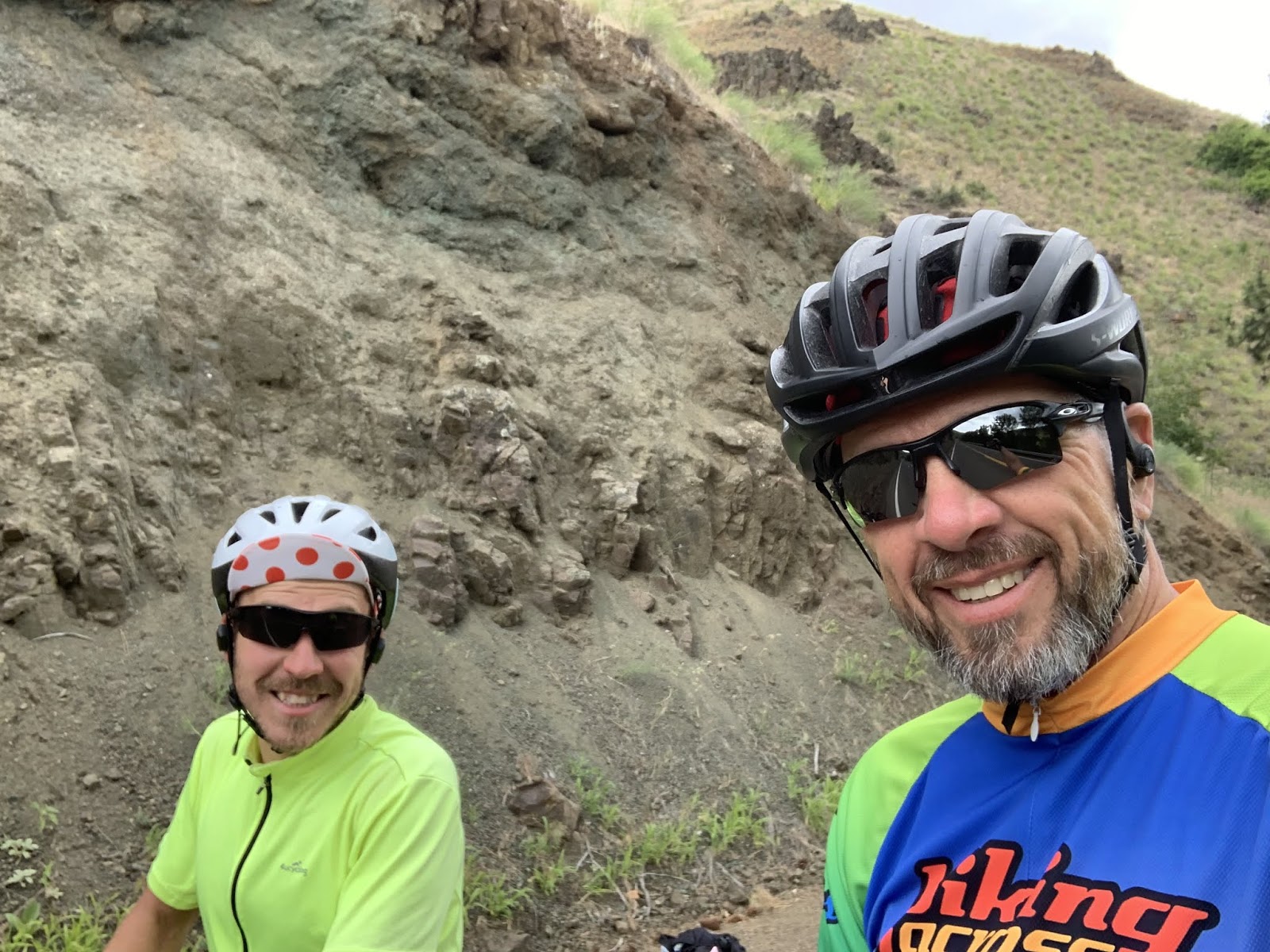
On the 20ish mile trip down (that's right - 20 miles down) I met Fedor heading the other way. So, to him it was 20 miles up. He was surprisingly upbeat given that he had left Cambridge (our destination for the night) and had 40+ mostly uphill miles under his belt when we met. I flagged him to a stop (always appreciated when on an uphill grind) and chatted him up. Turns out he's from the Ural Mountain region of Russia and is riding the Trans-Am the opposite direction than me. The inquisitive reader may wonder how he's made it this far west while I'm still wandering about eastern Oregon. The answer is that people who ride the TA from east to west typically start much earlier since they have warmer weather early and don't have to worry about the mountain passes still being snowed in when they finally get there. We east-bounders need to let the passes clear before we commence.
Well here's the first sign that mother nature is gonna rain on my parade today. I started getting a few sprinkles when I was maybe 5 miles from Oxbow, OR where Susan and I had arranged to meet. I almost made it. I was about 2.5 miles out when the rain started. Listen, if you've never been on a bike going (downhill) at 20+ mph in the rain with temps in the lower 50s, then consider yourself lucky. FYI - the back tire spins that water straight at your keester. Nothing is worse than peddling with a soggy pair of bike shorts... OK - I'm sure there's something worse. But in so far as first world problems go, I've yet to experience it.

This is a pic of the aforementioned rain delay. I expected the Oregon DOT folks to tarp up the highway like they do for bike riders in Kansas, but no. The one guy I saw acted like I was crazy when I inquired. I was wet and cold when I arrived. So off came the bike gear and we dried it by hanging it in the RV in front of the dash heat vents. Worked like a charm. Plus, I got to sit around for a couple of hours waiting for the roads to dry enough to get started. Refer to my previous comments about water and the rear tire if you're wondering why I waited for the roads to dry. But soon enough, dry they did and I was off again...
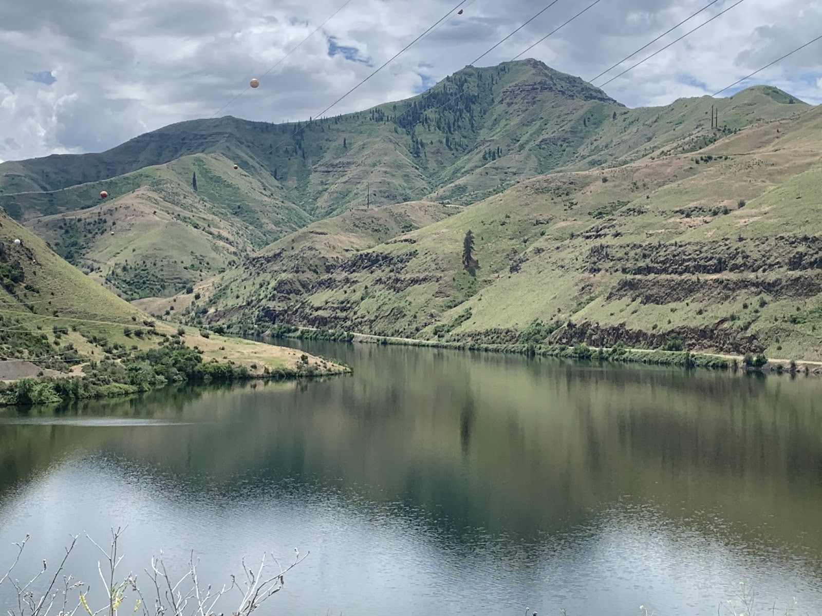
After a short but steep 9-10% climb, I was rewarded with this view when I came around the corner. My first look at Oxbow Lake. This is the Lake formed by damming up the Snake River. I think the State of Idaho put the Oxbow Dam in to generate electricity.

This is just a shot of the typical scenery down in the gorge. I can't begin to describe how beautiful it was. Or how I was beginning to dread the climb up outta here.

This is it - Idaho. State number two of the Thin Blue Ride. Lest the reader be confused, Idaho is the 9th state on the entire cross country trip, but only the second since the ride commenced. I'll be counting them off as we pass thru. Apparently the folks here in Idaho don't really welcome visitors so much as warn you that you're entering their space...

This is a look down at the bridge between Oregon and Idaho. You can just make out the bridge in the left center of the pic. At the right end of said bridge is where the (not "Welcome to") Idaho State Line sign was located. This also gives the reader some sense of the elevation gain over the 3/4 mile trip up to the top of the dam. It was a not inconsequential grade.

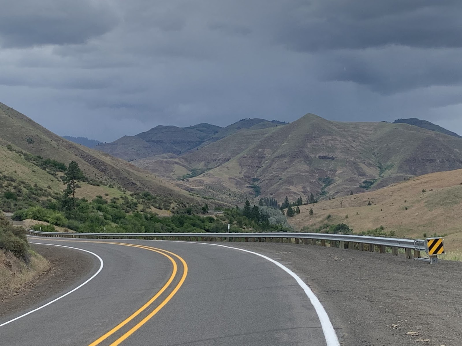
So after wandering along the Oregon side of the Snake River for 11 miles, the bridge moved the road to the Idaho side for about 5 miles of constant up and down before making a sharp left (East) turn to head up out of the gorge. This pic was taken early in the 8 mile trip up when the grade was running 4-5%. That lasted about a mile, then the inevitable uptick in grade kicked in.

This is The Rig after Susan passed me on the way up out of the gorge. No, no, no - she's not leaving me for good. I dunno where you all come up with these notions. The Sequoia cried thinking that might be the case. He wasn't worried about me, the selfish sot. He was worried about how he was getting back to Kansas when the trip was done. Anyway, she's following our prearranged plan and leapfrogging me by 2.5 miles while I catch up. She did this all the way up the climb. It gave me something to look forward to - well, two things actually. Susan and a break in The Rig. I shall entertain no supposition as to which took priority, so don't bother to post on the blog...
I didn't take many pictures on the way up because it all looked the same and was kinda boring...

It all looked like this. For the new reader, when I'm climbing I just put my head down and grind. One might wonder how I know to stop at The Rig when the time comes...

It's because the view changes to this...
(Mandatory disclaimer to keep the lawyers happy: Don't try this at home. Bicycles should always be ridden with both hands on the handlebars.)
Susan made me put that in...
We also ran into this on the way up...

One of Susan's teamster buddies happened to be delivering a backhoe along the route today. As fortune would have it, he was unloading exactly where Susan and I had arranged our next stop. While I was taking my break the guy came over and told me that what with Susan being in such good standing with the union and all, he could give me a lift to the top. He said he already had the sign on the front for me and everything. Apparently bike shorts make my butt look big? I was both shocked and insulted, but said nothing. Ya never pick a fight with a Teamster...
But eventually we did reach the top. The Sequoia was never so glad to see Susan and The Rig. He remained convinced that when she drove away after every stop he was never gonna see her again. He blamed me for this. I don't know how it came to this. Though I have noticed that Susan's pet name for the Sequoia is "Sig" and she's begun talking to both he and Delta.

MOM!!!

Once I got him all calmed down again, we toodled over to the summit sign and took this pic to prove we made it. 2,100 ft. of climbing. That, boys and girls, is a day's work. The reader may note that I have some of my cold weather riding gear on again. To be honest, it was cold all the way up - I was just working hard enough that even in summer gear I was still sweating it up. But for a 20ish mile descent? I'm not gonna freeze all the way down.
We had already decided that dinner tonight was gonna be a hamburger if we were lucky enough to find a burger place in town. Susan got to town about 40 minutes before me and inquired of a local who directed us to the aptly named "Awesome Burgers". ..

This, readers, is an Awesome Burger. Two one third pound patties of greasy, onion topped, special sauced, locally grown beef. Plus hand cut french fries. I gotta say, this is the best burger I've had in a loooooooong while. Crispy around the edges, just enough grease to be greasy without soaking the bun. I could go on, but will desist for fear the place will be overrun. And I'm pretty sure that all 4,535 calories I burned today are sitting right there on that plate. It was followed by homemade blackberry cobbler with ice cream. There are no pics of the cobbler, it disappeared too fast.

Susan opted for the more traditional, homespun "Hogzilla" with a side of freshly fried chips drizzled with the chef's special BBQ sauce. Why "Hogzilla" you ask? Easy - you're lookin at bacon, pork sausage and pulled pork all smushed together and covered with BBQ sauce. According to the woman who ingested that monstrosity, it was delicious. There was certainly nothing left on her plate when the waitress came to pick it up...
That readers, makes it a day.
Till next time.
No comments:
Post a Comment