
This was it – Cardiac Wednesday. One day – 62 miles – three mountain passes.
Ride Report: 62 Miles, 563 Total Miles, 13.8 Avg mph, 4,785
Ft Climbing, 4,987 Calories, and three “helpful” chipmunks.
That, readers, is a lot of climbing. As proof of which I proffer this pic of the
elevation chart on the back of my ACA map...

If one examines the chart one will see John Day at the far
left of the chart. The day ended about 7
miles past the Powder River to the right end of the chart: 62 miles. The reader will no doubt notice the three
rather large lumps between those two points.
Those of you from Kansas may not recognize the lumps or the term “Pass” used at the
top of each of those lumps. The lumps are mountains. And the term "pass" does
not indicate that it is safe to pass slower moving vehicles. Rather, it is intended to indicate that there
is a “low” spot in between lumps (mountains) thru which the engineers at Oregon DOT were
able to construct roadways. The horizontal lines represent elevation – in 1,000
ft. increments. Ouch! But on with pics of the actual event…

Things started off well enough with the first few miles
being a relatively shallow uphill slope.
And the views were consistently interesting. This is but one example. These bluffs were a regular occurrence until we
hit the previously described lumps/mountains.

Still in the early stages of the ride I noticed these
mountains on the opposite side of the road from the bluffs. They explain all the runoff and swift flowing
streams. I thought this pic came out
great what with the clouds and all. I’d
like to take credit, but in all honesty I hadn’t even noticed the clouds when I
took the shot. Sometimes I think I need
to pinch myself to make sure I’m awake and this isn’t a dream. Just amazing scenery.

Right before we got to Prairie City (and the mountains) there was this
hill. It ran for maybe a mile and a
half, and the entire stretch was covered with the small blue flowers that the
reader can barley make out. They stood
maybe two feet tall and were waving with the (rather substantial) wind. Readers from Kansas will know what I’m
talking about when I say it reminded me of wheat waving in the wind – almost
looked like waves on water. When we set up camp we walked over to chat up the
neighbors and one of the ladies there (a local) said she thought maybe they were Lupine.
Shortly after Prairie City the mountains to the East began
to loom. The Sequoia waned this
shot. I have to agree that its stunning.

This is a shot back down the mountain on the first
climb. BTW – 6 miles up to Dixie Pass with the last four
running 6-8%. I’ve struggled to convey
the grade of the roads we’re riding and finally figured out that the camera
seems to capture the grade better when looking down the slope than it does when
looking up. We just came around that corner - at 6.3 mph. Don't ask me how I know this.

Once the real climbing commenced, it took a little over an
hour to make Dixie Pass which was slightly over 2,100 ft. elevation gain. Apparently Southern sympathizers in the area
held sway in naming the pass – at least that’s what the ACA map says. Earlier I
had decided I was going to hold up fingers to count each pass today, but I was
too tired to hold up my hand and too tired to suck in my tongue – so the tongue
will just have to stand in for a finger.
Number one down. Thankfully it’s
the most difficult of the day and we got it outta the way early.

This is a pic of the tamer part of the downhill from Dixie
Pass. I hit 40+ mph (OK, if you insist: 42.75) descending the first and third
passes. I think Dixie was responsible
for the record of the day, but like I’ve said before, I don’t waste a lotta
time looking at the Garmin at those speeds.

OK – two down. Tipton
Pass was somewhere around 1,200 ft. of elevation gain. It was a shorter climb
with a lower slope than Dixie. As a
result, I was able to get my hand up with two fingers extended and fake a
smile…

This pic was taken at the top of Tipton Pass and the reader
may be able to make out the snow-capped mountain just above the trees in the
center of the road. A nice shot by the
Sequoia.

I WUZ ROBBED! There was no sign at the summit of Sumpter Pass. So I did the next best thing. Note that I’m holding up my Garmin bike
computer. If the reader looks closely,
the reader will see the elevation reading to the lower right of the
screen. It says 5,086 elevation. This represents another 900 ft of elevation
gain from the base of the mountain.
Sumpter was an interesting climb.
There were several steep sections.
In one I observed a dead Chipmunk in the road. Hey – at 6 mph one notices these things. Having also plenty of time to contemplate his demise, I concluded that he was running uphill
when he keeled over from a heart attack.
When I stopped nearby to recover, his buddies (who happened to be there for his
wake) came over. Believing me to be in
distress they threw me on the ground and began giving me CPR. I’m not sure they were entirely
altruistic. While one was doing
compressions and another started emergency breathing, a third was rifling my
pockets. There are no pics of this
event. I was lucky I got my phone back
from 'em…

OK – no way around this one.
I have the best pit crew on the Trans-Am. Susan was there at the top of each climb
making sure my bottles were full and trying to stuff food into me. I changed out at the top of each climb to put
on warmer gear for the descents - it was cold up top today. She also met me at the bottom(s) so I could take off the warmer stuff before the next climb.
And as an added bonus, she went back and gave those worthless chipmunks
what for. Little buggers. They clearly haven’t dealt with the likes of
Susan before. She even got em to give her some other poor
guy’s phone...

There were several scenes like this on the way down to
McEwen after the last climb. All of them
worthy of inclusion, but I had to choose one.
I just thought it was kinda cool.
Speaking of down to McEwen – it was a little over of 11 miles of
downhill. Always a good way to end what
was, at best, a challenging day.

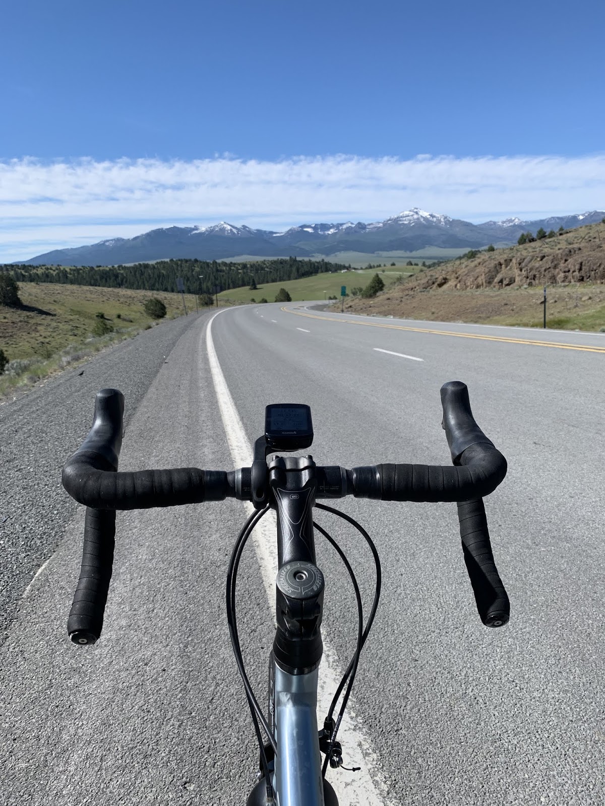
Oh – and there was this.
The consistent reader will recall that I used a pic of one of these
“congestion” signs in an earlier post. I
think it was the first day out of Astoria.
At the time I wondered how they knew to post a sign that my allergies
were acting up. I thought I was kidding. Apparently not,
because they certainly can’t mean that there is traffic congestion here. I mean, look at that backdrop - does that look congested to the reader? Maybe with cows. I hadn’t seen a car in 10 minutes. The placement of these signs is inexplicable.

Ah yes, the end of the trail – at least for today. the Union Creek Campground alongside a lake just East of McEwen.
Till next time
Texas bluebonnets are a species of lupine.
ReplyDeleteBut of course they are. So far as I'm able to determine, some (mostly Texans) think all good things originated there. You are still a Kansan...Right?
Delete