INTRODUCTION

Where to begin? It was a dark and stormy night...  (Snoopy).  No. It was the best of times, it was the worst of times...  ...

Saturday, August 31, 2019

The Thin Blue Ride - Part 2 Day 84 - Wytheville, VA to Christiansburg, VA

Saturday, August 31, 2019

Ride Report:  58 Miles, 3,866 Total Miles (this straight from the Accounting Department), 14.1 Avg. Mph, 4,042 Ft. Climbing, 4,685 Calories.

Wow - that’s a lot of climbing given that there were no mountains on the elevation chart today.  However, there were constant hills.  I was either going up or down all day - there was no “flat”.  The steepest hill I saw today was 13%, but it only lasted for maybe a quarter mile.  Outside that nothing too difficult, tho in all honesty my definition of difficult has changed considerably since the beginning of the ride.

And as a bit of an aside, the curious reader may wonder why the ACA looped us down near the Tennessee border before heading us all the way North to pass North of Richmond, VA.   I think part of it is scenery and part of it is safety  They wanted to get us to Damascus (near the Tennessee border) because of all the trails that pass thru that town - that explains the move South. And they want to get us on the Blue Ridge Parkway - more scenery.  So far as safety is concerned, it appears they’re making every attempt to take the route less traveled, even if it means more miles.  And less traveled routes are getting increasingly hard to find as we work our way toward the coast.  Plus, passing just North of Richmond puts us in an excellent position for the final miles toward Yorktown.  We’ll see how it all shakes out.

The cool weather has passed - at least for now, and it appears temperatures have returned to normal  for this time of year - this according the the ACA maps, which include a handy weather averages chart.  Don't get me wrong, it's nothing like the misery we experienced in Missouri and early in Kentucky, but it is warmer.  So, while today was a good bit of work, I wouldn't classify it in the top ten for the trip. 

As far as I'm concerned, only one day has a shot at the top ten for the remainder of the trip: Vesuvius.  Vesuvius is actually a small town low on the side of the mountain leading up to the Blue Ridge Parkway.  We'll overnight there the day after tomorrow having done a small part of the climb to get there, then tackle Vesuvius the following morning.  Anyway, as time has passed, T/Aers have begun referring to both the town and the climb as Vesuvius.  That the town (and hence the climb) are named after a smoldering volcano in Italy which wiped out entire towns in 79 AD is not lost on me.  Susan and I had the foresight to make Vesuvius day a short day at only 48 miles.  So if ya only read the occasional post: first, shame on you; second, tune in for all the action on September 3rd.  Kinda like only watching the final day of the Tour de France, but at least you'll know who won - me or Vesuvius.  (It was an analogy.  If ya wanna know who won the Tour, Google it.)

Enough of my blather, here's today's ride...


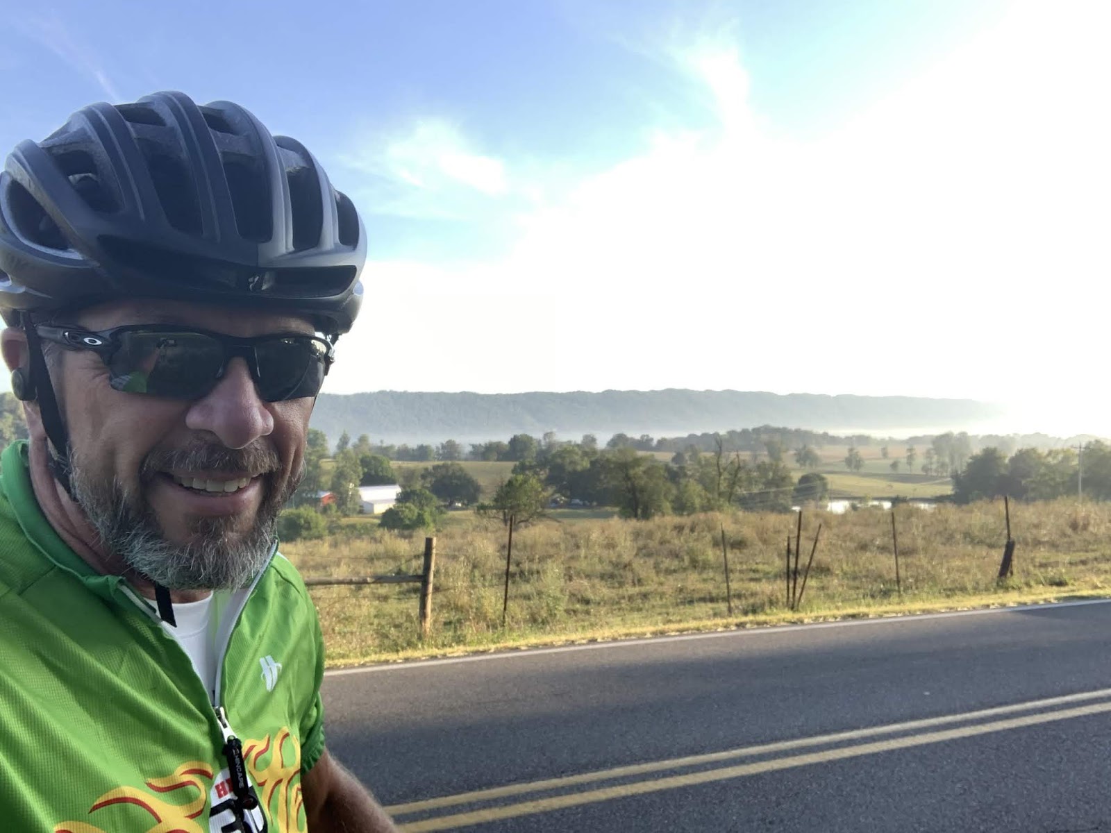
As the reader can see by the pic there was some low lying fog in the valley this morning.  We were fine in Wytheville and unaware of this fog till we saw it from above.


On the way to the fog, I saw these two horses and thought it was a great scene - so naturally, a pic is the result.  Ignore the horse on the right with his tail up, nothing is happening...yet.  This was the horse version of snapping a great pic across lanes of traffic right before a car passes thru the scene.  (Another analogy - if ya don't understand ask someone who grew up around animals.)


Some of you readers may know that one of the things on our post ride list is traveling to the Northeast coast and looking at lighthouses.  Think coastal Maine.  If the weather is still cooperative, that's our plan anyway.  If not, I snapped this pic for Susan just in case.  I'll inquire of the Accounting Department to determine whether seeing an actual lighthouse is preferable over saving the cash and looking at this pic.  Me?  I'm all for seeing the real thing.


The blue sign proclaims that Pulaski County, VA welcomes T/Aers and gives a phone number to call if they want anything from side trips to showers to places to sleep.  A big thumbs up to Pulaski County.  I've not seen anything like this elsewhere along the route.  The phone number is probably answered by the Tourism Director at Mouth of Wilson...


This is a pretty typical shot taken by Sig.  Little did we know that when we hit the crest of the hill at that small gap in the trees in the distance...


...this was the scene we would be greeted with.  I immediately slammed on the brakes (not a big deal at the crest of a 9% hill, BTW) and stopped.  I think we stood there 5 minutes just soaking up the view.  As we did so, a small car came up the hill toward us and pulled to our side of the road.  It was an old, local guy who asked where we were from.  When I said Kansas, he responded, "Well I'm not!"  We then had an all to brief conversation in which I assured him that they had some awesome views here in Virginia, but that the hills made ya work for the views.  He agreed and went on his way.  This more than made up for the idiot in the small car later who, as I was going up a hill, shouted "Get off the road." as he passed.  As luck would have it, I was near the crest and right after going over the top, there was a stop light.  I pulled up beside his open passenger side window and we exchanged pleasantries - during which I reminded him I was on a state sanctioned detour from what would be my normal route.


This was the detour on which I met the obnoxious Virginian who shouted at me.  (It's true - I was the victim of a drive by shouting.)  A bridge was out, hence the detour.  Many times a cyclist can get around these "out" bridges.  There was no work crew today what with it being the holiday weekend, so I inquired of a couple of locals.  Neither knew the exact stage of the demolition of said bridge.  So - it was 1.5 miles downhill to check it out on the chance that I could cross.  But if not 1.5 miles back up the hill and then the additional detour miles.  One of the locals assured me the detour would only add 1.5 miles to the route.  I decided not to take the risk and just went with the detour.  It added 2 miles, so he was close.  Really, after 3,866 miles what are two more?  The Accounting Department says 2 more miles is .0517% more miles.  Accounting Departments struggle with rhetorical questions...  


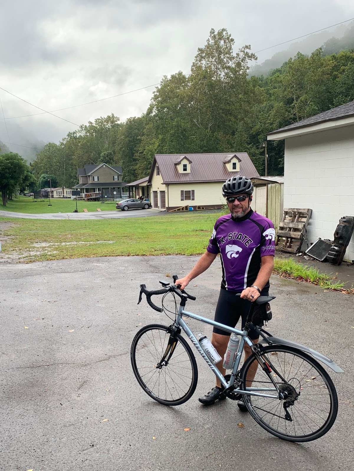
On the up side, I met these two on the detour route.  Say hello to Sue and Matt Cook.  They've been married four years and Sue is training to do her first triathlon.  Matt has already done four.  Since this is her first time, they decided on a shorter "sprint" triathlon in which all the distances (swimming, cycling and running) are reduced.  I hear from those who've done them that they're a good way to get into the sport.  Not for me tho - the Doc says no running with the fake knee - thank God.  I hate running.  Interestingly, Sue was riding a Specialized Sequoia - the exact same bike as Sig.  When I asked she said hers was 12 years old and she had rescued him on-line.  Hers was the exact same color and had the same set-up Sig came with when he was born.  She asked how old Sig was and I told her he was 14 and had probably 27k miles under his belt as a result of this trip. They both seemed surprised.  Sig took this well, believing they must have thought he looked in pretty good shape given his age.  I said nothing.  


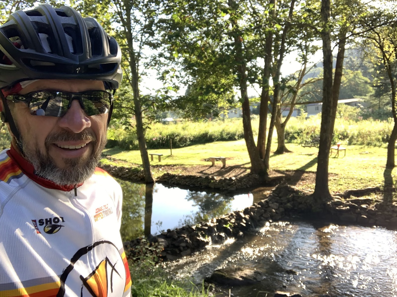
This is a shot of me pulling in to one of today's breaks.  Susan says she liked it because of the mountains in the background.  I'm pretty sure it's the spandex shorts.  I checked with Sig.  He said nothing.  Curious.  (Used by permission of Susan Schoen Photography, LLC.)


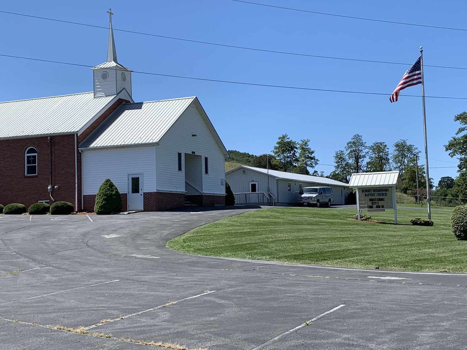
This is the parking lot where said break took place.  Church parking lots have "saved" us (if the reader will forgive the play on words) since leaving the mountains.  But if you're staying in one Saturday night, be sure to vacate the premises before the faithful arrive Sunday morning, or ya might not be able to get out till after the service.  This is not a problem for us since we're hitting the road NLT than 0730-0800.  They've all been very gracious letting us stay.  I don't think a single one of our requests to overnight at a church has been denied.


The New River - which is a surprising name since it is apparently tied with two other rivers as the third oldest on Earth.  Here in Virginia it's much calmer than the New River in West Virginia, where my lovely bride famously attempted to shoot the rapids in an inflatable canoe.  It didn't turn out well.  I tried to talk her out of it.  She said, "If I can drive the big rigs, I can paddle an inflatable boat down a river."  Yeah - I'm pretty sure that's what she said.  Ask her about it some time.  All I know is that our tour guide was surprised she could hold her breath for so long.


A better shot of the New River from the bridge over same leading into Radford, VA.  Note the groups of people drifting lazily down the river with the current.  This reminds me of float trips we saw on the Niobrara River in Nebraska when Susan and I did the Tour de Nebraska on our tandem several years ago.  It appeared those trips were mostly an excuse to guzzle beer.  Note the cool old railroad bridge in the background.


Also in Radford, the T/A route went thru this cool City Park for about a mile.  It's the only bike path I've been on that wasn't crowded with walkers and yappers, or walkers with yappers.  I loved it.


Well readers, Christiansburg represents the end of Section 11 of the ACA maps.  Only section 12 remains.  We start on it tomorrow.


This was the route for Section 11.  The reader can make out the bend South to Damascus, VA and the beginnings of our move to the North.  More on this as it develops.


I thought I'd throw this in just for kicks.  The blue dot is us.  I think I did this way back when we started the trip.  If not, it's a great idea and I should have.  Not far to go now.

Till next time.


Friday, August 30, 2019

The Thin Blue Ride - Part 2 Day 83 - Damascus, VA to Wytheville, VA

Friday, August 30, 2019

Ride Report:  57 Miles, 3,808 total Miles, 14.5 Avg. mph, 3,714 Ft.Climbing, 4,364 Calories.

The reader had not ought pay to much attention to the average mph today.  This because the best part of the day (an 8 mile downhill of up to 7%) was in large part negated because the tree cover was so thick it blocked Garmin’s satellite reception.  No satellite = no distance upon which to gauge speed in the moment.  Thus, it had no idea how fast I was going and consistently showed speeds ranging from 3.8 to 15.0 as I descended in my big chain ring at what I know to be in excess of 28-30 mph for much of those 8 miles.  What the average mph should be is known only to the Cycling Gods or someone who cares to do the math on my mileages and ride time.  I am neither.  Perchance if we suffer another rain delay I can assign the Accounting Department to do something constructive this time.  We shall see.

Speaking of rain, we’re keeping a watchful eye on tropical storm Dorian.  As of now, even the most disadvantageous of “cones” doesn’t appear to cause us any problems.  However, the cone just predicts the eye of the storm and the rain squalls may spin off a considerable distance from the eye.  I hope it doesn’t delay the finish of the trip considerably.  I’m not sure I can keep the Accounting Department out of mischief for several days.  Readers should post their ideas for Accounting Department “make work” just in case.  I’d appreciate the help.

Yup - it’s official - I like Virginia.  The landscape is becoming more and more enjoyable as we move east - tho there was a lot of North to today’s route.  If you’re curious, just plot it on Google Maps.  It won’t give you the same roads we traveled, but it’ll give ya a general idea.  Temperatures continue to be moderate.  Two observations regarding temperatures.  1: We had to run the heater for a few minutes this morning just to warm up The Rig.  I think the overnight low in Damascus was 52.  2: I haven't had sweat run into my eyes/mouth/nose for two days now.  I especially enamored of this one.  And these temperatures make for “easier” climbing, which comprised most of the first 20 miles today.  Speaking of which - here’s the day in pics...


Ready to start the day.  This is the first time I've worn leg and arm warmers since Colorado.  But it was pretty cold this morning.  They stayed on till after the second climb and descent of the day.  I was not enthused about today what with the three big climbs.  And they were first thing out of the gate today.  Within 2 miles of leaving The Rig I was on the way up.


This is the creek I followed up the first climb this morning.  It was considerably smaller (in fact it had disappeared entirely) by the time I reached the top.  But it was an interesting diversion.  There were a couple of small waterfalls and occasionally the rocks interrupted the flow of the creek enough to create small "rapids".  Hey - it kept my mind off what I was doing at the time.  That counts for something in my book.


And on the way down from that climb, some enterprising Virginian had carted rocks into the creek on the down slope and created this small "lake".  As the reader can see, they had mowed the bank down and placed benches and a picnic table.  There was also a rebel flag and a big "NO TRESPASSING" sign.  Sorta ruins that warm fuzzy feeling I was getting from first observing all the work they did.


This church was right beside my first rest stop of the day at the bottom of the first descent.  It was a Lutheran church.  A bit of a first for us in quite some time.  The Baptists apparently take after bunnies in these parts.  Ya can't swing a dead cat without hitting a Baptist church.  There are Free Will Baptists, Old Regular Baptists (I kid you not - they make quite a deal of it) and Missionary Baptist churches.  But Lutherans are apparently a bit more discriminating in their procreation, thus limiting their numbers?  Used by permission of Susan Schoen Photography, LLC.


A shot going down one of today's descents.  Garmin lost satellite signal for a bit here, but nothing like the descent described in the ride report.


This is what I mean when I describe the terrain as becoming more rolling and less severe here.  Having crossed over the "new" Appalachians this morning, we're now in what the ACA maps refer to as "The Great Valley."  This valley is apparently bordered on the other side by the "old" Appalachians.  From what I understand the two mountain chains were raised in different geologic times, thus the "old" ones have been subject to more erosion.  We'll eventually climb up out of this valley onto the old Appalachians to the Blue Ridge Parkway in a few days and that will be the last big climb of the trip. 


This was the peak of the highest climb of the day at right around 3,700 feet.  That green sign on the left proclaims our passing from one county to another.  This typically portends a change in the road surface - in this case for the better, which was handy since it let us keep our speed up on the descent.  Additionally, I started noticing this in Kentucky and it has continued here in Virginia.  It seems that County lines around here are frequently established along the ridge lines of mountains.  I suppose that's a handy way to go about it.


When we made it to this intersection Sig and I agreed it was a good thing that the bike route sign pointed to the left.  Neither of us wanted to go to "Mouth Of Wilson" - which was to the right according to the green sign.  For God's sake, who names a town Mouth Of Wilson.  How'd you like to be the tourism director for Mouth Of Wilson? 


This is the start of the down slope where the trees interfered with my Garmin.  Believe it or not, the tree cover got even heavier as we descended - and this went on for miles.  Note the blurred shadows on the pavement.  We were moving right along when I took this pic.  It was nice and cool tho.


A nice shot of a small farm house.  I stopped on the way down to take this pic.


We stopped in the parking lot of this (what else?) Baptist Church for a break today.  The reader should note the flag - that signifies a tail wind.  If, that is, Baptist flags are to be taken at their word.  If so, this would be good news because I think this stop was around 45 miles into the trip today.


Another cool pic.  I like these disheveled old farmsteads with mountains in the background.  I feel a bit uncomfortable using the term "mountain" on something less than 3,500 feet in elevation, but when in Rome...


This church appeared just after I crested the hill upon which Rural Retreat, VA sits.  It just begged a pic.  I noted two things as I passed.  First, it was another Lutheran church.  Apparently they're making a stand here.  Second, it has a red door just like the earlier Lutheran church in today's post.  I ascribe no great theological import to this observation, but it is interesting.  BTW - Rural Retreat sits on quite a hill.  Susan was waiting for me at highway 11 just a mile down the road - all downhill.  I love it when it works out that way.

After Rural Retreat it was only another 11 miles to Wytheville, VA where a laundromat awaits our presence.  Oh, and Wal-Mart, I think they invited us over tonight.  So, we'll do some catching up and then I think we may be spending the night with the Wal-Marts.  We'll probably stay up too late telling lies and playing poker.  Teamsters love poker.

Status report:  As of today there are 8 riding days left and 1 rest day.

Till next time.

Thursday, August 29, 2019

The Thin BlueRide - Part 2 Day 82 - Creekside RV Park, Damascus, VA (Rest Day)

Thursday, August 29, 2019

Ride Report: A shocker for a rest day, there actually is a ride report and here it is:  5 Miles, 3,751 Total Miles, 18.7 Avg. mph, 167 Ft.Climbing, 390 Calories.  Here’s the deal, Delta needed some minor adjustment to his shifting and it turned out that both wheels needed to be trued.  After the shop was done I took him for a spin to make sure everything was working properly.  Good thing, because the shifting was OK, but not what I would call crisp.  The mechanic nailed it in about 30 seconds on our post ride return visit.  And kudos to both he and Bicycle Junction for getting Delta in and out so quickly today.

Today consisted of typical rest day activities.  Sleep late, piddle at chores in the morning, plan a bit for the second week in the afternoon, start thinking about dinner at 1630 in the afternoon, figure out what restaurant to hit “later” (but not late), make sure things are ready to go in the morning, go to bed - hopefully early.  What with only a week and a half left till the riding ends in Yorktown, things are starting to feel surreal.  On the one hand I’ll be ready to finish, on the other hand what will I do with myself all day?  More importantly, what will Susan do with me all day and will she be able to tolerate me in large doses?  If I fail to post in the days following the conclusion of the ride, readers will have their answer.

Here’s the day in pics...

First thing up - a bath for Susan's bike.  That it has no name is a curiosity to me.  She names mine, but her bike suffers the ignominy of anonymity.  However, it still looks good after a bath.  She's a bit racy tho.  Sig reported to me that after arriving at the Creek Side RV Park last night she was talking to him from the trailer about going skinny dipping in the creek.


Sig following his bath.  For his part, Sig says he demurred to the whole skinny dipping thing.  He says that being a guy he was reluctant to provide her all the details, but assured her that water in her bottom bracket was not something she wanted to experience.  So if Sig is to be believed, it never happened.  I believe him, he's the more responsible of my two bikes.  Delta?  He'd have jumped on it.  That's why we make him sleep inside at night - so we can keep an eye on him.


This is Matthew, the mechanic who worked on Delta for me today.  He works at Bicycle Junction here in Damascus and was kind enough to get Delta in and out in the same day.  He's worked for this shop for three years and says he likes it.  When I asked, he said they maintain a fleet of about 300 rental bikes.  I gotta believe that'd be a chore.


This is the reason I took Delta out for a 5 mile spin today - on a rest day.  Normally I avoid riding on rest days like President Trump avoids complete sentences.  But today was an exception.  I really wanted to add another state to the list so that I could claim 11 states.  Unfortunately, before I left I checked the official T/A rule book and while short hops to neighboring states are permissible (and even encouraged) under the rules, they can't be part of a rider's official tally of states.  That's why the reader doesn't see Susan in the pic.  Side trip states, however, are permitted a thumbs up.  Curiously, the miles are permitted as part of a rider's official tally for the trip.  Now ya know.

This is The Rig sitting beside the creek at Creek Side RV Park.  I saw a sign in Tennessee proclaiming that the creek (which comes to Damascus from Tennessee) is stocked with trout.  I'm pretty sure I saw small ones rising to feed on several occasions today.


Susan (formerly known as my state line "hand person") and me beside the creek at Creek Side RV Park.  The reader will note the author's choice of grey to compliment his beard.  And while the reader can't see them, even the shorts I'm wearing are grey.  Susan, on the other hand, chose to go with a more colorful approach today, and refers to my outfit as "monochrome".  Well then.  I guess I'll go out and look for a more colorful top to go with my shorts.


The reader can make three observations from this pic.  First, I changed out my drab, monochrome UnderArmour look for this sporty, purple UnderArmour look.  The local fashion police, no doubt, approve.  I didn't inquire.  Second, we dined at the Seven Trails Grill tonight.  So named due to the seven different trails that intersect in Damascus, VA.  Chief among the 7 are the Trans-Am (which yours truly is riding), the Appalachian Trail (a hiking trail and probably more famous than the T/A), and Virginia's own Creeper Trail (which the AT joins for part of its route across Virginia).  Creeper Trail - hey - I didn't name it.  Three, that's what my eyes look like when not hidden behind my riding shades - which are way cooler.


From Left to Right: Me and Susan with Laura and Steve.  They had the slot right next to ours at the RV Park and we talked a couple of times today.  They're from North Carolina and rode 17 miles on the Creeper Trail today.  As it happens, they had recently been to Maine - where we hope to head at least in part, following completion of The Thin Blue Ride.  We took the opportunity to ask if they'd go to dinner with us so we could pick their brains about Maine.  We had a great conversation over good food.  It never ceases to amaze me how friendly everyone we meet has been.

Well, up early tomorrow - gotta make the donuts.  The elevation chart says it's gonna be a big day tomorrow.  Probably not 5k of total elevation gain like the last riding day, but a big day none-the-less.  We'll see.  Back  up over 3k on the elevation chart again also - probably closer to 3,700 ft.  Equally as important - most of that gain comes in three big climbs in short order in the middle of tomorrow's ride.  Sigh - probably better than hitting them at the end.  Maybe I'll include my elevation chart in tomorrow's post.

Till next time.

Wednesday, August 28, 2019

The Thin Blue Ride - Part 2 Day 81 - Haysi, VA (+3) to Damascus, VA

Wednesday, August 29, 2019

Ride Report:  65 Miles, 3,746 Total Miles, 13.5 Avg. mph, 5,390 Ft. Climbing, 5,381 Calories.

I have several observations concerning today's ride report.  1: Given how today shaped up I was nervous going in what with my melt down the other day.  2: Apparently each foot of climbing roughly approximates one calorie - at least for today.  3: That's a pretty darned good average speed for me given... 4: The amount of climbing today - Garmin says that's the biggest daily total yet for this trip.  I may have had more climbing in one day a number of years ago when I rode the Copper Triangle in Colorado and did three mountain passes in one ride.  But that Garmin died and the numbers are lost to history.

I am also pleased to report that despite all the climbing and the longer ride distance today, Virginia is starting to grow on me.  When we talked about it, Susan said she felt the same way.  And we both attribute it to the same thing - ya can actually see some scenery instead of just the trees beside whatever hill ya happen to be standing next to.  Speaking of hills, they are by all appearances less severe.  The climbs less short/sharp and seem to be more gradual and a bit longer.  The highest slope I ran across today was 12%.  A far cry from yesterday's 16%.  It also didn't hurt that the sun came out fairly early after the ride started today - and that it did so with no resultant increase in the temperature.  I think today's high here in Damascus, VA was 79 degrees.  Tho my nose is a bit red tonight.  (Yes daughter of mine - I put on sun screen.  But apparently it sweats off quite easily.  And I sweat a lot today.)

But the big plus in Virginia is that while people still have dogs outside their residence, they either leash them or have fences that prevent them chasing me.  So today when they ran (inside the fence) barking at me, I barked back.  So there.

So since it was such a good day today, let's get right to it...

The morning started out like this.  In all honesty, I was not looking forward to the day.  It rained off and on most of the night last night.  As the reader can see, it was wet out of the gate today.  This resulted in resetting the alarm (which was good) and a later start to the day (which is bad) thus putting us in Damascus later in the day than I would have preferred.  So, it was wet and I was cranky early.  Good thing Sig is a mudder (a horse racing term).  Note the long rear fender.  He hates wearing it.


But between 10-15 miles down the road I ran into this guy.  For those interested in such matters, I believe this to be an excellent example of the Eastern Red Spotted Newt (notophthalmus viridescens - God bless the internet) in its eft stage.  Note the lack of gills.  He was actually the second one I saw.  I was moving fast downhill the first time and didn't stop.  But this one I saw on an uphill, hence the pic.  I would say he's about 2.5-3 inches long.  When I asked, he said he'd hold up for a pic if I'd make sure he made it to the other side of the road.  Deal.


This small stream beside the road was very interesting.  The rocks, having been shaped by water, almost looked like ripples themselves.  It should give the reader what underlies the top soil around here as well as how thin the layer of topsoil is.  


This is what I meant about being able to see for a distance again.  Ignore, for the time being, that we'll eventually have to climb that range of hills behind me and the pic is very cool.  I don't recall which climb it was today, the Garmin told me that the summit was 3,006 feet.  that's the highest we've been since western Kansas.  I always find it amazing that tho the altitude is approximately the same, the topography is so much more severe here.


OK - I'm a sucker for a good lookin caboose.  I found this one leaving Honaker, VA.   I think the last one I saw was somewhere in Montana, maybe?


One of the few sections of relatively flat road around here.  And as always, we eventually need to get over those hills in the distance.  As an aside, the reader may note that Sig has reappeared in the blog.  I was beginning to experience some fairly severe pain in both shoulders.  As is typical, when I told Susan she inquired quite extensively and then concluded that it might be that my riding position on Delta is OK for a while, but could eventually cause the sore shoulders.  When I started thinking about it, I realized that with the exception of two days in Kansas, I'd been riding Delta exlusively since before Breckenridge, CO.  Sig sits a bit more upright than Delta - this apparently helps.  After riding Sig for a few days now, I've noticed that the soreness is already dissipating.  Susan missed her calling - but now that the Teamsters have their hooks in her, I fear it's too late.


This pic was cool enough when I stopped to look at the clouds.  The reader should really look at this pic full size.  I've never seen clouds that look so...bubbly?  I don't know what to call that.  But when combined with the road disappearing into a dark hole in the trees?  It was just eerie.  I expected to be accosted by trolls, or goblins or something.


Yet another scenic vista.  I can't describe how nice it is to be able to see things, anything, in the distance.  Even if it's just more hills.


I really liked this old tin roofed barn what with it being back stopped by the tree covered hill.


OK - this is a big deal.  The reader should note how the two mountains in the distance taper toward each other, creating a gap.  The old church sitting there is kinda cool too.  This is Hayters Gap.  The small town of Hayters Gap is about a mile behind me.  These naturally occurring "gaps" in the mountains facilitated westward exploration and expansion.  It's also a big deal for T/A'ers as there's a heck of a climb to get here.


This was just so fun I had to take a pic.  It was amazing to enter these areas.  The ambient temperature would drop considerably - maybe as much a ten degrees.  The dappled light is also on the cool side.  I smiled all the way thru this part of the route today.  That's been a while coming.  


This was the final rest stop of the day.  I'll quote Susan's consideration of the two possible sites.  "Well, there was a church and a truck stop.  The obvious choice is the truck stop."  Of course it is...

From this point she took a different route because the T/A route was questionable for The Rig.  I met her 13 miles later in Damascus.  And while I'm on the subject of The Rig and the roads upon which she drives it, I've been quite proud of her recently - and especially today.  On a couple of occasions today she was driving on one lane roads with switchbacks going up and then down the side of mountains.  On both occasions she had gone on ahead of me and when I saw the roads she was on I prayed.  On the second occasion (a downhill) I was relieved to meet her at the next scheduled break location.  I was greatly worried that even if she had made it successfully, she'd be all fretted up.  She was fine.  Those Teamsters are a tough bunch.  Pretty much nothing phases 'em.

Till next time.

Tuesday, August 27, 2019

The Thin Blue Ride - Part 2 Day 80 - Bypro, KY to Haysi, VA (+3)

Tuesday, August 27th, 2019

Ride Report: 54 Miles, 3,681 Total Miles, 13.0 Avg. mph, 4,619 Ft. Climbing, 4,619 Calories, 1 mental breakdown - keep reading...

My apologies for the brief introduction.  We finished late yesterday and due to the viewing, didn't get into the church parking lot till 2300 - after the final group of attendees left and the lot was empty enough to get The Rig in.  The short recovery time combined with little sleep and the previously mentioned mental breakdown means that I'm physically exhausted tonight and want to turn in early.

Here we go...

Somewhere near the top of the first climb of the day.  The top of that little gravel road in the center of the pic is about 100 ft. below me.  And there was about 500 ft. of climbing before getting to where it came out on the highway.  A lotta work. 


On the downhill run to the first break of the day.  More low clouds.  The first 20 miles today were rainy.  I was soaked.


After that break I came across this beside the road.  It just screamed to have its pic taken.  It was beside a large, well kept house.  Hilarious.  My favorite is the cow bell hanging from the bumper.


This pic is a little foggy, but it wasn't the weather.  It was the sweat in the back pocket of my jersey.  I took it because it gives the reader some idea of the ridges we're climbing over to get between drainage basins.


This, readers, is kudzu.  It has completely subsumed areas of the forest and on one occasion the (mostly abandoned) half of a town on one side of the highway.  I saw properties with outbuildings where the owners had obviously just given up and let this stuff take over a building.  I don't know what the long term impact on the forest here will be, but I've heard that it's a blight that's spreading.


This is the crest of the second big climb of the day.  This one was a monster.  It went on for 4 miles, and of that 4 miles, one mile ran between 14-16% grade.  I was going 3.8 mph then.  My God - unheard of.  I thought I handled it pretty well from a physical perspective, but there were times during that mile that it was open to question as to whether I was gonna make it up without walking the bike up the hill - something I'd sworn not to do before the trip started.  I didn't realize what a toll this hill had taken on me till I got to The Rig for a break.  I was physically exhausted and after sitting there for a few minutes started to cry.  I know, right?  Me.  I think this trip in general and that hill in particular are the most physically demanding things I've ever done.  Susan helped me get collected - what a sweetheart.  Then we were off again.  But not before an hour long break to recover mentally and physically for the rest of the day. 


Hmmm - not especially useful this way.  I had to go over and take a look to make sure I stayed on the route.


This was a downhill one lane road that from my perspective was pretty fun.  But Susan took this pic.  She thought it was a good illustration of a good one lane road.  Used by permission of Susan Schoen Photography, LLC.


Sig has apparently taken up my habit of kissing the local fauna.  This was in Elkhorn, KY - the last town in Kentucky.  Like father, like bike.  Susan was mortified.


Though the reader can't see it, there are drill marks all the way down this wall indicating that they had to remove all this material to make the road.  Quite a lot of work, only to have parts of the road consistently collapse down into the river on the other side.


Virginia!  Finally!  State number 10 - and the final state on The Thin Blue Ride.  But Google Maps had made apparent that the road was so narrow Susan would have no place to park The Rig - so she was unable to participate.  This proved to be quite the quandary.  What was I gonna do without her five fingers?  But, being prepared (as always) she sent her hand double.  The reader should take note of the attention that went into this thing.  I kid you not, it has fingernails.  Thus proving that I have a great smile even with a clothes pin in my mouth.  Hey - it was an open question.


The entrance to Breaks Interstate Park - our home for the night.  But right now, I'm just passing by.  I have 12 miles to go before stopping for the day and then we'll return to park The Rig.  The problem is that there was nowhere out here to stay that had either a dump station or full hook-ups, other than Breaks.  This is God's country.  So here we will be.


I thought this was a nice view of the hills in the distance thru the gap in the trees.


Another hill top shot by Sig.  Sloppily done what with him not being centered in the pic, but it happens.  Note the kudzu growing on the right side of the road.  There were places where it grew out into the road only to be "trimmed" by the wheels of passing cars.  This stuff is tenacious.  It's like overgrown bindweed on steroids.

So - today.  Yet another in a string of tough days.  I fear it may just be this way until we break out of the Appalachians nearer the Virginia coast.  We'll see, I guess.  And that monster hill today - that was a significant emotional event.  Looking back, I find it hard to believe that it elicited such a response from me.  But it is what it is - and I got thru it.  So I guess that counts for something.

Till next time.