
Ride Report: 57 Miles, 3,808 total Miles, 14.5 Avg. mph, 3,714 Ft.Climbing, 4,364 Calories.
The reader had not ought pay to much attention to the average mph today. This because the best part of the day (an 8 mile downhill of up to 7%) was in large part negated because the tree cover was so thick it blocked Garmin’s satellite reception. No satellite = no distance upon which to gauge speed in the moment. Thus, it had no idea how fast I was going and consistently showed speeds ranging from 3.8 to 15.0 as I descended in my big chain ring at what I know to be in excess of 28-30 mph for much of those 8 miles. What the average mph should be is known only to the Cycling Gods or someone who cares to do the math on my mileages and ride time. I am neither. Perchance if we suffer another rain delay I can assign the Accounting Department to do something constructive this time. We shall see.
Speaking of rain, we’re keeping a watchful eye on tropical storm Dorian. As of now, even the most disadvantageous of “cones” doesn’t appear to cause us any problems. However, the cone just predicts the eye of the storm and the rain squalls may spin off a considerable distance from the eye. I hope it doesn’t delay the finish of the trip considerably. I’m not sure I can keep the Accounting Department out of mischief for several days. Readers should post their ideas for Accounting Department “make work” just in case. I’d appreciate the help.
Yup - it’s official - I like Virginia. The landscape is becoming more and more enjoyable as we move east - tho there was a lot of North to today’s route. If you’re curious, just plot it on Google Maps. It won’t give you the same roads we traveled, but it’ll give ya a general idea. Temperatures continue to be moderate. Two observations regarding temperatures. 1: We had to run the heater for a few minutes this morning just to warm up The Rig. I think the overnight low in Damascus was 52. 2: I haven't had sweat run into my eyes/mouth/nose for two days now. I especially enamored of this one. And these temperatures make for “easier” climbing, which comprised most of the first 20 miles today. Speaking of which - here’s the day in pics...

Ready to start the day. This is the first time I've worn leg and arm warmers since Colorado. But it was pretty cold this morning. They stayed on till after the second climb and descent of the day. I was not enthused about today what with the three big climbs. And they were first thing out of the gate today. Within 2 miles of leaving The Rig I was on the way up.

This is the creek I followed up the first climb this morning. It was considerably smaller (in fact it had disappeared entirely) by the time I reached the top. But it was an interesting diversion. There were a couple of small waterfalls and occasionally the rocks interrupted the flow of the creek enough to create small "rapids". Hey - it kept my mind off what I was doing at the time. That counts for something in my book.
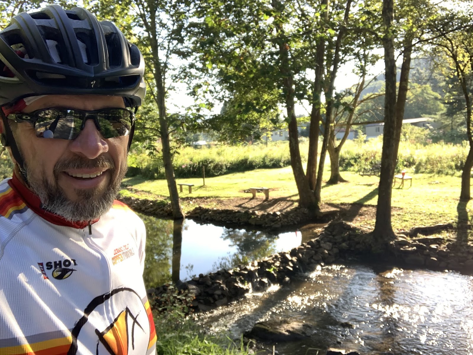
And on the way down from that climb, some enterprising Virginian had carted rocks into the creek on the down slope and created this small "lake". As the reader can see, they had mowed the bank down and placed benches and a picnic table. There was also a rebel flag and a big "NO TRESPASSING" sign. Sorta ruins that warm fuzzy feeling I was getting from first observing all the work they did.

This church was right beside my first rest stop of the day at the bottom of the first descent. It was a Lutheran church. A bit of a first for us in quite some time. The Baptists apparently take after bunnies in these parts. Ya can't swing a dead cat without hitting a Baptist church. There are Free Will Baptists, Old Regular Baptists (I kid you not - they make quite a deal of it) and Missionary Baptist churches. But Lutherans are apparently a bit more discriminating in their procreation, thus limiting their numbers? Used by permission of Susan Schoen Photography, LLC.

A shot going down one of today's descents. Garmin lost satellite signal for a bit here, but nothing like the descent described in the ride report.

This is what I mean when I describe the terrain as becoming more rolling and less severe here. Having crossed over the "new" Appalachians this morning, we're now in what the ACA maps refer to as "The Great Valley." This valley is apparently bordered on the other side by the "old" Appalachians. From what I understand the two mountain chains were raised in different geologic times, thus the "old" ones have been subject to more erosion. We'll eventually climb up out of this valley onto the old Appalachians to the Blue Ridge Parkway in a few days and that will be the last big climb of the trip.

This was the peak of the highest climb of the day at right around 3,700 feet. That green sign on the left proclaims our passing from one county to another. This typically portends a change in the road surface - in this case for the better, which was handy since it let us keep our speed up on the descent. Additionally, I started noticing this in Kentucky and it has continued here in Virginia. It seems that County lines around here are frequently established along the ridge lines of mountains. I suppose that's a handy way to go about it.

When we made it to this intersection Sig and I agreed it was a good thing that the bike route sign pointed to the left. Neither of us wanted to go to "Mouth Of Wilson" - which was to the right according to the green sign. For God's sake, who names a town Mouth Of Wilson. How'd you like to be the tourism director for Mouth Of Wilson?

This is the start of the down slope where the trees interfered with my Garmin. Believe it or not, the tree cover got even heavier as we descended - and this went on for miles. Note the blurred shadows on the pavement. We were moving right along when I took this pic. It was nice and cool tho.

A nice shot of a small farm house. I stopped on the way down to take this pic.
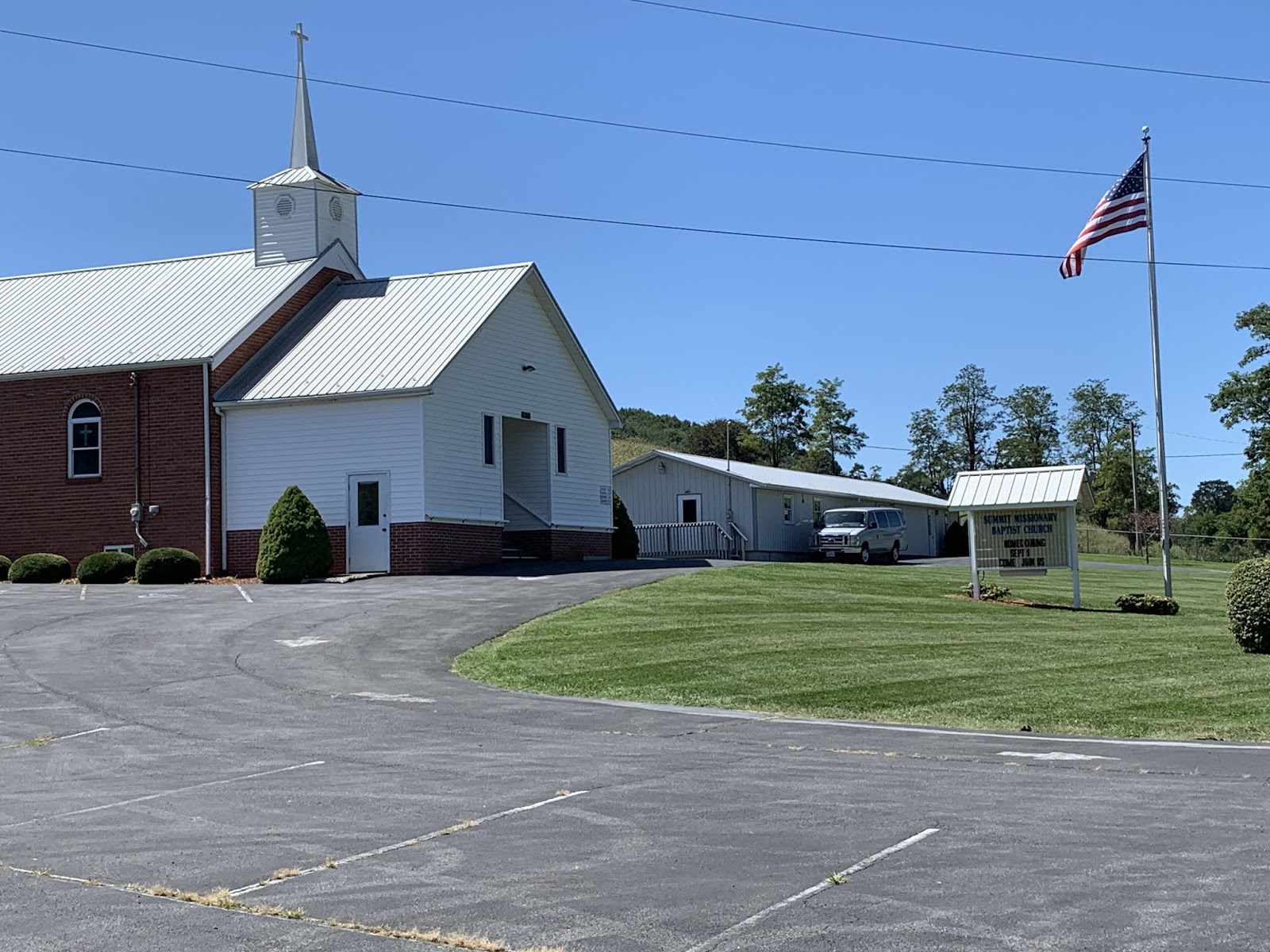
We stopped in the parking lot of this (what else?) Baptist Church for a break today. The reader should note the flag - that signifies a tail wind. If, that is, Baptist flags are to be taken at their word. If so, this would be good news because I think this stop was around 45 miles into the trip today.

Another cool pic. I like these disheveled old farmsteads with mountains in the background. I feel a bit uncomfortable using the term "mountain" on something less than 3,500 feet in elevation, but when in Rome...

This church appeared just after I crested the hill upon which Rural Retreat, VA sits. It just begged a pic. I noted two things as I passed. First, it was another Lutheran church. Apparently they're making a stand here. Second, it has a red door just like the earlier Lutheran church in today's post. I ascribe no great theological import to this observation, but it is interesting. BTW - Rural Retreat sits on quite a hill. Susan was waiting for me at highway 11 just a mile down the road - all downhill. I love it when it works out that way.
After Rural Retreat it was only another 11 miles to Wytheville, VA where a laundromat awaits our presence. Oh, and Wal-Mart, I think they invited us over tonight. So, we'll do some catching up and then I think we may be spending the night with the Wal-Marts. We'll probably stay up too late telling lies and playing poker. Teamsters love poker.
Status report: As of today there are 8 riding days left and 1 rest day.
Till next time.
The red door is suppose to represent the blood of christ. I googled it.lol Guess it makes sense.
ReplyDeleteThanks, and I hope you don’t mind, but check out the comment below and you’ll know why Corporate has assigned you as a Research Assistant.
DeleteFor your edification: "The name Mouth of Wilson originates from a young surveyor named Wilson, who died and was buried in a creek while surveying the line between Virginia and North Carolina in 1749. The creek was henceforth known as the Wilson Creek, the mouth of which empties into the New River where the town was established. The first European settler in the region was Robert Parsons, a veteran of the American Revolutionary War who was awarded a grant of 1,600 acres (6.5 km2) from the North Carolina line to Wilson Creek. One of Parsons' nine sons, Johnny Parsons, built the first mill on the creek. The mill was built to grind corn, with a sawmill as an extension. Johnny Parsons served one term as the overseer of the South Fork and New River Turnpike in the Virginia General Assembly. Another mill was constructed in 1884 by Colonel Fields J. McMillan. The community built a power dam in 1930, introducing electricity to Mouth of Wilson.[1]" Source: Wikipedia
ReplyDeleteOK - that’s more than I need to know. And I despite being edified, I still don’t wanna go there. Ha-ha. Corporate here at The Thin Blue Ride has now assigned you official duties as Research Department.
DeleteI accept!!
Delete