
Ride Report: 60 Miles, 3,314 Total Miles, 14.9 Avg. mph, 3,858 Ft. Climbing, 4,864 Calories. And the gas station where we stopped for the day also doubled as the local restaurant (This is just the way of things - don’t question it.) so Susan bought me a cheeseburger after I pulled in. Fresh from the griddle, by the taste of it - which I would rate as a solid 7.5 on a 10 point scale. It didn’t stand a chance and was gone quickly. It’s the little things in life that make it worth living, eh?
Speaking of which, the report from the ER is that Susan had a "boo-boo" on her knee. I'm not sure precisely what that means since medical lingo is beyond me what with all the Latin stuff they do. But the Dr. rubbed some dirt on it and sent her off. Again - it's the little things. Like the wonders of modern medicine. Now she's complaining about having a dirty knee.
Tough day today - again. Heat index was at 104 with still an hour of riding left. I got a bit dehydrated despite drinking so much that my stomach sloshed for most of the day. It just amazes me that I can lose such a volume of water to sweating. But as I type this, my hands are still trying to cramp. Funny cramp, that. They pull my thumbs in and down toward my palm. Then I grab em (the thumbs) and pull em back out to a less simian position and I’m good to go till the next one. If they both cramp at the same time, I may never know the joy of opposable thumbs again.
So - quick - before they both go at the same time, here's the day in a nutshell...

Seriously - this was today. Start on map section 120 about a third of the way in from the left edge. Then follow the elevation chart to the right and go just a smidge past McDaniels in section 122. That was today's route expressed in an elevation chart. The lines running horizontally are 250 feet apart. Then go back to the right edge of section 121. See those three climbs? The first one sets up pretty typical for a climb: climb, piddle around at that elevation for a bit, then descend again. The two that follow are insane. Climb, go over the top and immediately descend. Repeat. I was going either 6 mph or 40 mph thru those two hills. There was no in between. And it came late in the day, so it was a bit more taxing than usual.

Delta, soaking in the morning sun - thru a humidity induced haze. It was 98% humidity when we rolled out the door this morning. If this keeps up I'm gonna need scuba gear to ride. I wondered today if all that humidity affects performance by limiting oxygen uptake. I may have to check it out on the internet to see if there are any scholarly articles on the subject. Or, I could just ask Shorty. Kelsy - any idea?
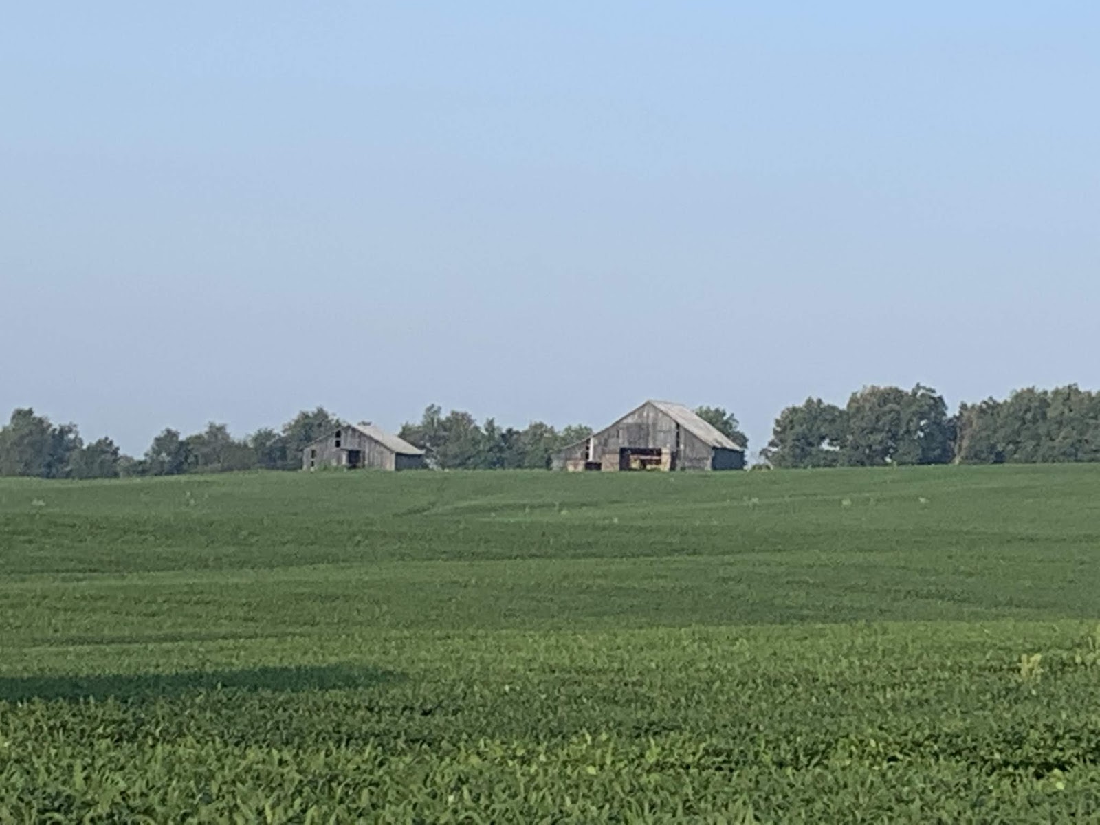
Still early in the ride, but we ran across these two cool old barns in a soybean field. We saw a lot of these today.

Here's a cool old barn that's not abandoned. Look to the left opening. That, readers, would be tobacco drying. I saw this a few times and on one occasion could actually smell drying tobacco. I couldn't see it, so I assume the breeze must have wafted the odor over the road.

After a break and just a short distance down the road, there was more tobacco. This time of the wacky variety. That's right readers - good old marijuana. I've no idea, but assume the great state of Kentucky must at least have regulated medicinal MJ. Worst case, they're in free fall like Colorado (and several other states) and it's just legal for personal use. (This he says while wearing his Colorado jersey...)

We also saw plenty of small, abandoned homes today. This is one example. I think The Rig is bigger than this house!

This guy was with me, all - day - today. I couldn't shake him. That, BTW, would be the replaced knee flexed and ready for the down stroke. Pretty good range of motion for a fake. Hey - if ya want more scenery or something, you're gonna have to man up and say so. What with so much time alone on a bike, my mind wanders a bit at times. Dunno if the reader has noticed.

Kentucky is pretty - when not obscured by trees. The hills and clouds are a nice back drop.

We rode past the West and North sides of the Rough River Lake today and will be camping at a campground on the lake tonight. We went past the lake to get to our stopping point for the day, and then returned a few miles in order to have a place to park The Rig. Campgrounds are great occasionally as they give us a chance to dump tanks. Tonight, since we were plugged in to shore power to run the AC instead of the generator, I also took the opportunity to change the oil in the generator. Hey - it's not all fun and games here at The Thin Blue Ride. Now we gotta figure out how to dispose of 1.5 quarts of old oil...

The folks at the lake were also kind enough to put up this wind sock for cyclists. As you can see by the pic, I've got a quartering tailwind. I'll take it. After they put up the wind sock, some bozo came along and installed an airport nearby.

This is me on the dam with the lake in the background. It's not like a lake in Kansas - which are essentially really big ponds. It's more like those big Missouri lakes that snake their way along the river valleys for miles. But in this case, the valley isn't very wide - so neither is the lake. check out those clouds - cool. They ganged up on us and rained at about 1700. We were all set up by then, but unfortunately only half way thru changing the generator oil. Eventually the rain gave up and we got it done.

This is what a lot of Kentucky looks like from the T/A - a tree tunnel.
So there ya have it. Kentucky consists of roads lined with trees, tobacco and marijuana fields, abandoned barns and houses, heat, humidity, hills, oh - and a lake. At least for today...
Till next time
No comments:
Post a Comment