
Ride Report: 47 Miles, 4,023 Total Miles, 13.0 Avg. mph, 4,511 Ft.Climbing, 3,958 Calories.
Well, let’s get right to it readers. There are really three stories to the day.
First, and as expected, Vesuvius sucked. I had done the math on the total elevation gain and figured the average slope to be 8.8%. When the first half mile ran 4-6%, I knew the mountain was gonna make that up somewhere. Somewhere turned out to be pretty much the rest of the mountain, save for the last .2 miles. Everything between the first .5 and the final .2 was between 9% on the low end and 13% on the high end. Though I did see 14% for a brief time. If I had to pick an average slope for those 3 miles, I’d say 11%. I covered the total 3.7 miles in 41 minutes. What a sufferfest. I’ll have some pics that will tell the tale...

...but the story starts here. This is the elevation chart for today. We started at Vesuvius on the left and went about as far past the red line to the right as Afton is to the left of that same line. FYI - the black horizontal lines represent 1,000 ft. of elevation. We won't see anything approaching 1k of elevation until we start the post ride trip.
Third, The Blue Ridge Parkway. Wow! The ACA nailed it by putting the Parkway on the route, if only they could figure out some sort of shuttle service or something to get ya up there. The Parkway numbers its miles from North to South. We came on at mile 27 (South) and rode to mile 0 (North). We were doubly fortunate because there were observation areas all along the route. Susan had mapped them out and knew how far it was from one to the next. (The Teamster's motto is apparently, "Always be prepared.") I told her last night that today was gonna be treated like a vacation day from a ride perspective once we reached the Parkway. Meaning that we were going to take time to stop and smell the roses - and to get some pics like we did on the Oregon coast. Oh yeah - and the Parkway was basically empty for the first hour. It was amazing. Even later when the traffic picked up, it was never so much as to be a bother.
There was a lot that was photo worthy today, so (for a change) I'll try not to be too wordy with the scenery pics and let them speak for themselves. All other pics are still fair game tho...

These three showed up for today's early start. When I asked, they said another deer sold them tickets to watch some idiot try to ride up Vesuvius today. I dunno... they're deer - the same animals that run in front of cars - who knows where they get these ideas.

Mr. Garmin asked to be included in today's post. This is what he had to say before the first pedal stroke of the day.
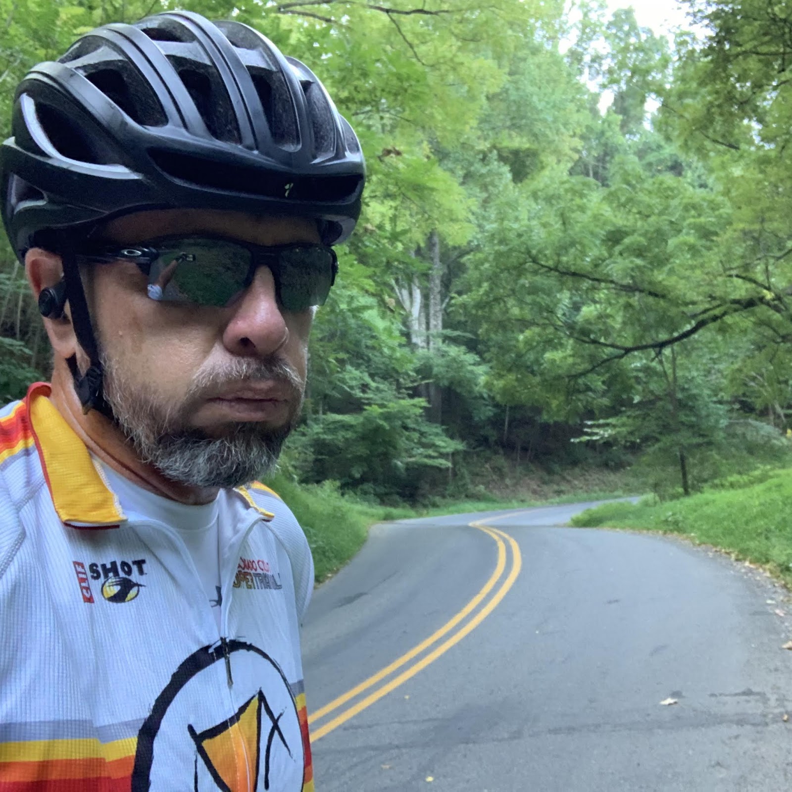
This is me about half way up Vesuvius. I had to stop...for some water. Yeah, that's it - water. Actually, I was a bit winded, sweat was running into my eyes and mouth from my headgear and ya really do have to stop to drink when the grade is so steep. It's hard to get the bottle out of the cage and back in without tipping over when you're goin' so slow. There was no smiling to be had.

This sign marked the final .2 miles where the grade lessened to maybe 6-7%. It felt like I was going downhill. I really did try and smile for this one, but it just wasn't gonna happen.
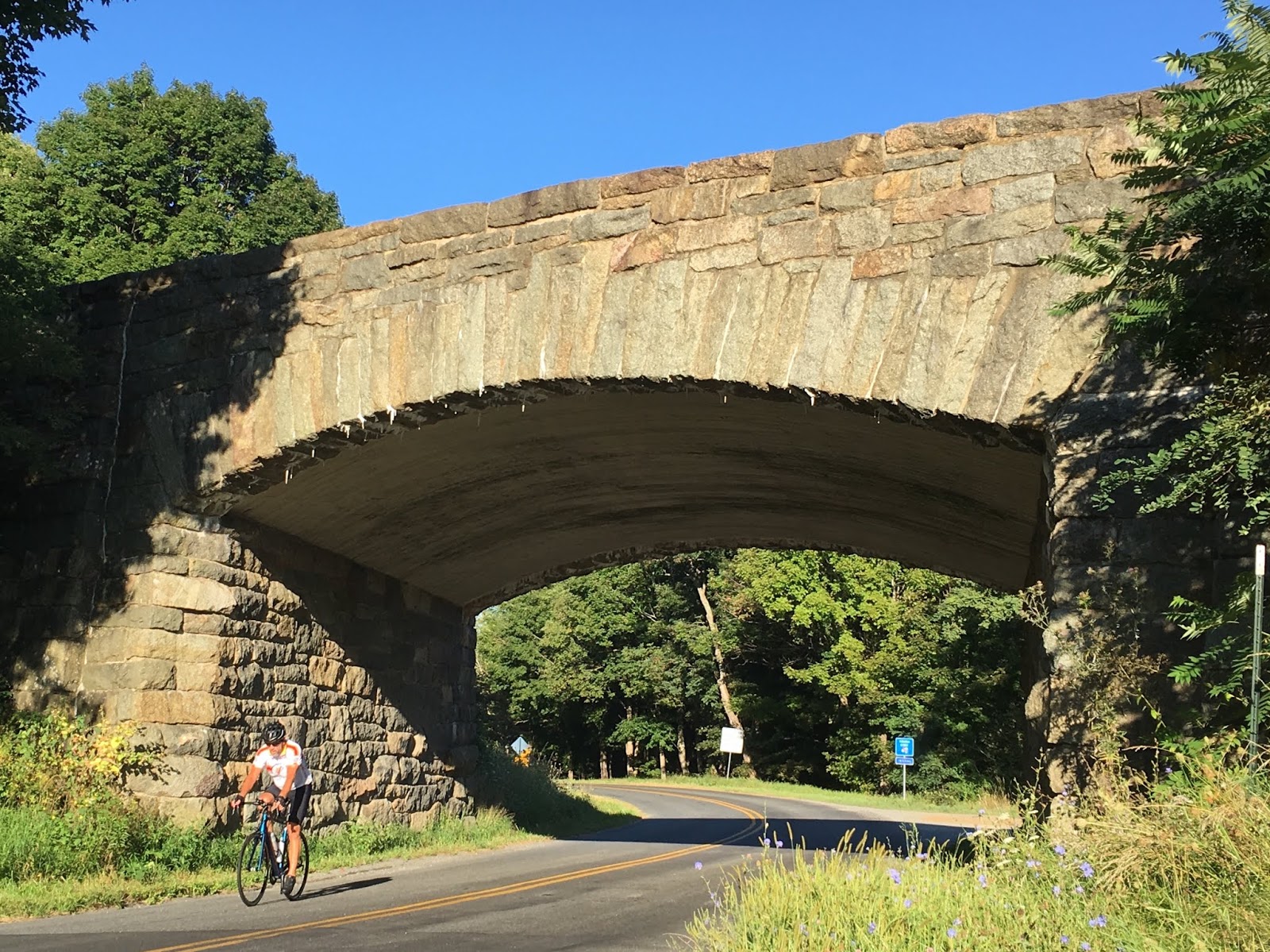
Susan snagged this one of me passing under the bridge for the Parkway. That's one impressive bridge. I don't know that I've ever been happier to see her and The Rig on this entire trip. (Used by permission of Susan Schoen Photography, LLC)

This is what Mr. Garmin had to say when we reached the top. And no - it wasn't raining today. This climb was so tough that even Mr. Garmin sweated it up. He was moaning and complaining. I told him to wipe down and rub some dirt on it. The reader can do the math on the elevation gain. Interestingly, Garmin showed both the starting and ending elevation of the climb as being a few hundred feet less than the ACA map. The difference is about the same tho.

Scene #1 from atop the Parkway. This gives the reader some idea of the lay of the land. BTW - the Parkway is not flat once ya get up there. There was still plenty of climbing to do.

Delta and me at a pull-out Susan couldn't get into with The Rig. Some family of bicycles on vacation happened to pass by and Delta asked one of the kids bikes to take a pic for us.

Susan and me with a nifty valley in the background.

Susan also snagged this one of me arriving at another of the pull outs on the Parkway. Check out the backdrop between the trees. (Used by permission of Susan Schoen Photography, LLC)

Delta happened across this - the Appalachian Trail. It crosses the Parkway several times. He thought that once we finish the T/A we should do the A/T. I tell ya, the bike has more energy than brains.

The view from the Three Ridges pull-out. The A/T came out over to the right of the pull-out...

...and went back into the forest on the other side of the road. Unlike Delta, Susan and I can now say that we've hiked a portion of the A/T. "Portion" apparently being Latin for "20 yards". I wore my helmet for safety reasons. Susan? She's a daredevil.

Delta - with the Shenandoah Valley to the West and 1800 feet below. This was an amazing view. Reminder: the climb to this height was on a bike! Holy mother of pearl!

It went on - the valley is quite long and there several pull-outs from which one could view it.

Susan and me with the Rockfish Valley behind us. This view is to the East and came shortly before we exited the Parkway.

I hadn't had one like this taken in a while, and I was wearing my Trans/Am jersey, so the timing seemed good. That's the same Rockfish Valley in the background. (Used by permission of Susan Schoen Photography LLC) But she forgot to ask me to sign a waiver so there may be issues later.

From left to Right: Angelo, me, Frank and Ray. Angelo and Frank were traveling together and just met Ray a half hour earlier. They're on a road trip - and as it turns out two other bikers showed up after we took this pic. It was then that they learned they were going the wrong direction on the Parkway. They took it in good humor - probably better than I would have. Frank picked Delta up and was surprised how light he was. I didn't try it with his bike.

After we came off the Parkway, there were a number of small state highways which led to White Hall - our destination for the day. This was one. I tried this shot to give the reader of the slope of the roads around here...

...but maybe this one does a better job. And no - this is not a pano shot of a straight road. I think the inside edge of that hairpin drops 6-7 feet. And at both ends of the visible road - you guessed it - another hairpin. This was a really steep section of road. Fortunately, after coming down off the Parkway, most of the rest of the day was down hill - as was this road. Thankfully, Susan had taken a different route.
So - a tough start to the day, but that was expected. When I got into The Rig after Vesuvius I told her, "This Blue Ridge Parkway better be all it's cracked up to be." It was.
Till next time.
No comments:
Post a Comment