INTRODUCTION

Where to begin? It was a dark and stormy night...  (Snoopy).  No. It was the best of times, it was the worst of times...  ...

Saturday, April 6, 2019

TEXAS TEST FLIGHT - DAY 16

Ride report: None.  Today was an unplanned rest day.  It rained overnight, misted throughout the morning, rained some more, and then drizzled on us all the way to Blanco where I thought I could get West of the rain.  Turns out not.   After I decided to pack it in, it rained on us all the way to Fredericksburg.  It was supposed to be a short day today anyway, just turned out to be a little shorter.  It finally cleared up at about mid afternoon, but by then I was committed to being a tourist of the ambulatory variety.

As it turns out, I’m OK with that.  I had already gotten in 11 long riding days with only one rest day in Austin.  So - as far as I’m concerned my two chief objectives have already been met.  1.  Determine whether I had trained sufficiently to handle said riding. (Yes) 2.  Live with Susan in a confined space and not cause her to kill me.  I suspect I can be a "challenge".  (So far so good - but I still have a few days left.)

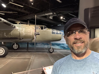
Turns out there is some pretty cool stuff in Fredericksburg.  At least that’s what we heard last time we were here.  So today we checked.  Sure enough.  Did you know that Admiral Nimitz was from Fredericksburg? (Google him if ya don’t know). He was kinda a big deal in WWII.  Very interesting museum dedicated to the history of war in the Pacific during WWII.  And some REALLY cool exhibits.  You’ll get to see them in the pics below, but trust me, they’re more impressive in person.

Interesting observation of the day.  As we're waiting in line to pay our $30 to get into the museum, a nice elderly lady asked the guy behind the counter where the ships are.  He begins telling her about the submarine conning tower out front, the door off the Arizona, etc.  No - she's looking for a big ship.  I'm looking around...yep - looks like the middle of Texas to me.  Not sure how they'd float one up here, but I guess that's why I'm not the museum question answer guy.

Today’s big adventure was doing laundry in the laundry room at the RV Park.  We get to the building where the laundry room is supposed to be...  Me, “Where is it?”  Susan, “Check these doors.”  I wander off and report back a minute later that the only thing on the other half of the building is a rec room.  Susan, “I’ll go check on the map back in the RV.”  While she’s gone I discover the laundry room behind the door beside which she had set the laundry and begin loading some machines.  Susan returns and we commence work.  Me, “Did ya bring the roll of quarters?”  Susan, (sighs) “I’ll be right back.”  Susan returns and shortly things are headed for the dryer.  Me, “Where are the hangers?”  Susan, “I’ll be right back.”

From all this I learned that doing laundry is like a home improvement project.  It requires three trips to the hardware store before the task can be completed.  Any man can tell you that this is one of the maxims of home improvement.  Apparently laundry is the same, which is why so many women insist on a laundry room in the house rather than going to laundromats.  It makes the trips shorter.  I think that in all fairness, men should insist on a hardware store room in the house.

So, on with today’s cheesey tourist pics...


I proffer these first two pics simply as proof of the aforementioned rain.


This is really cool.  The conning tower off an actual WWII submarine is in the background.  In the foreground is a concrete edifice which looks like the front of said submarine.  In between the two are rolling "waves" of soil with ground cover thus making it appear as if an actual submarine is breaching the surface.


A Japanese float plane fighter.  Sounds like an oxymoron to me...  The Japanese had a name for it which was pretty much unpronounceable.  Our guys called em "Rex".


A Navy bomber like the one which George H W Bush was flying when shot down during the war.


An actual Mitchell B-24 bomber  This is the same type of plane with which the Doolittle raid on Tokyo was conducted..


A Japanese midget submarine.  5 attempted to enter Pearl harbor on the date which will live in infamy.  None were successful in their efforts to attack American naval forces.


The big guy himself.  Admiral Nimitz doing his best to pose as Brad Schoen...


Susan looking for some good help in the laundry room at the RV Park.


Good help...
Note the biker tan line which has developed during our time in Texas.

Till next time.

Friday, April 5, 2019

TEXAS TEST FLIGHT - DAY 15

Ride report: 62.7 miles, 666.4 total miles,  15.3 mph avg, 4,695 calories, 2,848 ft. climbing, 1 unplanned bath, 1 obstinate road construction guy.

Yeah, yeah, yeah - there was some beautiful scenery today and I’ll get to that later.  I know you’re all dying to hear about the bath...

So there I am, riding merrily along less than 5 miles in to today’s trip when what do I see but a low water crossing.  If I’ve been thru one of these I’ve been thru a hundred by now.  And this one didn’t look like much - my first missed clue.  But I slowed to less than 5 miles an hour regardless.  Just as I was entering the water, which was maybe 2 inches deep, I noticed that the concrete was dark.  My second missed clue.  Just then the ACA map’s warnings flashed thru my head: slick moss.  Unfortunately my “flash” reflex needs some work because at about the time I flashed, the bike went down.  This, of course, meant that I went down with it.  Thus answering the question in yesterday’s post, “What can go wrong at less than 5 miles an hour?”

So, now I'm lying on my back in 2 inches of what turns out to be rather brisk water.  (Note: all water is brisk when one is sweaty and said water suddenly fills your spandex shorts.)  Well this was just ridiculous - I got up.  A misnomer, I made it to one foot and one knee and when I had the audacity to use the other foot, the moss struck and I went down again.  OK - this is some slick moss.  I tried again - same result.  This evolution thing isn't all its cracked up to be - the moss was winning.  Now lying on one’s back in running water clarifies one’s thinking.  I remember thinking quite clearly, “this sucks”.  But it was obvious that getting up the normal way wasn’t gonna happen.  So I took the only option available to me.  I rolled over to my stomach (the last dry part of me) and used a swimming motion (yes - in 2 inches of water) until I made it to the edge of the running water where the moss was no more.

This was good.  Damned moss...  Until I realized that my map had fallen out of my pocket and was balanced precariously on the edge of the low water crossing about to go into the creek.  Sigh...  I entered the moss infested water and retrieved it.  Without falling - because I went in on my hands and knees.  Why the hand and knee thing didn't occur to me when I was "swimming" in two inches of water I've no idea.  I took solace in the fact that the ACA made their maps water proof.  clearly I wasn't the only one to have suffered this fate.

Great - I needed to call Susan for a dry set of clothes.  Why can’t I read the map?  (Takes off glasses). Oh, one of the lenses is missing.  Sure enough, there it was back in the water.  So, in I go on my hands and knees - again.  Laurel and Hardy couldn’t write a schtick like this. I tell ya, wet moss is enough to make a man wanna curse like two sailors. Fortunately the lens hadn't gone over the edge by the time I got to it, so I didn't have to.  We won't discuss my reaction when I later discovered that there was now a small scratch on my lens.  There are no pictures of this event...

But back to Susan.  Apparently the Teamsters have a roadside assistance plan, because she came to the rescue in the parking lot of the next town at an abandoned grocery store/restaurant with a dry set of riding clothes.  God bless the Teamsters.  (Sidebar: Imagine trying to explain all this to her over the phone.)  I made a mess of her recently cleaned floors in the RV, but I couldn't strip down and squeeze the water outta everything I was wearing in while standing in the parking lot.  Apparently there are some things even the Teamsters will not tolerate.

What's the deal with the obstinate road construction guy, you ask?

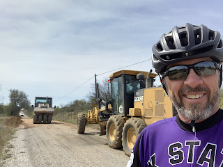
So there I am, riding merrily along (a lie - Hunter road into Groene from the North absolutely sucks)  when I see a "road closed to thru traffic" sign.  Now this sign is conveniently placed for the cyclist, seeing as how by the time one gets to it you either live there and thus aren't "thru" traffic or you have to backtrack about 5 miles.  So, I did what any good touring cyclist would do.  I rode up to the first guy in a neon yellow vest I could find and politely inquired about waking thru the site.  "No.  The road is closed.  Can't you read the sign?"  Yes, I can read the sign, but I'm on a bicycle and by the time I got to the sign I was well past the point of no return.  Do you have any suggestions?  "Yeah - find another way around."  Might you be able to offer any suggestions?  "No. Figure it out.  Everyone else has."  Everyone else is driving a car.  I'm just trying to save five miles.  "Ya can't walk thru here."  How about if I just walk where your guys are walking up by the train tracks?  "No.  we're improving the crossing. Its all torn up."  (Now I knew he was lying.  So far as I am able to determine Texas road crews work actively to make the road surfaces rougher - not improve them.)

Can I speak to your supervisor?  (Guy in road grader pulls up and guy in neon yellow vest bellows at him from the ground.)  Guy in road grader, "Well, we're really not supposed to let you thru."  OK, I'm just looking for a solution that works for everybody.  What would happen if I left the road right here and walked thru the grader ditch over to the train tracks and then followed the train tracks until I was on the other side of the guys you have walking around up there where I can't walk?  Road grader guy, "Ain't nothin we can do about that."  Great, I can work with that.  Thank you.  Neon yellow vest guy stomps off - his day ruined.  Good, seems like justice.

So that's the deal with the obstinate road crew guy.  Ya can't make this stuff up.  Now on to today's pics, because some of the scenery was absolutely beautiful.  Even if pics can't do it justice...


The first 11% hill of the day - that's why I'm still smiling.


Me - pulling into Groene.  Photo courtesy of Teamsters local 1976.


Good thing Delta isn't here.  He'd wanna race.  You can see our rig in the background.  Susan was wanting to give em a go.  To her its all about turning left...


But alas it was not to be.  She didn't make the start - apparently Teamsters are a bit slow out of the pits.


Susan found this really cool old house while waiting for me to show up in Groene.


Is this pic politically correct?  Hey - I'm not the guy renting out a tepee.


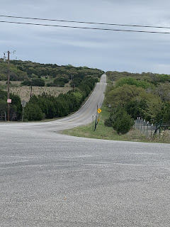
This pic is along River Road following the ACA map out of Groene.  Once again I was riding along the Guadalupe River - this time heading upstream.  What the Guadalupe giveth it taketh away.  Last time I followed it was for a downhill run into town.  This time - uphill for about 12 miles.


Another river pic.  The water is quite clear.  I could see the bottom.


The farther upstream we got the more of this we saw.  I knew the reckoning was coming.


The reckoning came and went in order to get to here.  This is the lake fed by the Guadalupe River.


Which also happens to be where we're spending the night - Potter's Creek State Park.

Till next time.


Thursday, April 4, 2019

TEXAS TEST FLIGHT - DAY 14

Ride report: 61.7 miles, 603.7 total miles,  14.3 mph avg, 4,337 calories, 2,557 ft. climbing.

A different day than all the rest.  From the time I left the KOA in Leander until I arrived in Creedmore, there was little in the way of back country roads.  Some - just not many.  In the main because the first probably 35-40 miles took me thru downtown Austin and out the South side of the city.  It takes a while to get away from a city that large.  However, I can report that Uhland is about as far away from the “city” as one can get.  It’s interesting - we can see the water tower for Kyle, Tx. (Where Susan had the RV water heater replaced right along I-35) but there’s not much to say about Uhland.  Well, except for the folks at the Lutheran Church here being quite helpful and letting us set up camp in their parking lot for the night.  Very nice of them.

There was no Susan lunch break today.  Which is unfortunate.  We were talking last night and both really enjoy getting to spend a bit of time together midway thru the day’s ride.  But there was nothing to be done about it today as there was no way she was bringing the RV thru the middle of Austin.  Her teamsters buddies told her there was extra pay for that sorta route and since she’s doing this for free, she went around the East side of town.  So I had lunch (if one can refer to an Italian sandwich in a plastic sleeve bought from a cooler and warmed in a microwave as, “lunch”) at the Valero Station at the West End of Lake Austin Boulevard.  Italians everywhere should be outraged at this injustice.

As anticipated the wind was mostly in my face today.  Late in the ride it shifted to a cross wind out of the West, but it was so late as to make the distinction meaningless.  If the wind doesn’t stay outta the South for the next three days as promised (giving me a tail wind for most of the ride up to Fredericksburg) I will be much displeased with “Accu”weather.  More on this situation as it develops.

Anyway - enough blather from me.  I don’t have a lot of pics today since the country (what there was of it) was largely unremarkable.  But regardless, on to the pics...


I rode thru what has to be a pretty pricey neighborhood just NW of downtown Austin.  The roads were wide, the houses big, as you can see by the pic.  Interestingly, it was here that I encountered a new steepest grade of the trip - this according to Garmin.  So, I zoomed down this one (very) steep hill trying to maintain as much speed as I could to get up the other side - which appeared equally as steep.  I think I was going maybe 35 when I bottomed out - it was steep but short.  Then when I started up the other side I pretty much had to dump the cassette and get in my lowest gear almost immediately.  The reader should know by now that when I'm grinding up a hill my head is down.  Anyway, when I opened my eyes (Yes they're sometimes closed when I'm going 5 mph - how much can go wrong at that speed?), there was Garmin staring me in the face and telling me: 25%.  I didn't believe it and assumed it must have something to do with how rapidly I started up the hill what with the speed I carried into it.  But even when I was grinding it still read anywhere between 23-25%.  That, boys and girls, is steep.


There were two or three miles (?) of this.  Downtown Austin.  Pleasantly flat.


Me in downtown Austin.  Except for this pic, the traffic wasn't bad at all.  Was a little busy right here though.  That said, motorists were all very polite.  I was a little edgy riding past parked cars - didn't wanna get doored.  If ya don't know, use your imagination...


Me on the river bridge.  It took a bit to find the road that led over the bridge.  I think it must be closed to vehicular traffic having been replaced by the more modern bridge you can just make out in the background.  But the sidewalk was still open for bicyclists.


The Colorado river from the bridge.  It looks a lot different here than it did from where we stayed farther up-river when we were last in Austin.


I ran into these two guys on the bridge and chatted em up for a few minutes.  Turns out they're both from Germany though the younger (the son) is working in Austin and his Dad is over for a visit.  We had a great conversation.


This is what happens when ya marry the cutest girl in high school. You get to take her out to dinner at the Supermercado in Uhland, Tx.  Lucky girl...


Plus, ya get to treat her to a night at the finest hotel in town - or at least in the Lutheran church parking lot...

Till next time.

Wednesday, April 3, 2019

TEXAS TEST FLIGHT - DAY 13

Ride report: 60.0 miles (TODAY’S BREAKING NEWS: I didn’t get lost - not even once), 542.0 total miles,  14.2 mph avg, 4,719 calories, 3,241 ft. climbing.

Today’s ride started at the Buchanan Dam NW of Austin and ended in Leander, a NW Austin Suburb.  Tho it was the typical 60 miles I considered abandoning for the day at Susan’s rest stop/lunch in Bertram.  PB&J and cookie dough, if you must know.  It was Susan's idea.  She says I wasn't in the mood for much else.  The wind, predicted to be 8-12 mph out of the SSE ended up at about 15 steady with gusts to 21 - if “Accu”weather is to be believed.  I think it was all of that.  To the uninitiated, this means that the entire 60 miles was pretty much into a headwind.  And the first 36 miles to Bertram was the hilliest.

With the complaining done, I gotta say that the scenery was great.  Apparently Llano County is known for granite outcropping - they were in evidence along today’s route as the pics below will confirm.  Granite outcroppings are like all other hills - they look better from a distance and when going down them.  (OK- one last complaint.)  Thankfully, after Bertram the route profile was generally downhill.  Don’t misunderstand, there were still hills.  But overall the elevation was decreasing rather than increasing.  I felt better when I got to Leander than I did at Bertram.

As a final side bar before getting to the pics...

The reader may recall one of my earlier posts in which I showed a flood gauge at a low water crossing.  Apparently there are different types.  Along today’s route I encountered a low spot in the road with one of those 8 foot fences on one side of the road.  Located about 5 feet above ground level was a young raccoon.  Sorry, a dead young raccoon - stuck in the fence.  I was left to conclude that high water had deposited the carcass.  An effective means of tracking water depth - unless you happen to be the afflicted raccoon.

So - pics...

The Colorado River at Buchanan Dam.  Impressive.


One of many granite outcroppings.  This one appears to have suffered a recent fire and had a bunch of wildflowers to boot.  In Inks Lake State Park.


Also in Inks Lake State Park.  All very nice.  Until the three mile climb getting outta here.


Somewhere along the route this afternoon.  Its an advertisement for an RV resort South of Bertram - a town of maybe 1,300 people.  While their advertising is eye catching, even more surprising was the PRIVATE AIRFIELD for the RV resort.  Needless to say, it was populated with high dollar, new, class As.  The kind that run 300-500k.  Wowza!  Private airfield (shakes head)...


And to close out the day we unlimbered the scooter for a 19 mile jaunt from our campground to a restaurant called "The Oasis At The Lake".  Google it.  The place is amazing.  Tiered open air seating combined with enclosed seating for up to 3,000.  Unfortunately (as you can see) we didn't get to see a sunset.


Also at The Oasis.  I can't explain it, I just take the pictures...


Don't bother me.  I'm thinking...


A view of the dining area below ours.  Gives some perspective on the view.


The shoreline from our dining area,


Why am I not surprised?  Damn Yankees?  OK - I'll buy that.


Some of the houses along the shoreline beside The Oasis.


Its inexplicable, but Susan keeps taking these pics for me...

Till next time.

Tuesday, April 2, 2019

TEXAS TEST FLIGHT - DAY 12

Ride report: 64.9 miles (I got lost.  More on this later - sound familiar?), 482.0 total miles,  15.5 mph avg, 5,168 calories, 3,392 ft. climbing.

This whole getting lost thing was really no big deal.  Susan says she sees a consistent theme here.  I pay her no mind.  Turns out I stayed on 965 N out of Fredericksburg when I was supposed to be on Crabapple until it intersected with 965.  Regardless, I ended up at the intersection of Crabapple and 965.  Pretty much a no-harm-no-foul sorta thing.  Susan says I was lost.  I maintain that I couldn’t be lost if I was standing at the right intersection.  As I was standing there pondering the mysteries of my ACA map, a little old lady pulled up and I took the opportunity to ask her for directions.  She was very nice and gave me directions to Welgehausen road when I asked, “Just 3/4 mile up the road.  And if you don’t mind me asking, why on earth are you going that way to get to Llano?”  Whereupon I had to explain the concept of ACA maps, bicycle tourism, and an apparent desire to find the tallest hills around.  She assured me I was on the right track.  She wasn’t kidding.

I must say that Welgehausen Road and County Road 111 North out of Fredericksburg are some of the most scenic routes I’ve ridden yet in Hill Country.  Flowers were everywhere,  as were butterflies.  Scenic vistas, creek bottoms, cliffs - on several occasions I would come around a corner and just exclaim, “Wow!”  Oh yes - and lest I forget, the steepest grade of the trip was encountered today - 17%.  As I labored up it, I was passed by a Monarch butterfly headed the same direction.  I tried to chat him up, but he was in no mood for idle conversation as he was suffering up the same grade.  I didn’t push the issue, he seemed irritable enough as he mumbled, “Outta my way.  Tourists!"”

So - on to today’s pictures...

I knew cactus didn't need much soil, but this was a new one for us.


Address: Middle of No-where, Tx.  00000


Average Hill Country Face


17% Hill Country Face.  Also known as "Anticipatory Ouch-Face"


Part of CR 111 was torn up down to the sand - I'd say dirt but there wasn't any here.  I wondered what was going on, so I chatted up Dave who works for the County - he's not an SB since he doesn't work for Tx-DOT. Turns out last fall's rains soaked thru to the roadbed and the clay under the road swells when wet thus "heaving" the road.  Kinda like freeze heaving in Kansas, but swollen clay is the cause rather than frozen water.  Made the road suck in places, but I learned something today.  The guy in the roller raced me to the other end of the "fix".  It was no contest.  Him and the butterfly came out ahead...


There was just a whole lotta this today.  But this was the only time the blue, orange and white flowers intermingled.


Downtown Llano.  Very 20s.  Kinda cool.


And the courthouse was impressive.

Till next time.

Monday, April 1, 2019

TEXAS TEST FLIGHT - DAY 11

 Ride report: 75.6  miles (I got lost.  More on this later), 417.1 total miles,  15.0 mph avg, 6,258 calories, 5,456 ft climbing. (Yes - you read that right.)

Getting lost really wasn't my fault.   I knew that after meeting Susan for lunch in Johnson City  I had to turn within a few hundred yards of leaving the RV.  I was going to Fredericksburg and I was supposed to be on a highway numbered in the 200s.  One would think that would be enough to navigate to the correct location.  Turns out that Texas decided that both highways 290 and 281 should pass thru Johnson City.  I see the sign that says Fredericksburg and a highway numbered 290 - naturally I turned left.  However, 2.5 miles later my ACA map was telling me that I should have crossed the Pedernales River when I had clearly done no such thing.  Hmmm...  What are the odds that neither the state of Texas or the ACA know what they're doing?  At 3.5 miles I decided that the odds had diminished sufficiently to actually think about it and concluded that I had taken a wrong turn.  Such is life.  3.5 miles later (a total of 7 miles out and back) I was back where I was supposed to be.  Susan was still lounging in the RV.  I called her to let her know what had happened and pulled out of town.  So there ya have it - a directionally challenged guy's version of reality...

As you might imagine, with that much climbing there was a lot of this today.


The Sequoia just couldn't pass this one up.


Same location - different shot.  The Bluebonnets were more impressive in person.


Steepest decent of the day.  I had just hit about 40 mph when I scanned the radius of the curve and saw something in the road.  Something in my head took me back to the ACA map's reference to cattle guards and I hit the brakes.  Just in time.  I stopped after the cattle crossing to check out the low water crossing.  The water was running about 8 inches deep across the road.  The ACA folks suggest walking thru these as moss may make the road slick.  They had no idea the temps wold be barely above 50 degrees.  No way I'm doing that.  I rode thru.  Managed to only get my left foot wet.


These were all inside an 8 foot fence on some ranch.  I'm still trying to decide if they're pets or targets waiting for deer season in the fall.  There are certainly a lot of buck in the pic.  I'm leaning toward targets.

In keeping with the guys desire to take their pictures with large plants...  They don't grow these this big in Kansas either.


This was a small one.  He was in a pasture right across the road from...


...this big one.  As I was standing there, the small one started bellowing at the big one.  I watched two bulls fight and tear down a fence between two pastures when I was a kid.  Not wanting to stand between two love struck bulls and the object of their desire, I left forthwith.


Jut showing my eye for an artsy shot here.  The juxtaposition of the prickly cacti contrasted with the softness of the bluebonnets, when combined with the last standing section of wooden fencing leaves the viewer with a more complete understanding of nature's grandeur...

Hows THAT for artsy!


Yeah - there was a whole lotta this today.


And also a lot of this.  Sometimes the bluebonnets were so thick I could smell them as I rode past.  Very nice.


This was just a typical view.


Ah - the Texas state bird.  These things are all over the place.  I think I saw a bike jersey in that pile of vultures.  One of em followed me for several miles uphill.  He was flying just behind me encouraging me to work harder.  Hmmm... 


Then there was this - the Texas state scaly animal.  The observant viewer will note that he's sipping from a Corona.


This thing was prolly 4-5 ft. tall and 12 ft. long.

Till next time.