INTRODUCTION

Where to begin? It was a dark and stormy night...  (Snoopy).  No. It was the best of times, it was the worst of times...  ...

Tuesday, June 18, 2019

The Thin Blue Ride - Part 2 Day 9 - Mitchell, OR to John Day, OR

Ride Report: 69 Miles, 501 Total Miles, 17.8 Avg mph, 2,943 Ft. Climbing, 5,993 Calories.  Just in case the reader isn't aware - this is one WHALE OF A RIDE REPORT.  At least for me.  That's a lot of climbing to end up with an average speed of 17.8.  For details see below...

First thing out of the gate today - Keyes Creek Pass.  The reader will recall that yesterday I mentioned that Mitchell, OR is at the base of the climb.  Folks, this one sucked.  The first two miles were 4-5%.  I'm thinkin to myself, "Self, you got this licked."  I should have known better.  The remaining 4.5 miles were dead steady at 6-8%, all the way to the top.  So, it was head down and grind all the way.  The thing about grinding with one's head down is that when one sweats profusely it drips off one's helmet right between the eyes (annoying at best), it drips off one's nose onto the Garmin (thus making it difficult to read the % slope - this may be a good thing), and it drips out of one's beard at the chin (again - annoying).  When I made it to the top, Susan was waiting to refill water bottles, and I availed myself of the opportunity to change base layer, headsweats and gloves.  Yes gloves.  I had wiped the various drips sufficiently to make the gloves slick with sweat.  Not a good idea on a downhill.  Given this description, I hope the reader will understand that there are only two pics of the ascent.

Good thing the Sequoia bothered me early for this one.  As is typically the case, he's chatty when I'm suffering.  Which just adds to the suffering...


An early uphill shot.  Trust me, there was nothing worth looking at the rest of the way up.  Note the scenery.  There is a small creek just beside the road - green.  There is no such creek in the hills - brown.


Proof we made it to the top.  Smiles lie.  I wasn't feeling smiley inside.

While the reader can't see it because my head is in the way in that last pic, Susan and The Rig are right behind me on the down slope.  There was a conveniently place turnout there.


The downhill went on for about 25 miles.  This is when one wonders if God rides a bike.  How else to explain a 25 mile downhill.  Apparently the Devil is in charge of up-slope topography.   But - the downhill made it pretty easy to recover by the time I got to the lunch stop in Dayville, OR.  When I arrived, Laura (of Ken and Laura fame) was in The Rig talking with Susan.  I was glad Susan had found someone to chat with.  Unfortunately their schedule won't line up with ours after today.  We likely won't see them in person again.  But we intend to check out their YouTube channel.  The reader can do so by going to YouTube and searching for "Team Lucki" - yes, with an i.  They plan to post once a week.


Those are actually giant sagebrush plants on the side of the road.  I'd no idea they got so big.


The mountains you can see in the distance are on the schedule for Wednesday - that would be tomorrow.  The reader may recall my previous mention that I'll be climbing three separate mountains tomorrow.  Hence, I've dubbed it Cardiac Wednesday.  Leave it to a mountain to ruin a perfectly good downhill.  Stupid mountain.
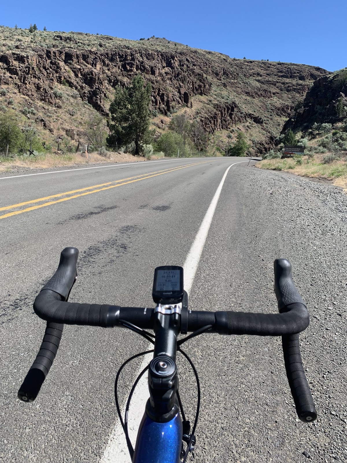

But back to the downhill.  The reader may note that Delta is now in the pic.  That's because I swapped out bikes at the summit.  Maybe I'm imagining things, but Delta seems more responsive and also more stable in corners.  So, if I'm goin' downhill for 25 miles, he's the guy.    


Lest the reader think that by "stable" I meant emotionally mature, I proffer this pic.  This tire weight happened to be on the ground when Delta and I stopped for the pic above.  When he asked, I explained to him that car tires are sometimes out of balance and require these weights so their tires don't  "jump around" at high speeds.  He thought this ridiculous in the extreme, asserting that bike tires require no such contrivance and that as a result, bikes are better than cars. (sigh)


I gotta tell ya, the ACA folks nailed it when they chose this route.  Highway 26 West of Dayville, OR is possessed of absolutely stunning views.  This is one.


This is another - in an area that I think was called "Picture Canyon".   It was something like that.  I was paying attention to where Delta was going, looking at the canyon and trying to read the sign all at the same time.  While there is a bit of room on the right side of the road here, in many places it was just river to left of road and rock wall on the right.  Regardless, it was breathtaking.


But eventually all downhills (like all good things in general) must come to an end.  So it was with the descent from the Keyes Creek Summit.  On the bright side, the end of the downhill occasioned my introduction to the John Day River.  Delta and I eventually crossed it three times before reaching our destination of  John Day, OR.  Both, by the way are named after some finder of fossils.  There are the John Day fossil beds just West of John Day (the town).  As is typically the case, once one meets a river flowing the opposite direction one is riding, the pitch kicks up.  In this case mostly around 1-2%.  But it was no big deal because there was a strong tailwind all the way to John Day (the town).


Gotta agree with the Oregon Tourism guys on this one.  This has been one Oregon Scenic Byway.

That's about it for today reader.  Tomorrow is an even bigger day what with the three mountain passes.

Oh - and I apologize again for the irregular timing of the posts lately.  Its kinda like cell service out here - irregular.

Till next time.


The Thin Blue Ride - Part 2 Day 8 - Prineville, OR to Mitchell, OR

Ride Report: 50 Miles, 432 Total Miles, 15.2 Avg mph, 2,408 Ft Climbing, 3,766 Calories.

As the reader has likely noted from the ride report, today was a bit shorter than normal.  Thus far I’ve avoided looking forward too much in the daily posts.  The exception being McKenzie Day.  But in order to understand why today was a bit shorter, its necessary to have some idea what has yet to come this week.  In essence, there are six mountain passes this week.  McKenzie Pass and Ochoco Pass have already fallen to the rotation of my cranks.  The reader will see proof that I topped Ochoco Pass in the pics that follow.  Tomorrow is Keyes Creek Pass.  (Hey, I don’t name em, I just ride em.)  Mitchel, OR is where we'll overnight tonight and is on the up slope of Keyes Creek Pass.  Not wanting to handle two mountain passes today we called it a day at Mitchell.  If the reader is proficient in math (and for those who are not) this leaves three mountain passes this week.  Unfortunately, they’re all grouped so closely together that they must, of necessity, be beaten down in one day.  That would be the day after tomorrow.  So, it now gets a bit easier to understand why we called it a day at 50 miles.

But on with today.  The ride was interesting – in a different sort of way than were the Cascades.  It's similar to when we drove thru New Mexico and Arizona on the way out to start The Thin Blue Ride, it kinda grows on ya.  So yes, its rocky and sandy, there are scrubby looking plants everywhere, water is becoming less in evidence as we progress East, but where you find it the countryside remains lush.  Its just that there’s a lot less lush than was the case even in Prineville where the day started.  Here’s what it looked like…

According to what I read on the menu at the restaurant last night, Prineville is one of the few cities to have constructed its own railroad spur and the City still owns/maintains that spur today.  This was sitting on the main drag thru town as I left this morning.


Before long we’d climbed up to Ochoco Lake which I presume supplies water to Prineville.  It was very scenic.  The only problem was that it bred mosquitoes like rabbits breed…well…more rabbits.  And they apparently called their annual convention right along the edge of the road in the shade of the pine trees that lined the highway.  I learned something new today.  Flocks (?) of mosquitoes like to hover at precisely head height to a rider.  I learned this when I rode thru the first flock – with my mouth open.  Well, technically I didn’t learn it till after the 4th mosquito snack, but learn it I did.  Regardless, the lake was a nice distraction – from the mosquitoes if not the effort of the ride.


This is what I’m talking about when I say that where there is water things look all green and spring like.  It also happens to show what I’m now positive will be my last look at the Cascades.  I know, I know – I said the same thing earlier, but this time I think its true.  If the one looks closely one can just make out a snow capped mountain in the slot of the hills in the foreground. 


This lasted for maybe a mile and a half or two miles this morning.  While it might look flat, I can assure the reader that its actually a steady uphill slope of between 1-3%.


About 15 miles in, this happened.  The reader will note that the road no longer looks flat in the distance.  One can just make out that the road starts to wind around the hill in the distance.  It kept winding for the next 15 miles.


Oh yes – some kind soul had pity on we poor riders and set up a water stop for riders – complete with a bench in the shade.  Very kind.  Hmmm… or maybe they just got tired of riders knocking on their door and asking for water all the time?  I was doing fine.  No need to stop for anything but a pic.

Susan and I had arranged to meet for lunch at a trail head about a mile before the summit.  I was feeling pretty good, but it was still a welcome break.  So – shortly after lunch, I finally reached the top of Ochoco Pass.

It wasn’t nearly as difficult as McKenzie, but 31 miles of steady uphill wears on a guy.  The last fifteen miles varied between 4-6%

Then started the downhill.   It was 18 miles to Mitchell with about 14 of those miles being downhill before the route flattened out.  The early descent was a hoot since the slope was probably at 6-7%.  This side of the mountain is clearly more consistently steep than the side I climbed.  Unfortunately, the wind (which had been in my face all day, to include coming up the freakin mountain) remained so and actually increased in velocity – thus stemming some of the fun associated with a blistering downhill.  I think my high speed for today was only 39.5 mph.  But it was still fun.


I don’t stop often on downhills, but when I saw this shot I just couldn’t pass it up.


This is a tamer part of the downhill.  I think the slope was maybe minus 2-3% here.  I always think it looks cool when the road disappears between rock formations on a downhill.  One has to learn how to judge the radius of the corner and adjust speed accordingly.


This is the thriving metropolis of Mitchell, OR – population about 140.  Most of the businesses were closed.  They did have two restaurants and a grocery store.  When Susan stopped and went into one of the restaurants for directions to the RV park, the inside door knob fell off when she opened the door.  Need to get the maintenance guy on that...  We also wandered thru an antique store.


But being on the Trans-Am they’ve availed themselves of the opportunity to put a stylized bike beside their town sign.  Very nice.  They also turned what I presume is a disused church building into a biker hostel.  Its right on the highway before taking the "Mitchell Loop Road".  That would be the one street in the previous pic.  Hmmm... The Mitchell Loop - very catchy.  Prolly draws tourists like flies to honey.

I’d show the reader a pic of the RV in the Mitchell RV Park, but frankly its kinda depressing.  Just a small dirt lot with the occasional bout of dust blowing across when people drive by on the road  above it.  We were, however, surprised to see electrical hookups.  Great!  A/C tonight - and for only $25.  We're in.

So there ya have it sports fans.  Another day in the books.

Till next time.


Sunday, June 16, 2019

The Thin Blue Ride - Part 2 Day 7 - Prineville, OR (Rest Day)

Ride Report: 2 Miles, 382 Total Miles, 10 Ft. Climbing, 61 Calories.  Disclaimer - the only riding I did today was when Susan and I toodled over to a local restaurant for a Father's Day outing.

And a rest day it was, as evidenced by the pic below.

No better way to spend an afternoon, mind you.

There were a few chores left to take care of.  I washed all our bikes and lubed the chains to prepare for the next week's riding.  Susan took care of the interior stuff - cleaned the RV up - that sort of thing.  Its a great blessing having her along.  Life is so much easier when some of the day to day life stuff is taken care of.  I have sympathy for the self contained tourers.  Tearing down a tent every day, setting it up at night, finding food, going at a much slower pace and thus more time on the road due to carrying all their gear - it all consumes so much time that from what I've read their entire life becomes about the ride.  The way we're doing it we have some spare time to ourselves.  Plus, we kinda like hanging out together.  Anyway, on with the day's report.  Other than what I've already described, that starts at about 1700.

This is Susan leading the peloton on the way to dinner.  Having an apparent disdain for riding in the bike lane, I was left to hang on for the 1 mile route.  As the reader knows from today's ride report, it was all uphill - 10 feet uphill, but uphill none-the-less.  What can I say, she's a climber.


Once firmly ensconced at our table I ordered the prime rib.  Hey - it is Father's Day, after all.  Dunno who decided to put those green things on my plate.  Again, not being much of a horticulturalist, I've no idea what they are.  Susan mumbled something about beans that are green.


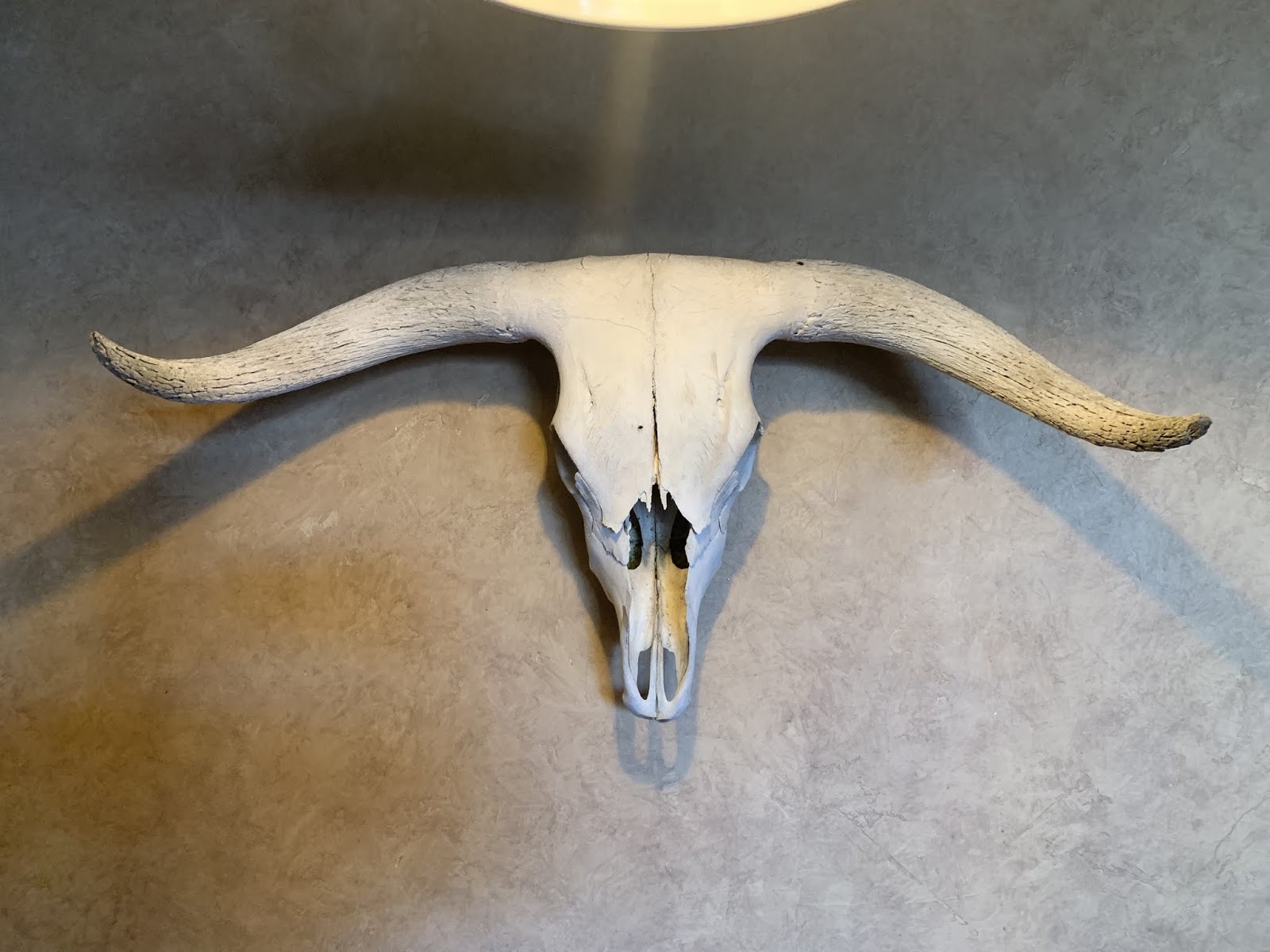
Then there was this guy hanging right above us.  Notice how he's giving me the stink eye.  He kept that up for the majority of the meal.  I figure word of my elkburger back in Terrebonne got out and he's letting me know he doesn't take kindly to my menu selection.


But I wasn't intimidated.  I told him to back off or I'd talk to the proprietor about turning him into one of these - also hanging on the wall.  That did the trick and I was able to enjoy my meal in relative peace...


As evidenced by this pic.  Notice that I left the beans green alone.  I wanted to do my part to maintain a healthy relationship between we carnivores and the vegetarian crowd.  Showing the beans some kindness can't hurt.


And finally, when we were seated at the restaurant Susan struck up a conversation with the people seated next to us.  They were locals and amenable to a chat.  Their names are Tom and Judy.  That would be Judy on the right.


They were quite interested to hear about The Thin Blue Ride.  Tom happens to be a rider himself, though of the sort who uses a throttle rather than pedals.  He was telling us about going up to remove mill equipment from mills in the damaged area around Mount Saint Helens within 60 days of the eruption.  He also had a story that started off about being on a motorcycle in the southern California  desert with his buddies years ago and coming across a desert tortoise that he picked up and put on his gas tank to transport back to where his friends all were so he could show em the tortoise.  It evolved into finding some railroad tracks on the San Andreas Fault that had dropped several feet, thus severing the then abandoned tracks during an earthquake.  Anyway - when he finished the story Judy asked, "What about the turtle?"  It was hilarious.  We all laughed.  As I recall the tortoise turned out fine.  He showed it to his buddies and let it go.  Prolly wouldn't wanna pick one up today.  I think they're protected?  It was fun to meet them.  Judy's son lives in Gardner, Kansas.  Susan's sister-in-law, Ronda, is from the Gardner area as well and she worked in Gardner for a number of years.  It was the whole six degrees of Kevin Bacon thing.  Google it. 

And that, readers, is what a rest day looks like.  Back in the saddle tomorrow.

Till next time.


The Thin Blue Ride - Part 2 Day 6 - McKenzie Bridge, OR to Prineville, OR (McKenzie Day)

I know I typically start with a ride report.  Today I'm gonna start with two ride reports.  And while I understand that I said supplemental ride reports would remain an anomaly, the second is not a supplemental report.  They're both part of the same long day.  I'd like to delude the reader into believing that I did this intentionally, but the truth is I accidentally shut off the Garmin and had to restart it - which created the second ride.   This was fortuitous as the point at which I shut it off was at a distinct divide in both the geology and climate encountered during the day.  Additionally, the first report encompasses the climb and descent of Mt. McKenzie - nothing more, nothing less.  So - the ride reports:

Ride Report 1: 30 Miles, 334 Total Miles, 2,904 Ft Climbing, 2,463 Calories, AND Mt. McKenzie.  More on this vile monstrosity later...

Ride Report 2: 46 Miles, 380 Total Miles, 1,040 Ft. Climbing, 3,618 Calories.  And one forgiving wife.  More on this later as well...

So, all in all 76 miles, 3,944 Ft. Climbing and a 6,081 calorie day.

Well, as the reader knows I've been carping about Mt. McKenzie interminably.  Today was the day.  Susan dropped me at the turnaround point for over sized vehicles and I was off.  Closed road to the contrary, I tried to convince her she should just follow me with The Rig. I was rewarded with this look...

Its a look I'm familiar with.  Unless I've been misinterpreting this look for the last 40 years, she's makin googly eyes at me.


This is the road up McKenzie at the start.  The grade isn't too bad here yet - running 4-6%.  Forgive the hazy nature of the pic.  The phone was in my back jersey pocket and I think the lens was fogged from the sweat.  This is a combination which bodes ill, the grade isn't steep yet and already the lens is fogged...


But in short order the grade kicked up.  Within a half mile of starting I was looking at minimum 6%.  If I had to say, I'd peg the average at 7-8% with some pitches up to 10%.  And this went on up to the 8 mile point.  Ouch.  The discerning reader will note several things concerning this pic.  1. I'm still smiling.  The reader should not be deceived. I've learned how to smile between gasps of air. 2. Note all the undergrowth in the forest behind me.  This is actually a rain forest.  There are ferns everywhere. 3. Note the patch of grey between the two big tree trunks.  That's the road I just came up.  There is a hairpin curve behind me (out of the pic) and I'm looking down some 80' to where I was just moments ago.  That, readers, is steep!


At 4,000 ft. its game on baby!  Reader's choice: I'm either making my mean face, or I mistimed the pic and am gasping for air again...


Wait a minute - what's this stuff doin here in June?


Interestingly, at the 8 mile mark the pitch leveled out and ran thru what I guess I'd call a meadow that had suffered a fire recently.  There was still some work to be done, but the heavy lifting was pretty much done in the first 8 miles.


Once past the burned area, the meadow looked like this.  It was stunning.  Only problem was that when one stopped for a pic, the mosquitoes latched onto you like ticks.   Except that they were larger and meaner.


As we neared the summit, we started seeing the lava flow that apparently covers the summit.


Just before the summit there was an observation area where one could take in the "Sisters" mountains.  The juxtaposition of the snow capped Sisters with the lava field in the foreground was stunning.


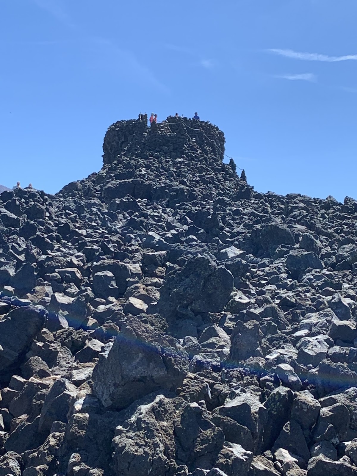
 There was also this just before the summit.  It's the Dee Wright observatory.  I'd heard of it, and anticipated a star gazing thingy.  Nope, it's there to keep an eye on the lava field.  There were what looked like flagged survey markers out in the lava field.  My ACA map says that its been determined that the lava flowed about the same time the Pilgrims were getting off the Mayflower.  Interesting.


And here we are at the summit.  The inquisitive reader may have been curious as to my choice of jerseys in which to climb the mountain.  When I bought it , it was sold as the "Global Warming" jersey, and yes - that's the fireball from a nuclear explosion on the front.

So, my McKenzie report.  It was a tough fight.  I clearly held sway in round one, the first half mile.  Round two was a slugfest with both McKenzie and I getting in our licks.  But by round three, the big guy wore down and I'm smiling at the top.  For real smiling.  The pic below is part of the print on the back of the jersey.  I wanted McKenzie to see it as I coasted away downhill.


 We know how this fight turned out.  'Nuff said.

The downhill was interesting in that the climate (and hence the forest) changed completely.  Gone were the frequent rains - and with it the ferns.  No rain forest on the East slope!


Within 25 miles of the peak of McKenzie, I was looking at this.  That, readers, is sagebrush.  Oh - and some spindly looking sorta cedar tree thing.  Nasty.  And as an added bonus, it was hotter as well.


They also have some interesting crops in these parts.  I'm a ways off from this field, but to my discerning eye, these appear to be marijuana plants.  That's right reader, the devil weed, wacky tobaccy, mary jane, the list goes on.  I don't think we're in Kansas any more Toto...


At one point I turned around and looked West.  This is where we came from.


And this is where we're going.  Pretty much sums it up.


Which is not to say that the area was bereft of neat photo ops.   Eastern Oregon thus far appears to be a story of "where's the water"?  Along the river its very lush.  Away from the river - not so much...


One last look at the cascades.  Used by permission of Susan Schoen Photography, LLC.  She took this one at Sisters, OR.  Gorgeous.


I believe I mentioned earlier that it was hotter East of the Cascades.  So after leaving Sisters, I had 26 miles to go to get to Terrebonne, OR. where I was scheduled to meet Susan.  We thought it a good idea just to check in before she headed on to Prineville some 20 more miles down the road.  This turned out to be a good thing.  I had run thru most of my water by the time I got to Terrebonne and had been rationing it for the last 5 miles.  It was hot and I had to wait 10 minutes to turn left onto 97 highway due to heavy traffic.  I thought I got lost in Terrebonne (a city of - well - not very many people).  I find it prescient that just a few days earlier I had described myself as cranky when I get hangry.  Susan said no - I get cranky when I'm dehydrated.  I was dehydrated now.  I later apologized to Susan for being cranky when I got to Terrebonne.  She said it wasn't a problem because she knew what was going on.  I have this maxim - All men marry up.  I certainly did.

Anyway, we both decided I needed a break and some time to cool down before the last 20 miles in to Prineville.  Fortunately for us there was a restaurant right across the street from the church parking lot where she had stashed The Rig.  It resulted in this


The reader will note that half of my elkburger is already gone in this pic.  You read that right - elkburger.  Half is gone because I wanted to be able to report on its merits rather than just posting a pic of some plate of food.  I'd give it 4 stars.  After about an hour, two Diet Pepsis, Two Diet Cokes, and a glass of water that I looked at, I felt much better.  On to Prineville!


The remainder of the ride followed the Crooked River (No - I'm not describing it.  That's its name.) into Prineville.  This is always a good thing as it means a steady downhill slope of at least 1%.  Just what the Doctor ordered at the end of a long day.  But first I had to descend to the river bottom.  The bluff you see in this pic was right out of the church parking lot and followed me all the way to Prineville.  Very scenic.

Till next time.