INTRODUCTION

Where to begin? It was a dark and stormy night...  (Snoopy).  No. It was the best of times, it was the worst of times...  ...

Thursday, June 27, 2019

The Thin Blue Ride - Part 2 Day 17 - Wilderness Gateway Campground, ID to Lolo Hot Springs, MT

Ride Report:  60 Miles, 955 Total Miles, 13.5 Avg mph, 3,284 Ft. Climbing, 4,155 Calories.  Minus an additional 1.5 pounds this morning.  I'm gonna feel like I'm starving when I have to cut back after this ride...

Big day today – and to illustrate I’ve included a pic of the elevation chart from the ACA map for today’s ride.  I’ve mentioned before that the ACA maps break The Thin Blue Ride (also known as the Trans-Am) into 12 segments.  On each segment, the map provides additional detail in the form of about a dozen 30ish mile sections for a total of roughly 360 miles per segment.  The sections are numbered sequentially starting in Astoria.  So, when the reader looks at this elevation chart, it roughly depicts the elevation gain over sections 32 and 33 of segment 3.  Got it?  If not call with any questions and leave a message.  We can talk when I get back to Manhattan in October and finally have decent cell service again.

We overnighted just to the left of the farthest left red line – we were just barely inside section 31.  The goal for the day was Lolo Hot Springs, to the right edge of section 33.  That’s a total of 60 miles.  As the reader can clearly see, the day was all uphill until Lolo Pass, with the exception of a couple minor descents.  Let me assure you, they weren’t significant enough to relieve the tedium of 52 miles uphill.  That’s how far it was to Lolo Pass, which at 5,235 feet is (I believe) the highest pass we’ve been over since McKenzie.  That, ladies and gentlemen, constitutes a big day.

I have to insert here the gist of a conversation Susan and I had with Kelsy and Parker a couple of days ago.  During the course of this conversation, I received a dissertation on the merits of eating healthy and how the food I was consuming was all “bad” sugar (somebody show me the good stuff then) and how I should consume better quality calories.  This in furtherance of avoiding that "tingly" sensation I described in my legs during the conversation.  Thanks – this set your mother out to buy better food for me.  As a result, I consumed this on one of my breaks…
Yup – an avocado  - and I’m eatin it right out of its shell – or whatever that hard part on the outside is called.  An exoskeleton maybe?  I dunno.  Poor thing.  I must admit that it wasn’t too bad.  And as an added bonus, it made  Kelsy’s mother happy.

But then I got a call from one of The Thin Blue Ride’s corporate sponsors.  They reminded me of my contract and as a result, I was compelled not only to consume their product, but to give it equal billing. Hence…
I demolished a Hostess cupcake - two bites, BTW.  It was horrible. Over the last week I barely managed to choke down the contractually obligated 12 pack.  But duty being what it is, I soldiered on. The fine print requires both resupply and additional consumption.  My God – the horror of it all…

But on with the actual ride – brought to you by Hostess cupcakes - freshness in every bite!

This was the view of the river from the bridge to the RV Park first thing in the morning.  Only 52 miles to the summit...  


This is the Sequoia checking out the next ten mile uphill stretch.  The first 40 miles went like this: ten miles at a crack, then stop for a ten minute break.  I planned today’s ride this way because I knew it was somewhere around 46 miles when the grade would kick up.  I also made it a point to ride easy for the first 46 miles in order to save energy for the real climb between 46 and 52 miles.  There was just a whole lotta this – 46 miles worth, to be precise.


Well, this is encouraging...


As was this just a bit later.  I don't think so...


But this was good.  One of the stops Susan selected for a ten mile break was at what the maps call "pack bridges".  We eventually concluded that they're for the crossing the river on the numerous hiking trails throughout these mountains.  Susan noted that when I went out on the bridge with her it swayed.  It was a suspension bridge for God's sake.  How is that my fault???


On the way up, I ran into this historical marker.  Is there any place those Lewis and Clark guys DIDN’T go in these parts.  How did they not end up with a state or two named after ‘em?  I propose re-naming Washington and Oregon as Lewis and Clark respectively.  I had a sense that the end was near when I saw it.  And sure enough, about 2 miles later…


State number three – Montana!  I don’t know if the reader is aware (I certainly wasn’t until today) but Lolo Pass demarks the state line between Idaho and Montana.  Cyclists tend to affix stickers to such signs as a memento of their passing.  Hey - its the T/A.  A lotta riders have been thru here.  Not me tho – I’m not in to defacing public property.  That’s my story and I’m sticking to it.


However, there being no Lolo Pass sign, I took a pic of the next best thing.  I believe this is a snow depth marker.  Holy Cow! That’s some snow.


So, this is me pointing out the benefit of spending all that time going 52 miles uphill.  The reward?  Eight miles of downhill.  Seems disproportionate, I know, but such is a rider’s life.


This is home for the night – Lolo Hot Springs.  We reserved a spot for The Rig in the RV Park just across the highway from the Hot Springs.  As I pulled in, Susan had just finished checking in and was pulling in to our slot.  I kept up with her for the first 4 miles of the downhill, but then it leveled out a bit and she was able to get ahead of me.


This is one of the benefits of overnighting at Lolo Hot Springs.  It’s kinda implied in the name, but they have a hot springs here and use it to feed both a swimming pool and this (much) warmer and smaller pool.  This baby was right at 103 degrees at the “cool” end.  That would be the end farthest from where the spring water enters directly from between the rocks.  I did two stints in it.  Stayed a bit too long the first time and my legs were wobbly when I got out so I had to sit down on the conveniently placed benches. (Oh, that’s why they’re here.)  The reader should note a couple of things in this pic.  1: The nifty biker tan I have going.  2: The absence of said tan on my right shoulder.  (Yes reader – your left)  The white spot there is a scar left over from sliding down the road after tangling with the mini-van while on a lunch hour ride last September.  I still watch mini vans closely when encountered on a ride.  Them and logging trucks.  The mini vans are the chihuahua of vehicles.  It’s always the little ones that that have the worst attitudes.

Now I want to take a moment to follow up on something I mentioned yesterday: Brad Schoen’s Mountain Misery Index.  We’ll just use the acronym BS-MMI. It goes like this.  In order to determine the index one must first calculate the Fatty Factor (FF).  FF is simply the rider's weight divided by the number of bottles of water consumed during the climb.  A rider can positively influence the FF by either losing weight or increasing water consumption during a climb.

Next one must Determine the LAG (Length and Grade).  LAG is a measure of the length of the climb to the nearest tenth of a mile multiplied by the average grade (expressed as a percentage) of that same climb.

The FF is then divided by the LAG in order to determine the BS-MMI.  The lower the quotient the more difficult the climb. 

Expressed mathematically the formula looks like this:

Rider weight / Bottles Consumed = FF
(LG) X (%G) = LAG (Length and Grade)

 FF
LAG = BS-MMI

So - now a real world example.

203 (my weight) / 6.2 bottles consumed
8.2 (length of climb) X .05 (5% grade)

32.7
.41

BS-MMI = 79.8.  That's a pretty tough mountain, owing - in this case - to the length of grade.  Ya can't make this stuff up.  And, I might add, it serves as further proof of the scientific basis for my many and varied speculations.

And my high school math teacher thought I wasn’t paying attention.  Bah!

And if the reader will permit, one last pic for today...
This is what Susan’s plan for today looked like.  Yup - she did it - solved the whole quantum mechanics thing.  Right there on the dash of The Rig.  It was the uncertainty principle that gave her the hardest time just before breakfast.   Actually, it’s her way to track when and where to stop and wait for me to pass by.  She just enters a parallel universe and waits for me to pass by in my universe, then reappears.  According to her, it was much easier than figuring out teleportation.  She didn’t have to figure out how to disassemble and reassemble all those molecules.  I was pleased since I like my molecules just fine the way they are, thank you.

Till next time.

Wednesday, June 26, 2019

The Thin Blue Ride - Part 2 Day 16 - Grangeville, ID to Wilderness Gateway Campground, ID (Near nowhere)

The Thin Blue Ride – Part 2 – Grangeville, ID to Wilderness Gateway Campground, ID (Close to Nowhere, ID)

Ride Report: 69 Miles, 895 Total Miles, 15.9 Avg mph, 1,991 Ft Climbing, 4,911 Calories, and 1 rain delay.

Well readers, despite this…
I managed to talk my way thru with the guy replacing the culvert and didn’t have to take the three mile detour on gravel roads.  Thank God for small blessings, eh?  And after this shaky start, the day went pretty well until the final segment of the day.  Read on or the suspense will kill ya.

It started out as a generally flat day in so far as topography is concerned.  The first 17 miles from Grangeville, ID to Kooskia, ID (apparently named by a bunch of Russians?) had a lot of what I call rollers.  The grades ran in the 7% range on most of em, but they weren’t lengthy so everything was good.  By the time I hit Kooskia, the average speed was running about 17.9 mph.  Pretty good, and I didn’t feel like I was working too hard.  But I gotta say, the descent from the high plateau (Recall the pics from the summit of White Bird mountain yesterday – that was the plateau.) down to the river valley in which Kooskia is located was hairy.  Take a look at these pics for a summary of the first 17 miles…

That’s right. Wheat!  A whole field of it!  Now I’m getting homesick.


And just when I’d gotten over the wheat, there was this.  Yes! Actual dirt!  Susan and I got to talking about the last time we saw actual dirt.   We know it was before we entered New Mexico and generally place it somewhere around Oklahoma.  If one looks closely at this pic, one can also make out an actual tractor in the tan patch behind the actual dirt.  Listen, if ya see dirt every day it’s no big deal.  But after 5 weeks – it’s a big deal.


This is more wheat.  (Used by permission of Susan Schoen Photography, LLC.)  We gotta talk to the farmers in Kansas and get ‘em to plant their wheat in places with backdrops like this.  What’s wrong with those guys.  Fortunately, Susan has an in with the farm crowd seeing as how two of her brothers farm.  If they can pull the scenery thing off maybe they can organize ‘em all and control production to force commodity prices up.  I’ll suggest it…


This is me at the top of the only real descent of the day.  This is what I was talking about when I previously mentioned the high plateau.  In short order Delta and I will be at the bottom in the river valley below.  I think we went from about 3,200 ft. elevation to maybe 1,400 in just a couple of miles.  I think they called it Lambs Grade Road because sheep are the only things capable of going up it.  This baby was steep.  Those cows in the pic were roped off and belaying each other to take turns grazing.


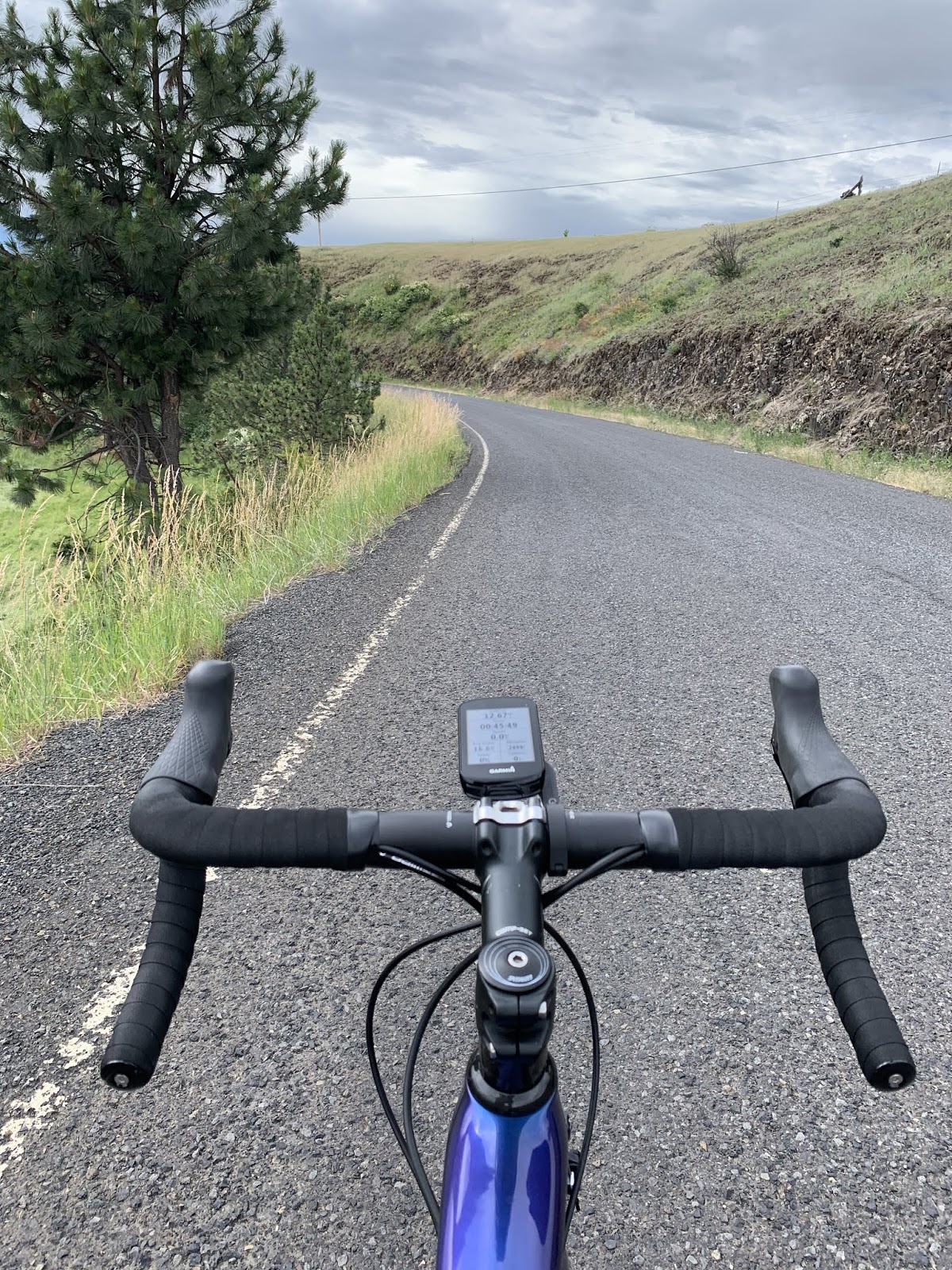
Delta wanted this pic.  Having examined the day’s elevation chart before leaving The Rig this morning we were both anticipating a rip roaring good time.  Ah…not so much.  Look just to the right of that cedar tree closest to us on the right side of the road.  One can just make out the road wrapping around the side of the hill.  That’s right.  The road disappears in front of us and then reappears prolly 150 feet lower in just the wink of an eye.  I glanced down only once and saw both 9 % and 10%.  The problem here is that the road was exceedingly rough, there were a few potholes, and the corners were very technical – oh – and there was loose gravel mostly in the corners.  I braked all the way down the hill and was reluctant to let our speed get much over 25 mph.  On the few occasions I did let off both brakes, I could feel Delta surge ahead as the speed shot up.  It wasn’t scary, but if I hadn’t kept a tight rein on Delta, it would have been.  At the bottom, Delta was upset.  The road was so rough it loosened a bolt on his stem cap.  This is the cap that covers the bolt holding the front fork tightly in place.  Ouch!  Luckily Susan met me at the bottom and the problem was quickly corrected with the allen wrenches I brought along on the trip.  Wow – what a ride!


Things got much tamer after that.  We left Kooskia over this bridge (very quaint) and headed out on highway 12.  We had heard rumors about how tight it was, how it had no shoulders, and how busy with truck traffic it was.  While it’s true that it didn’t have much in the way of shoulders, in our experience it was lightly travelled and everyone who passed us gave us plenty of space.  The one exception being two logging trucks travelling together.  Frankly, those guys are startin to piss me off.  Not that I can do anything about it.

From Kooskia on, it was a steady uphill climb since we’re heading to Lolo Pass tomorrow.  So, the remainder of the day was uphill at 1-2% with the occasional 4-5% blip on the radar.


We were traveling along the middle fork of the Clearwater River.  They weren’t kidding when they named it.  Even from the road I could count the rocks on the bottom of the river, which at times was running (I think) maybe 6-8 feet deep.  This was one wide river.

After a bit of this, my feet needed a break, so…
And what better way to give ‘em one than a quick dip in cool, refreshing river water?  Let’s get real – it was freezing – it is from snow melt, after all.


But the scenery was great – even for feet.  I call this my "stop and smell the roses" series...


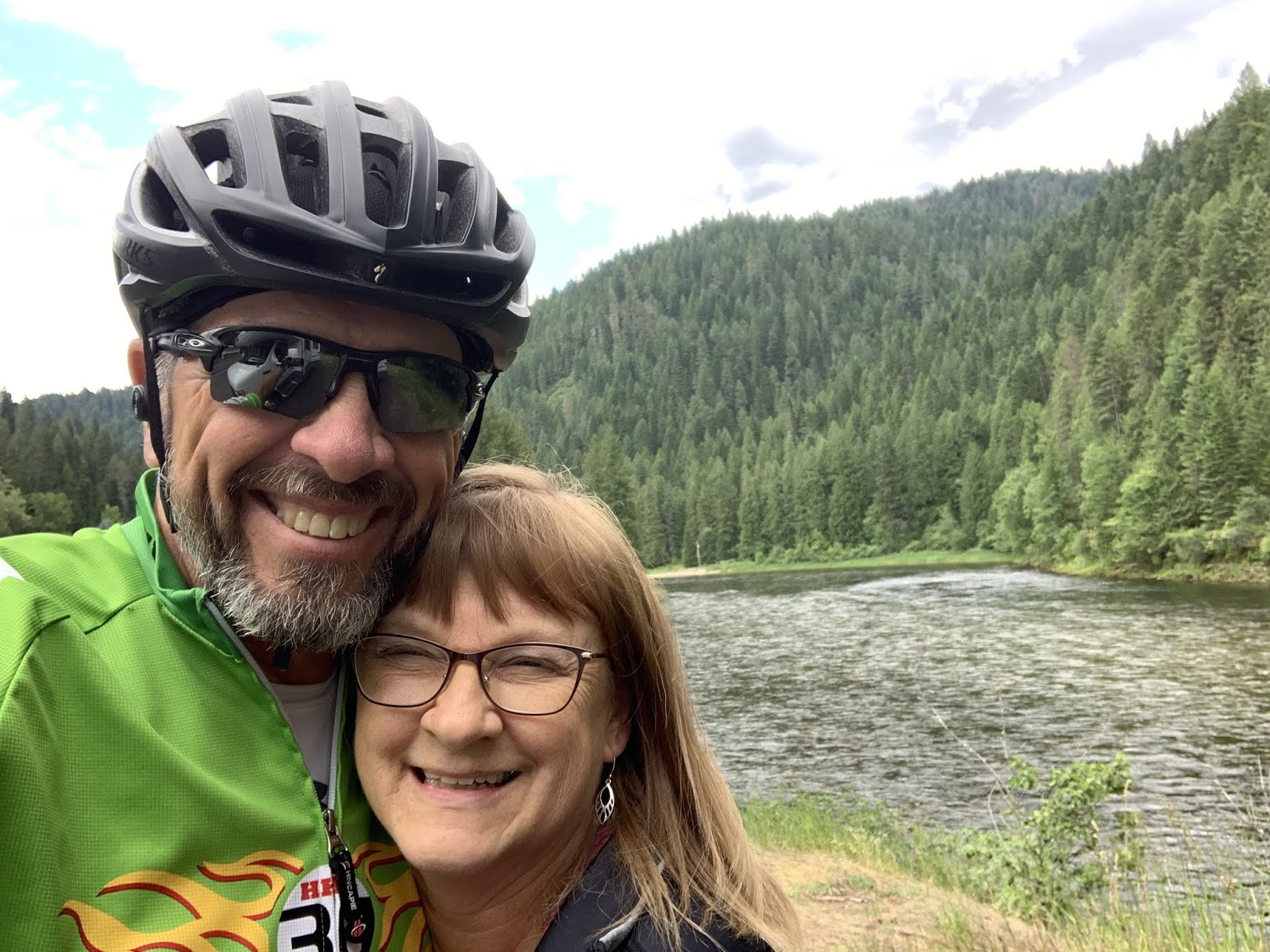
Shortly after that I completed the 23 mile section to near Lowell, ID where I met Susan for lunch.  It occurred to her that we hadn’t had a selfie together for a good while and this was a scenic place to take one.  Brilliant.  I married the smartest, cutest Teamster I know.  Just look at that smile.  This is also where we had our brief rain delay.  We could both tell that it was nothing serious, but (as always) I had to wait for the roads to dry out after the rain stopped.  Since the elevation chart showed the grade picking up a bit, I also traded out Delta for the Sequoia.  Then it was off to the races once again.


Except in this case there wasn’t much racing goin on.  There are two reasons I’m exposing the reader to me in all my bald glory.  1. The wind was in my face for the final 26 miles to the campground.  I think this is because as the temperatures rise lower on the slopes, the cooler air at the top of the mountains rushes down.  I’m helmetless in an attempt to cool off.  2. I figure a little sun can’t hurt the bald thing.  Maybe some sunshine can get something to sprout.

The  middle fork of the Clearwater River and I eventually went our separate ways.  It wasn’t the river’s fault.  It certainly wasn’t mine.  We just realized that we wanted different things from our relationship and agreed to go our separate ways as friends.  This is me with my new squeeze, the Lochsa River.  It’s not as impressive as the Clearwater, but more my style.  Just look at those rapids…

The Sequoia doesn’t know what I see in the Lochsa and pines for the Clearwater.


These people have figured out how to have fun in the water even if it is freezing.  Susan and I both saw them.  I think they had wet or dry suits on.  But I don’t know enough about that stuff to tell the difference.  Ya can’t swing a dead cat without hitting a rafting company around here.  (Used by permission of Susan Schoen Photography, LLC.)


And one last river shot.  It looked like this around every corner today. Which is understandable, since once we hit Kooskia we were following rivers uphill all day.  (Used by permission of Susan Schoen Photography, LLC.)  I really hope she doesn’t decide to start charging me for these at some point.  I’ll owe her a fortune.  Maybe I can get a good husband discount…  Don’t hold your breath.

So – tomorrow is Lolo Pass.  52 miles uphill to get there, approximately 3,400 ft above us in elevation from where we are parked right now.  As always, the final number will be greater than the difference in elevation since ya gain some and then give it away.  I’ll give everyone the final numbers tomorrow.  I’ve also been considering the establishment of a “misery index” to mountains.  It could be similar to what they do in the Tour (If ya don’t know, ya need to get out more.)  We’ll see.

Till next time.

Monday, June 24, 2019

The Thin Blue Ride - Part 2 Day 15 - Pollock, ID to Graingeville, ID

Ride Report:  63 Miles, 826 Total Miles, 13.3 Avg. mph, 3,494 Ft. Climbing, 5,218 Calories, 1 shredded tire - hey, it's gotta happen some time.  At least it was one of the relatively cheap tires on the Sequoia.  Everything on Delta costs more.

Things went pretty well today, except for the tire thing, but I hit a rock several days ago with that tire and put a cut in it then that I've been keeping an eye on since.  That tire did the entire Texas Test Flight and wasn't new when we left for that trip.  But now there was some delamination of the rubber from the threads near the cut.  Bah - Just yesterday I told Susan I was hoping it would make it to Missoula - guess not.  I was starting to worry that it'd cause a flat anyway.  Bike tires do that when the tread wears thin.  I'll have to change it tonight.  On with the day's report.

So, after leaving Pollock, ID and somewhere before Lucille, ID I ran into this lady...
This is Brenda - she flags cars at the construction site Delta and I went thru today.  We had to wait for the pilot car to return and chatted her up in the interim.  When she asked what we were doing I mentioned The Thin Blue Ride and that Susan was following behind in The Rig.  Brenda then described The Rig and Susan.  I asked her for Lotto numbers, but it turns out that when we stayed in the City Park in Cambridge Susan had to wait to park The Rig appropriately because there was a Vacation Bible School being held in the park at the time.  When Susan went to check with the VBS crew she ended up talking to Brenda's Mom, who gave us the OK to park there and said they'd be leaving shortly.  What are the odds?  It was a nice chat.  Brenda pointed out a mule deer doe as it walked toward us on the side of the hill in the background and told me where the deer would bed down.  Yup - Brenda pointed out the exact bush.  The deer went right to it.  She also told me where to look for Bighorn Sheep, but none were there when I went by.  I think Brenda has spent too long standing on the side of the road...


And speaking of  road construction - Delta was beside himself with joy.  This, readers, is a pic of what would turn out to be 13 MILES of new asphalt.  It was so new that the State of Idaho hadn't yet had time to put oil down and throw the boulders they use for chat in these parts on it.  I don't know how to explain what a big deal this is to a rider and his mount.  When the pilot car showed up Delta and me followed after the last car.  We met the pilot car coming back with a bunch of cars in tow headed the other way - but other than that we rode for 13 miles on fresh pavement with nary a car to be seen.  The pilot car never caught us with a group of cars going our direction.  It was blissful.  Especially so since highway 95 is pretty busy.  Lots of traffic, and an inordinate amount of logging trucks hauling logs to the mills and "regular" trucks hauling lumber the other way.  Somebody pinch me.  Besides Susan...


A great shot of the Little Salmon River - not so little any more.  We crossed a ton of streams and creeks that fed into it on the way to White Bird, ID.  Note the continuing new tarmac.


Sigh - OK, note the return of the boulder sized chat.  Nothing good lasts forever.  But more importantly check out the size of the house with the red roof on the hill in the distance.  Also note the sand beach right on the bank of the river.  What the reader can't make out is the road connecting the house with the beach.  My Lord but these people must have some money. 


Another shot of the Little Salmon River.  The trip to White Bird went on like this for 40 miles.  I love the mountains in the background, but only cause I don't have to climb this particular bunch of 'em.


Oh yes - I saw this on the way.  It was a ways off, but the first thing that caught my eye was the small house.  What a view they must have every day.  However, when I looked a little closer I saw an old wooden boat hull to the right of the house.  Then I saw it... The Rig.  The reader should look to the left of the house at the white vehicle peeking out from around the corner at me.  That's right - it's The Rig!  I dunno how Susan got it up there, but clearly with it and a boat in the same location the Teamsters and Longshoremen were holding court.  No doubt for some nefarious purpose.  I'll have to wait for Susan to talk in her sleep to find out what's up...


Some of the views here in Idaho are simply beyond words.  Given that, I'll let this pic speak for itself.


Finally - this is the bridge where new highway 95 passes over old highway 95 at White Bird.  The ACA map put Delta and me on old 95.  Thank God, at least we got away from the traffic. The bridge looked a little low on one end, so I helped out till the I-DOT guys could get there.


And at White Bird, the Sequoia took over as we departed for today's climb.  10 miles - with 8 of 'em running at 6%.  And lest the reader think my keester looks lumpy, I'm carrying three extra water bottles in the pockets on the rear of my jersey.  This particular stretch of old 95 has a number of switchbacks and neither Susan nor I thought it a good idea to take The Rig up there - so she stayed on new 95.  Having run out of water once on the Oregon coast, I'm determined not to make the same mistake twice.  Used by permission of Susan Schoen Photography, LLC.


As we gained elevation I took this shot back down the valley.  The Little Salmon River runs next to those mountains in the distance.


I thought I saw this was coming on Google Maps last night and was curious how the engineers would have handled it when the road was built.  What the reader is seeing is a road cut across the side of that hill.  This one happens to be where the road moves from one hill to another and the cut traverses the valley between them.  Just out of view to the left is the corner, where the road turns right to head up the cut the reader can see.  The problem is that in order to get to the correct elevation on the hill, they really had to pitch the road up for about a half mile - hence the cut.  In about a mile I will have gone thru 8 switchbacks and ended up at the small knoll in the top left of the pic.

I think I took it well...
Gaaaaaaaa!


But once thru the switchbacks and at the top of the hill it was all smiles.  The switchbacks are below me in this pic.  If the reader looks below that brown square on the mountainside in the distance (I think it was mowed for hay) and just above the trees below the brown square, you can make out the road we were on before the switchbacks.  And that road is prolly already 1k ft. above White Bird.  We're close to the top now.


Susan took this one from a pullout where she could see the switchbacks.  It shows them better than my pic above does.  If one clicks on the pic to enlarge it, the first four can be seen quite plainly.  There are four more running to the top of the hill to the left in the pic.  Used by permission of Susan Schoen Photography, LLC.  (Pricing available upon request.)


Near the summit, old 95 connected with new 95 for maybe half a mile before taking off on its own again and heading back down the mountain to Grangeville.  Susan and I had arranged to meet at a historical marker pullout there to make sure I was set for the descent.  I wasn't - hence the Oreos.  I might add that the brief stretch where old and new 95 joined was part of a much longer paving project.  As a result, both lanes of traffic were shifted over with those skinny little cones being all that separated the Sequoia and me from mayhem.  As I was riding thru, a dually pickup pulling a car trailer with another pickup loaded on it hit one of those barricades as it passed us.  It made an ungodly noise and scared the bejeebers out of me.  The Sequoia took it well, but then he's a stoic.


So after departing Susan's rest stop, I took Delta out again and there was still about a mile of climbing before the summit.  There is no official "summit" sign because we're on the old highway.  But these people seem quite proud to live at the summit of White Bird hill.  Click on the pic and enlarge if you doubt my word - it says "White Bird Summit".  Just know that the web site will record all you doubters out there and report you to me later this week.


This was our first glimpse of the view just around the corner from the summit.  Delta saw it first, so he got the honors.


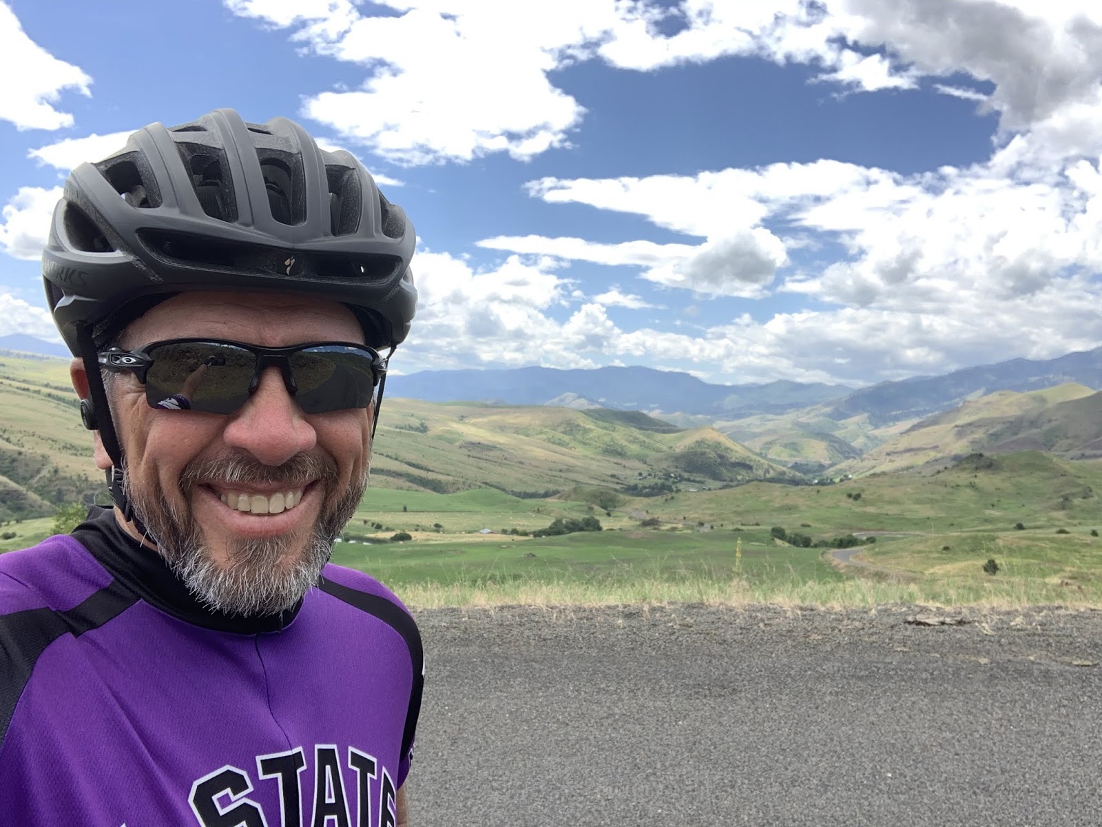
And this is a much better pic taken by yours truly just a bit further down the road.  Sometimes it pays to be patient. - a characteristic for which I am renowned...

And other than one more interesting story (without pics) that's it for the day.  The interesting story is this...

Susan wanted to pull in for gas since it may be hard to locate for the next few days a gas station that she can get The Rig in and out of easily. (There are no truck stops where we're going - she was disappointed.) Fine by me - she even told me to stay in The Rig while she ran the pump.  Now that's service with a smile.  Turns out that the guy using the pump across from us saw the K-State tag on The Rig and her KSU shirt and started talking to her.  His name is Chad Webber and he was from Hutchinson, KS.  He went to KSU back when.  Since Parker (Kelsy's husband) is from nearby Buhler, Susan inquired and sure enough - he knows the Rayls.  He knew Parker's dad, Brad, and his Aunt Kay as well as her husband, Dick.  Chad used to work for Dick's son, an outfitter in the Hutchinson area and Kay used to cook for them.  How funny is that?  At a gas station in the middle of Nowhere, ID.  Especially after running into Brenda, the traffic flagger, earlier in the day.  Say what you will about seven degrees of Kevin Bacon, but I'm a believer.

Till next time.


Sunday, June 23, 2019

The Thin Blue ride - Part 2 Day 14 - Pollock, ID (Rest Day)

Ride Report: None (Rest Day - Stupid mountains.)

The ill intent of the previously disparaged and much maligned mountains aside, it was still a great day.  It started off sleeping late, which is a bit easier to do now that we're back on mountain time.  Stupid mountains.  They even have a time zone under their control.

Anyway - after sleeping late here...
Just thought it had been a while since The Rig had gotten some screen time.  She was gettin jealous.  But it really is a nice location for an RV Park.  Right along the Little Salmon River which Delta and I followed down to the Park yesterday.


And shortly after getting outside it was time to do what will become a Rest Day ritual. - wash and lube the bikes.  The boys both needed a bath.  Delta is such a whiner.  He doesn't like water in his cranks.  What a baby.

Then it was time for LUNCH!
Yes readers, that's right.  I ate my lunch sideways.   Forget that.  It's really about the Mac and Cheese.  And lest we forget to mention it, that's a brat there beside all the yellow stuff.  This is how I know Susan loves me.  And yes, I know that I can edit the pic and rotate it to align correctly on the page.  It just takes so long to download the pics here in the RV park that I decided to go with it.  Oh - and note the chocolate cake in the plastic container in the background.  It will figure prominently later in the post.


Then comes what rest days are designed for: rest.  The reader may recall a similar pic from last week's rest day in Prineville, OR.  Note the improved napping technique on display in this shot.  (A) Instead of lying crossways on the recliner I am now aligned properly for better support of my spine and legs.  (B) I had Susan cover me with a blanket.  I anticipate continued improvement.  Next week I'll move up to having her pull the handle on the recliner for me.  Unless she tries to charge me union rates, in which case I'll do it myself.  I'm not helpless y'know.


After the nap it was time to go sit by the Little Salmon River.  Watching a fast flowing river is like watching a fire - mesmerizing.


Susan took this one.


I then took this pano of the river.  It wasn't till I downloaded the pic for the blog that I realized we were sitting at a bend in the river.


After dinner there was this...
Prominent...


And finally there is this...
I took this shot when I wandered out while Susan was making dinner.  I couldn't believe how beautiful it was.


It's not every day a guy can catch a shot like that in the laundry room of the RV park.  Which is where we have to go to get service.  Speaking of which...

When Susan made the reservation the guy told her they had both 3g and 4g networks in the park with one at each end of the park.  Perfect - except that our spot is in the middle of the park where there is NO service.  But Susan figured it out while I was down in the laundry room (where there is service) working on the today's post.  She just walked right in, told me she'd sent me a text and left.  Then I got the text.  No problem.  I'm tellin ya, that girl is one smart cookie.

Till next time.